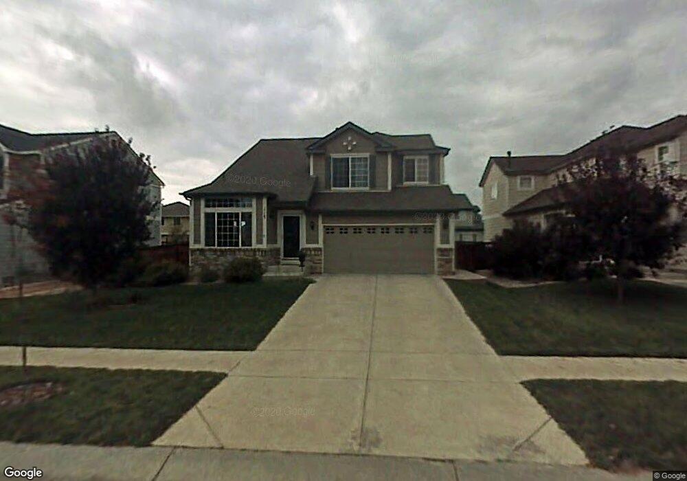
115 Cisne Cir Brighton, CO 80601
Estimated Value: $484,000 - $518,000
3
Beds
3
Baths
2,073
Sq Ft
$244/Sq Ft
Est. Value
About This Home
This home is located at 115 Cisne Cir, Brighton, CO 80601 and is currently estimated at $506,146, approximately $244 per square foot. 115 Cisne Cir is a home located in Adams County with nearby schools including Pennock Elementary School, Overland Trail Middle School, and Brighton High School.
Ownership History
Date
Name
Owned For
Owner Type
Purchase Details
Closed on
Dec 23, 2002
Sold by
City Of Brighton
Bought by
United Power Inc
Current Estimated Value
Purchase Details
Closed on
Sep 20, 2001
Sold by
Richmond American Homes Of Colorado Inc
Bought by
Thomas Howard A and Thomas Rebecca L
Home Financials for this Owner
Home Financials are based on the most recent Mortgage that was taken out on this home.
Original Mortgage
$226,815
Interest Rate
6.88%
Mortgage Type
FHA
Create a Home Valuation Report for This Property
The Home Valuation Report is an in-depth analysis detailing your home's value as well as a comparison with similar homes in the area
Home Values in the Area
Average Home Value in this Area
Purchase History
| Date | Buyer | Sale Price | Title Company |
|---|---|---|---|
| United Power Inc | $18,000 | -- | |
| Thomas Howard A | $230,090 | Stewart Title |
Source: Public Records
Mortgage History
| Date | Status | Borrower | Loan Amount |
|---|---|---|---|
| Previous Owner | Thomas Howard A | $226,815 |
Source: Public Records
Tax History Compared to Growth
Tax History
| Year | Tax Paid | Tax Assessment Tax Assessment Total Assessment is a certain percentage of the fair market value that is determined by local assessors to be the total taxable value of land and additions on the property. | Land | Improvement |
|---|---|---|---|---|
| 2024 | $5,624 | $31,560 | $6,250 | $25,310 |
| 2023 | $5,602 | $36,600 | $6,360 | $30,240 |
| 2022 | $4,588 | $26,480 | $6,530 | $19,950 |
| 2021 | $4,422 | $26,480 | $6,530 | $19,950 |
| 2020 | $4,097 | $25,520 | $6,220 | $19,300 |
| 2019 | $4,102 | $25,520 | $6,220 | $19,300 |
| 2018 | $3,698 | $22,960 | $6,480 | $16,480 |
| 2017 | $3,701 | $22,960 | $6,480 | $16,480 |
| 2016 | $2,866 | $18,370 | $3,660 | $14,710 |
| 2015 | $2,854 | $18,370 | $3,660 | $14,710 |
| 2014 | -- | $15,320 | $2,630 | $12,690 |
Source: Public Records
Map
Nearby Homes
- 102 Pelican Ave
- 5624 Killdeer St Unit 5624
- 5292 Goldfinch St
- 5224 Snow Goose St
- 33 Gaviota Ave
- 282 Tall Spruce Cir
- 5113 Grey Swallow St
- 329 Apache Plume St
- 4950 Mount Cameron Dr
- 5174 Golden Eagle Pkwy
- 5277 Royal Pine St
- 5157 Goshawk St
- 5161 Chicory Cir
- 4824 Mt Shavano St
- 300 Wheatberry Dr
- 5840 Longs Peak St
- 5010 Golden Eagle Pkwy
- 5242 Longs Peak St
- 4749 Mount Shavano St
- 5055 Pelican St
- 135 Cisne Cir
- 105 Cisne Cir
- 116 Prairie Falcon Pkwy
- 106 Prairie Falcon Pkwy
- 136 Prairie Falcon Pkwy
- 155 Cisne Cir
- 156 Prairie Falcon Pkwy
- 95 Cisne Cir
- 176 Prairie Falcon Pkwy
- 96 Prairie Falcon Pkwy
- 175 Cisne Cir
- 85 Cisne Cir
- 104 Cisne Cir
- 117 Prairie Falcon Pkwy
- 184 Cisne Cir
- 186 Prairie Falcon Pkwy
- 174 Cisne Cir
- 114 Cisne Cir
- 76 Prairie Falcon Pkwy
- 137 Prairie Falcon Pkwy