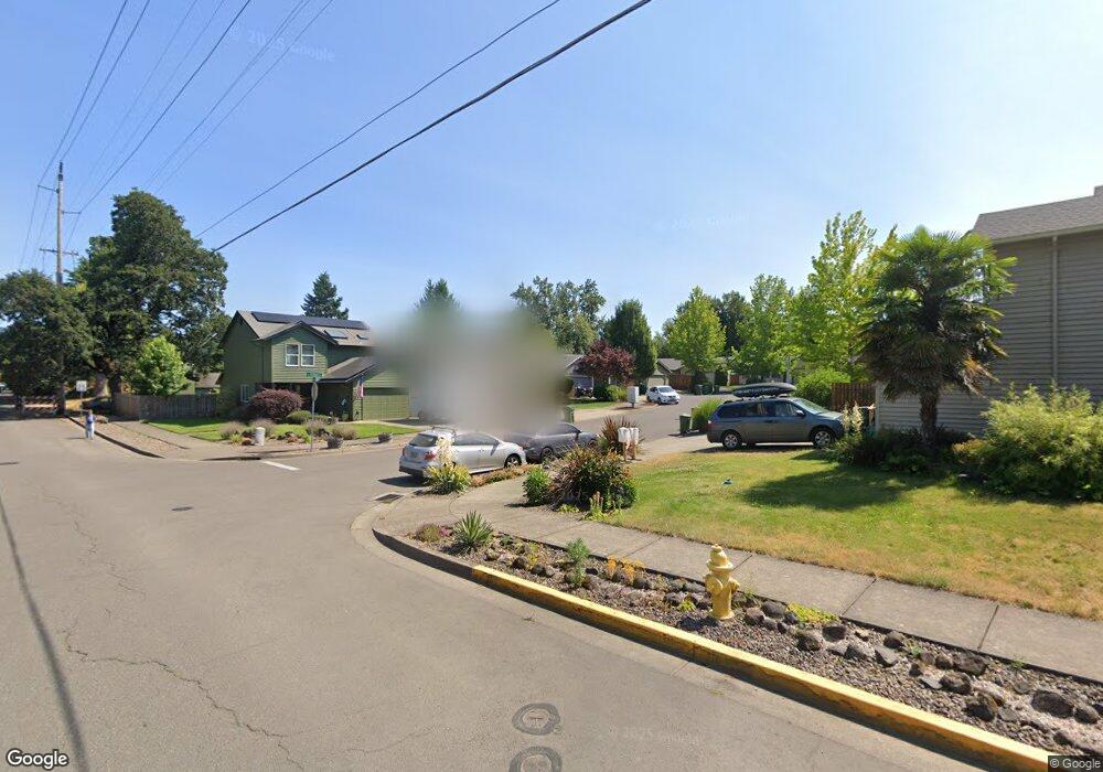
115 Clifford Ct Newberg, OR 97132
Estimated Value: $449,000 - $496,000
3
Beds
2
Baths
1,449
Sq Ft
$327/Sq Ft
Est. Value
About This Home
This home is located at 115 Clifford Ct, Newberg, OR 97132 and is currently estimated at $474,208, approximately $327 per square foot. 115 Clifford Ct is a home located in Yamhill County with nearby schools including Antonia Crater Elementary School, Chehalem Valley Middle School, and Newberg Senior High School.
Ownership History
Date
Name
Owned For
Owner Type
Purchase Details
Closed on
Dec 29, 2009
Sold by
Schutter Joel Hartley
Bought by
Schutter Daniel A and Schutter Joan E
Current Estimated Value
Purchase Details
Closed on
Jun 16, 2009
Sold by
Kessler Diana K
Bought by
Schutter Joel Hartley
Purchase Details
Closed on
Feb 11, 2005
Sold by
R P Grahn Inc
Bought by
Kessler Diana K
Home Financials for this Owner
Home Financials are based on the most recent Mortgage that was taken out on this home.
Original Mortgage
$153,200
Interest Rate
5.81%
Mortgage Type
Unknown
Create a Home Valuation Report for This Property
The Home Valuation Report is an in-depth analysis detailing your home's value as well as a comparison with similar homes in the area
Purchase History
| Date | Buyer | Sale Price | Title Company |
|---|---|---|---|
| Schutter Daniel A | -- | None Available | |
| Schutter Joel Hartley | $235,500 | Fnt | |
| Kessler Diana K | $191,500 | Northwest Title Company |
Source: Public Records
Mortgage History
| Date | Status | Borrower | Loan Amount |
|---|---|---|---|
| Previous Owner | Kessler Diana K | $153,200 |
Source: Public Records
Tax History
| Year | Tax Paid | Tax Assessment Tax Assessment Total Assessment is a certain percentage of the fair market value that is determined by local assessors to be the total taxable value of land and additions on the property. | Land | Improvement |
|---|---|---|---|---|
| 2025 | $3,994 | $247,504 | -- | -- |
| 2024 | $3,841 | $240,295 | -- | -- |
| 2023 | $3,709 | $233,296 | $0 | $0 |
| 2022 | $3,610 | $226,501 | $0 | $0 |
| 2021 | $3,512 | $219,904 | $0 | $0 |
| 2020 | $3,163 | $213,499 | $0 | $0 |
| 2019 | $3,120 | $207,281 | $0 | $0 |
| 2018 | $3,137 | $201,244 | $0 | $0 |
| 2017 | $3,335 | $195,383 | $0 | $0 |
| 2016 | $3,266 | $189,692 | $0 | $0 |
| 2015 | $3,208 | $184,168 | $0 | $0 |
| 2014 | $2,992 | $178,806 | $0 | $0 |
Source: Public Records
Map
Nearby Homes
- 617 N Grant St
- 293 E Wayno Way
- 818 Sierra Vista Dr
- 704 E Pinehurst Dr
- 1650 NE Chehalem Dr
- 310 N School St
- 1801 N Daniel Dr
- 528 W Sherman St
- 301 E Columbia Dr Unit 73
- 301 E Columbia Dr Unit 62
- 301 E Columbia Dr Unit 66
- 1704 N Meridian St
- 2000 Nugget Ln
- 110 S Lincoln St
- 110 S Harrison St
- 514 E Melody Ln
- 1609 N Johnson Dr
- 0 NE Cullen Rd
- 23895 NE Dillon Rd
- 1205 Johnson Ct
- 109 Clifford Ct
- 119 Clifford Ct
- 105 Clifford Ct
- 125 Clifford Ct
- 129 Clifford Ct
- 130 Clifford Ct
- 1020 N Main St
- 1109 Mission Ct
- 110 Clifford Ct
- 121 Mission Dr
- 116 Clifford Ct
- 120 Clifford Ct
- 104 Clifford Ct
- 1019 Rentfro Way
- 126 Clifford Ct
- 125 Mission Dr
- 901 N Main St
- 1140 N Main St
- 1009 Rentfro Way
- 1009 N Main St
Your Personal Tour Guide
Ask me questions while you tour the home.