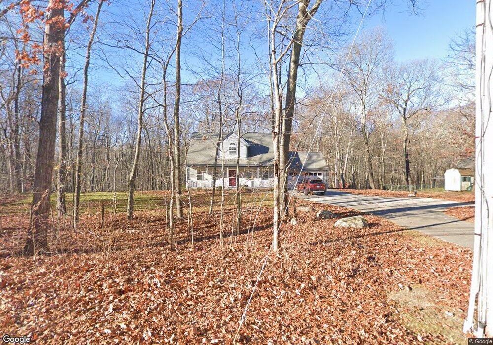
115 Dean Rd East Lyme, CT 06333
Estimated Value: $483,000 - $553,000
3
Beds
3
Baths
1,627
Sq Ft
$319/Sq Ft
Est. Value
About This Home
This home is located at 115 Dean Rd, East Lyme, CT 06333 and is currently estimated at $518,309, approximately $318 per square foot. 115 Dean Rd is a home located in New London County with nearby schools including East Lyme Middle School, East Lyme High School, and Carelot Children's Center - East Lyme.
Ownership History
Date
Name
Owned For
Owner Type
Purchase Details
Closed on
Oct 1, 1998
Sold by
Laplante Kerrie M and Laplante Francis C
Bought by
Smith Rufus and Smith Shelly L
Current Estimated Value
Purchase Details
Closed on
Nov 1, 1995
Sold by
Turgeon Guy R
Bought by
Laplante Kerrie M and Laplante Francis C
Create a Home Valuation Report for This Property
The Home Valuation Report is an in-depth analysis detailing your home's value as well as a comparison with similar homes in the area
Home Values in the Area
Average Home Value in this Area
Purchase History
| Date | Buyer | Sale Price | Title Company |
|---|---|---|---|
| Smith Rufus | $180,500 | -- | |
| Laplante Kerrie M | $164,900 | -- |
Source: Public Records
Mortgage History
| Date | Status | Borrower | Loan Amount |
|---|---|---|---|
| Open | Laplante Kerrie M | $100,000 | |
| Open | Laplante Kerrie M | $190,000 | |
| Closed | Laplante Kerrie M | $80,000 |
Source: Public Records
Tax History Compared to Growth
Tax History
| Year | Tax Paid | Tax Assessment Tax Assessment Total Assessment is a certain percentage of the fair market value that is determined by local assessors to be the total taxable value of land and additions on the property. | Land | Improvement |
|---|---|---|---|---|
| 2025 | $7,235 | $258,300 | $102,200 | $156,100 |
| 2024 | $6,806 | $258,300 | $102,200 | $156,100 |
| 2023 | $6,427 | $258,300 | $102,200 | $156,100 |
| 2022 | $6,158 | $258,300 | $102,200 | $156,100 |
| 2021 | $5,768 | $202,300 | $97,090 | $105,210 |
| 2020 | $5,737 | $202,300 | $97,090 | $105,210 |
| 2019 | $5,703 | $202,300 | $97,090 | $105,210 |
| 2018 | $5,533 | $202,300 | $97,090 | $105,210 |
| 2017 | $5,292 | $202,300 | $97,090 | $105,210 |
| 2016 | $5,132 | $202,370 | $91,980 | $110,390 |
| 2015 | $5,001 | $202,370 | $91,980 | $110,390 |
| 2014 | $4,863 | $202,370 | $91,980 | $110,390 |
Source: Public Records
Map
Nearby Homes
- 13 Willow Ln
- 28 Alexander Dr
- 72 Society Rd
- 25 Marion Dr
- 223 N Bride Brook Rd
- 6 Marion Dr
- 270 N Bride Brook Rd
- 156 Flanders Rd
- 16 Cubles Dr
- 10 S Ledge Rock Rd
- 37 Stoneywood Dr
- 496 Boston Post Rd
- 20 Sunrise Trail
- 57 Spring Rock Rd
- 55 Corey Ln
- Waramaug Plan at Riverside Reserve
- Highland Plan at Riverside Reserve
- Hayward Plan at Riverside Reserve
- Ashford Plan at Riverside Reserve
- Lillinonah Plan at Riverside Reserve