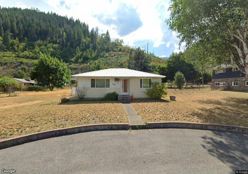
115 E Fir Ave Osburn, ID 83849
Estimated Value: $203,000 - $320,396
2
Beds
1
Bath
885
Sq Ft
$299/Sq Ft
Est. Value
About This Home
This home is located at 115 E Fir Ave, Osburn, ID 83849 and is currently estimated at $264,599, approximately $298 per square foot. 115 E Fir Ave is a home with nearby schools including Silver Hills Elementary School and Wallace Junior/Senior High School.
Ownership History
Date
Name
Owned For
Owner Type
Purchase Details
Closed on
Aug 18, 2025
Sold by
Hill Wayne and Hill Wayne R
Bought by
Hill R Wayne
Current Estimated Value
Home Financials for this Owner
Home Financials are based on the most recent Mortgage that was taken out on this home.
Original Mortgage
$30,000
Outstanding Balance
$29,974
Interest Rate
6.72%
Mortgage Type
New Conventional
Estimated Equity
$234,625
Purchase Details
Closed on
Aug 11, 2025
Sold by
Hill R Wayne
Bought by
Hill R Wayne R and Hill Tisan
Home Financials for this Owner
Home Financials are based on the most recent Mortgage that was taken out on this home.
Original Mortgage
$30,000
Outstanding Balance
$29,974
Interest Rate
6.72%
Mortgage Type
New Conventional
Estimated Equity
$234,625
Create a Home Valuation Report for This Property
The Home Valuation Report is an in-depth analysis detailing your home's value as well as a comparison with similar homes in the area
Home Values in the Area
Average Home Value in this Area
Purchase History
| Date | Buyer | Sale Price | Title Company |
|---|---|---|---|
| Hill R Wayne | -- | Flying S Title And Escrow | |
| Hill Wayne | -- | None Listed On Document | |
| Hill Wayne | -- | None Listed On Document | |
| Hill R Wayne R | -- | None Listed On Document |
Source: Public Records
Mortgage History
| Date | Status | Borrower | Loan Amount |
|---|---|---|---|
| Open | Hill R Wayne | $30,000 |
Source: Public Records
Tax History Compared to Growth
Tax History
| Year | Tax Paid | Tax Assessment Tax Assessment Total Assessment is a certain percentage of the fair market value that is determined by local assessors to be the total taxable value of land and additions on the property. | Land | Improvement |
|---|---|---|---|---|
| 2025 | $42 | $169,310 | $45,054 | $124,256 |
| 2024 | $42 | $169,310 | $45,054 | $124,256 |
| 2023 | $42 | $170,773 | $45,054 | $125,719 |
| 2022 | $42 | $155,813 | $40,995 | $114,818 |
| 2021 | $62 | $127,365 | $35,065 | $92,300 |
| 2020 | $104 | $99,469 | $31,369 | $68,100 |
| 2019 | $88 | $96,151 | $28,931 | $67,220 |
| 2018 | $40 | $67,411 | $26,301 | $41,110 |
| 2017 | $40 | $67,411 | $26,301 | $41,110 |
| 2016 | $99 | $67,241 | $26,301 | $40,940 |
| 2015 | $350 | $64,011 | $26,301 | $37,710 |
| 2014 | -- | $64,011 | $26,301 | $37,710 |
Source: Public Records
Map
Nearby Homes
- 511 E Idaho Ave
- 315 W Yellowstone Ave
- 905 Terror Gulch Rd
- 807 E Garden Ave
- 0 Cameron Dr Unit 25-1685
- 712 W Yellowstone Ave
- 1154 E Larch Ave
- 235 Rio Vista St
- 225 Rio Vista St
- 67 Nuchols Gulch Rd
- Lot 2B Upper Dr
- 104 Ninth St
- 99 Sather Field Rd
- 3 Polaris Peak Rd
- 1 Polaris Peak Rd
- 2 Polaris Peak Rd
- 498 Revenue Gulch Rd
- NNA County Club Rd
- 86 E Circle Dr
- 930 Moon Gulch Rd