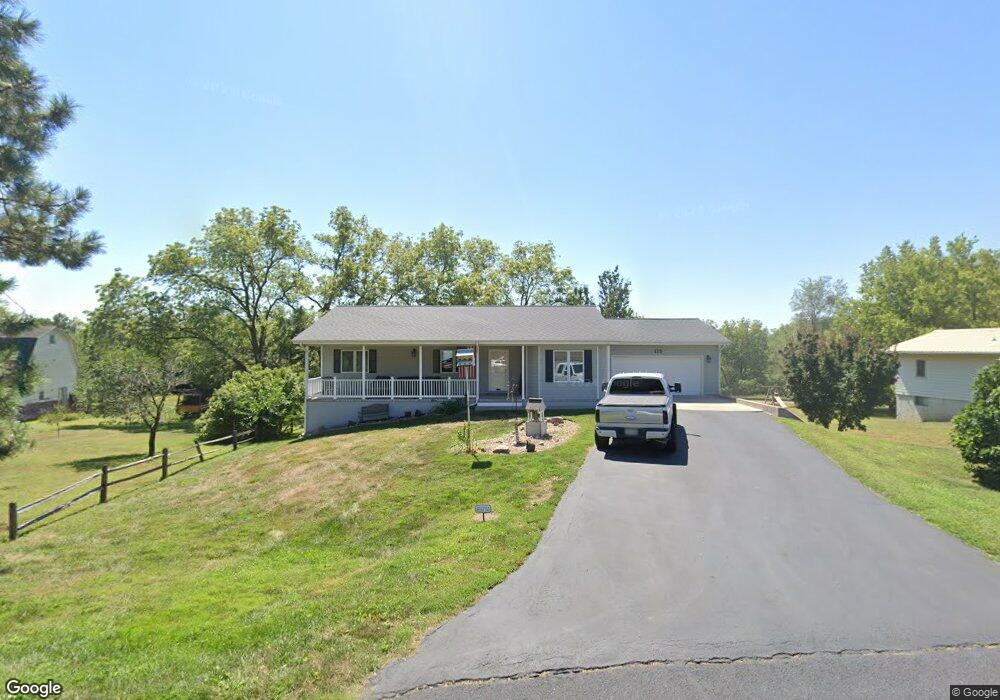
115 Fir St Bennet, NE 68317
Estimated Value: $307,000 - $387,000
3
Beds
2
Baths
1,350
Sq Ft
$250/Sq Ft
Est. Value
About This Home
This home is located at 115 Fir St, Bennet, NE 68317 and is currently estimated at $338,089, approximately $250 per square foot. 115 Fir St is a home located in Lancaster County with nearby schools including Elementary at Bennet and Junior/Senior High School at Palmyra.
Ownership History
Date
Name
Owned For
Owner Type
Purchase Details
Closed on
Jun 15, 2005
Sold by
Bruhn Jean T and Bruhn Allen C
Bought by
Bruhn Allen C
Current Estimated Value
Purchase Details
Closed on
Jan 18, 2002
Sold by
Bolder Homes Inc
Bought by
Bruhn Jean T and Bruhn Allen C
Home Financials for this Owner
Home Financials are based on the most recent Mortgage that was taken out on this home.
Original Mortgage
$128,800
Interest Rate
7.07%
Create a Home Valuation Report for This Property
The Home Valuation Report is an in-depth analysis detailing your home's value as well as a comparison with similar homes in the area
Home Values in the Area
Average Home Value in this Area
Purchase History
| Date | Buyer | Sale Price | Title Company |
|---|---|---|---|
| Bruhn Allen C | -- | -- | |
| Bruhn Jean T | -- | -- |
Source: Public Records
Mortgage History
| Date | Status | Borrower | Loan Amount |
|---|---|---|---|
| Closed | Bruhn Jean T | $128,800 |
Source: Public Records
Tax History Compared to Growth
Tax History
| Year | Tax Paid | Tax Assessment Tax Assessment Total Assessment is a certain percentage of the fair market value that is determined by local assessors to be the total taxable value of land and additions on the property. | Land | Improvement |
|---|---|---|---|---|
| 2025 | $3,630 | $305,200 | $64,400 | $240,800 |
| 2024 | $3,630 | $281,900 | $57,200 | $224,700 |
| 2023 | $4,925 | $281,900 | $57,200 | $224,700 |
| 2022 | $4,267 | $225,700 | $38,400 | $187,300 |
| 2021 | $4,024 | $225,700 | $38,400 | $187,300 |
| 2020 | $3,729 | $201,500 | $38,400 | $163,100 |
| 2019 | $3,750 | $201,500 | $38,400 | $163,100 |
| 2018 | $3,574 | $184,600 | $28,000 | $156,600 |
| 2017 | $3,457 | $184,600 | $28,000 | $156,600 |
| 2016 | $3,359 | $164,300 | $24,000 | $140,300 |
| 2015 | $3,290 | $164,300 | $24,000 | $140,300 |
| 2014 | $3,027 | $148,300 | $24,000 | $124,300 |
| 2013 | -- | $148,300 | $24,000 | $124,300 |
Source: Public Records
Map
Nearby Homes
- 0000 Jackson St
- 380 Van Buren St
- 1240 Hackberry St
- 135 Jefferson St
- Acreage 1 134th & Satillo Rd
- 13611 S 150th Ct
- 195 Switchgrass Ln
- 185 Switchgrass Ln
- 1220 Evergreen Rd
- 920 Evergreen Rd
- 985 Evergreen Rd
- 400 Evergreen Rd
- 415 Evergreen Rd
- 1223 Evergreen Rd
- 1020 Evergreen Rd
- 1000 Evergreen Rd
- 1140 Evergreen Rd
- 1125 Evergreen Rd
- 420 Evergreen Rd
- 1180 Evergreen Rd