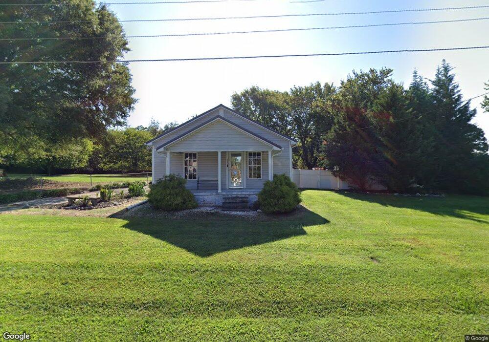
115 Fox Rd SE Conover, NC 28613
Estimated Value: $161,000 - $174,000
2
Beds
1
Bath
750
Sq Ft
$226/Sq Ft
Est. Value
About This Home
This home is located at 115 Fox Rd SE, Conover, NC 28613 and is currently estimated at $169,138, approximately $225 per square foot. 115 Fox Rd SE is a home located in Catawba County with nearby schools including North Newton Elementary School, Newton-Conover Middle School, and Newton-Conover High School.
Ownership History
Date
Name
Owned For
Owner Type
Purchase Details
Closed on
Apr 24, 2008
Sold by
Myers Mark A and Myers Tonja J
Bought by
Elrod Lee C and Lumpkin Tonia Jo
Current Estimated Value
Home Financials for this Owner
Home Financials are based on the most recent Mortgage that was taken out on this home.
Original Mortgage
$61,534
Outstanding Balance
$38,714
Interest Rate
5.84%
Mortgage Type
FHA
Estimated Equity
$130,424
Purchase Details
Closed on
Jul 14, 2004
Sold by
Lail Tony Ray
Bought by
Fox Drive Partnership
Purchase Details
Closed on
Feb 1, 1993
Create a Home Valuation Report for This Property
The Home Valuation Report is an in-depth analysis detailing your home's value as well as a comparison with similar homes in the area
Home Values in the Area
Average Home Value in this Area
Purchase History
| Date | Buyer | Sale Price | Title Company |
|---|---|---|---|
| Elrod Lee C | $62,500 | None Available | |
| Fox Drive Partnership | $25,000 | None Available | |
| -- | $12,500 | -- |
Source: Public Records
Mortgage History
| Date | Status | Borrower | Loan Amount |
|---|---|---|---|
| Open | Elrod Lee C | $61,534 |
Source: Public Records
Tax History
| Year | Tax Paid | Tax Assessment Tax Assessment Total Assessment is a certain percentage of the fair market value that is determined by local assessors to be the total taxable value of land and additions on the property. | Land | Improvement |
|---|---|---|---|---|
| 2025 | $1,020 | $128,500 | $12,500 | $116,000 |
| 2024 | $1,020 | $128,500 | $12,500 | $116,000 |
| 2023 | $1,020 | $128,500 | $12,500 | $116,000 |
| 2022 | $683 | $63,500 | $12,500 | $51,000 |
| 2021 | $683 | $63,500 | $12,500 | $51,000 |
| 2020 | $683 | $63,500 | $12,500 | $51,000 |
| 2019 | $683 | $63,500 | $0 | $0 |
| 2018 | $564 | $52,500 | $12,200 | $40,300 |
| 2017 | $549 | $0 | $0 | $0 |
| 2016 | $549 | $0 | $0 | $0 |
| 2015 | $567 | $52,470 | $12,200 | $40,270 |
| 2014 | $567 | $61,000 | $13,000 | $48,000 |
Source: Public Records
Map
Nearby Homes
- 1118 St Michaels Dr SE
- 1005 2nd St SE
- 918 Emmanuel Church Rd
- 406 Rock Barn Rd NE
- 701 3rd St SE
- 1708 Emmanuel Church Rd
- 505 2nd Street Place NE Unit D2
- 505 2nd Street Place NE Unit B2
- 1002 4th St NE
- 811 4th St NE
- 109 9th St SE
- 105 9th St SE
- 203 3rd Ave NE
- 2081 N Whisnant Ave
- 304 Parlier Ave NE
- 503 5th Ave NE
- 227 W 27th St
- 510 7th St NE
- 0000 Burris Rd
- 1818 N Rankin Ave
- 117 Fox Rd SE
- 113 Fox Rd SE
- 111 Fox Rd SE
- 114 Fox Rd SE
- 1104 Daffodil Ct SE
- 112 Fox Rd SE
- 1106 Daffodil Ct SE
- 119 1st Street Place SE
- 1102 St Michaels Dr SE
- 117 1st Street Place SE
- 109 1st Street Place SE
- 121 Fox Rd SE
- 107 1st Street Place SE
- 1104 St Michaels Dr SE
- 1016 Davids St
- 105 1st Street Place SE
- 105 1st Street Place SE Unit 4
- 1107 Daffodil Ct SE
- Lots 1-7 St Davids St SE
- 1017 Saint Davids St SE
Your Personal Tour Guide
Ask me questions while you tour the home.