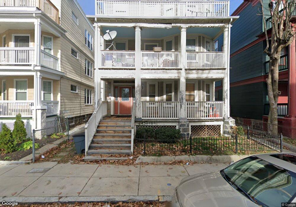
115 Howland St Unit 3 Dorchester, MA 02121
Washington Park NeighborhoodEstimated Value: $598,000 - $602,814
4
Beds
2
Baths
1,468
Sq Ft
$409/Sq Ft
Est. Value
About This Home
This home is located at 115 Howland St Unit 3, Dorchester, MA 02121 and is currently estimated at $600,954, approximately $409 per square foot. 115 Howland St Unit 3 is a home located in Suffolk County with nearby schools including Bridge Boston Charter School and Mother Caroline Academy & Education Center.
Ownership History
Date
Name
Owned For
Owner Type
Purchase Details
Closed on
Aug 15, 2008
Sold by
Bullens Donald L
Bought by
Jones Tyissha K
Current Estimated Value
Home Financials for this Owner
Home Financials are based on the most recent Mortgage that was taken out on this home.
Original Mortgage
$195,000
Outstanding Balance
$128,423
Interest Rate
6.4%
Mortgage Type
Purchase Money Mortgage
Estimated Equity
$472,531
Create a Home Valuation Report for This Property
The Home Valuation Report is an in-depth analysis detailing your home's value as well as a comparison with similar homes in the area
Home Values in the Area
Average Home Value in this Area
Purchase History
| Date | Buyer | Sale Price | Title Company |
|---|---|---|---|
| Jones Tyissha K | $243,750 | -- |
Source: Public Records
Mortgage History
| Date | Status | Borrower | Loan Amount |
|---|---|---|---|
| Open | Jones Tyissha K | $195,000 |
Source: Public Records
Tax History Compared to Growth
Tax History
| Year | Tax Paid | Tax Assessment Tax Assessment Total Assessment is a certain percentage of the fair market value that is determined by local assessors to be the total taxable value of land and additions on the property. | Land | Improvement |
|---|---|---|---|---|
| 2025 | $6,477 | $559,300 | $0 | $559,300 |
| 2024 | $5,525 | $506,900 | $0 | $506,900 |
| 2023 | $5,234 | $487,300 | $0 | $487,300 |
| 2022 | $5,049 | $464,100 | $0 | $464,100 |
| 2021 | $4,855 | $455,000 | $0 | $455,000 |
| 2020 | $4,166 | $394,500 | $0 | $394,500 |
| 2019 | $3,780 | $358,600 | $0 | $358,600 |
| 2018 | $3,415 | $325,900 | $0 | $325,900 |
| 2017 | $3,225 | $304,500 | $0 | $304,500 |
| 2016 | $3,131 | $284,600 | $0 | $284,600 |
| 2015 | $2,702 | $223,100 | $0 | $223,100 |
| 2014 | $2,648 | $210,500 | $0 | $210,500 |
Source: Public Records
Map
Nearby Homes
- 9 Abbotsford St Unit 1
- 75 Ruthven St
- 4 Ruthven St
- 99 Harrishof St
- 151 Townsend St
- 28 Wabon St
- 214 Humboldt Ave
- 90 Munroe St
- 164 Ruthven St Unit 1
- 41 W Walnut Park
- 136-138 Homestead St
- 4 Wyoming St Unit 2
- 78 Hutchings St Unit 1
- 16 Mayfair St
- 495 Warren St
- 7 Waumbeck St Unit 3
- 8 Brinton St Unit 2
- 476 Warren St
- 35-37 Notre Dame St
- 26-28-30 Notre Dame St
- 115 Howland St Unit 2
- 115 Howland St Unit 1
- 117 Howland St
- 111 Howland St
- 84 Waumbeck St
- 88 Waumbeck St
- 88 Waumbeck St Unit B
- 88 Waumbeck St Unit A
- 88 Waumbeck St Unit 2
- 88 Waumbeck St Unit 1
- 76 Waumbeck St Unit 78
- 107 Howland St
- 112 Howland St
- 112 Howland St Unit 3
- 112 Howland St Unit 2
- 112 Howland St Unit 1
- 114 Howland St
- 110 Howland St
- 110 Howland St
- 110 Howland St Unit 1