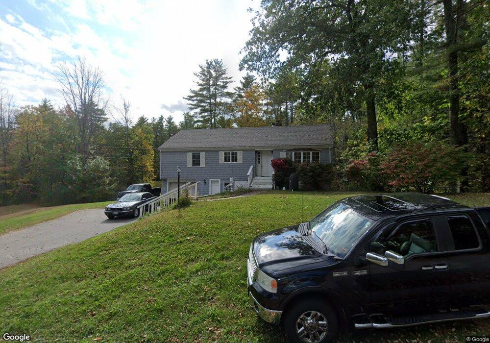
115 Lower Methodist Rd Cumberland Center, ME 04021
West Cumberland NeighborhoodEstimated Value: $317,000 - $364,703
3
Beds
1
Bath
1,200
Sq Ft
$279/Sq Ft
Est. Value
About This Home
This home is located at 115 Lower Methodist Rd, Cumberland Center, ME 04021 and is currently estimated at $334,676, approximately $278 per square foot. 115 Lower Methodist Rd is a home located in Cumberland County with nearby schools including Mabel I. Wilson School, Greely Middle School 4-5, and Greely Middle School.
Ownership History
Date
Name
Owned For
Owner Type
Purchase Details
Closed on
Feb 3, 2010
Sold by
Stratton Gene
Bought by
Galvan David I and Galvan Devon C
Current Estimated Value
Home Financials for this Owner
Home Financials are based on the most recent Mortgage that was taken out on this home.
Original Mortgage
$132,498
Outstanding Balance
$87,779
Interest Rate
5.05%
Mortgage Type
FHA
Estimated Equity
$246,897
Create a Home Valuation Report for This Property
The Home Valuation Report is an in-depth analysis detailing your home's value as well as a comparison with similar homes in the area
Home Values in the Area
Average Home Value in this Area
Purchase History
| Date | Buyer | Sale Price | Title Company |
|---|---|---|---|
| Galvan David I | -- | -- |
Source: Public Records
Mortgage History
| Date | Status | Borrower | Loan Amount |
|---|---|---|---|
| Open | Galvan David I | $11,049 | |
| Open | Galvan David I | $132,498 |
Source: Public Records
Tax History Compared to Growth
Tax History
| Year | Tax Paid | Tax Assessment Tax Assessment Total Assessment is a certain percentage of the fair market value that is determined by local assessors to be the total taxable value of land and additions on the property. | Land | Improvement |
|---|---|---|---|---|
| 2024 | $3,576 | $153,800 | $88,700 | $65,100 |
| 2023 | $3,407 | $153,800 | $88,700 | $65,100 |
| 2022 | $3,261 | $153,800 | $88,700 | $65,100 |
| 2021 | $3,161 | $153,800 | $88,700 | $65,100 |
| 2020 | $3,109 | $152,800 | $88,700 | $64,100 |
| 2019 | $2,987 | $150,500 | $88,700 | $61,800 |
| 2018 | $2,951 | $149,800 | $88,700 | $61,100 |
| 2017 | $2,816 | $149,800 | $88,700 | $61,100 |
| 2016 | $2,734 | $149,800 | $88,700 | $61,100 |
| 2015 | $2,711 | $149,800 | $88,700 | $61,100 |
| 2014 | $2,607 | $149,800 | $88,700 | $61,100 |
| 2013 | $2,547 | $149,800 | $88,700 | $61,100 |
Source: Public Records
Map
Nearby Homes
- 17 Buds Trail
- 24 Feldspar Ln Unit 23
- 26 Feldspar Ln Unit 22
- 23 Feldspar Ln Unit 12
- 8 Feldspar Ln Unit 29
- 21 Feldspar Ln Unit 11
- 1 Feldspar Ln Unit 1
- 27 Feldspar Ln Unit 14
- 13 Feldspar Ln Unit 7
- 30 Feldspar Ln Unit 21
- 7 Preston Way
- 15 Feldspar Ln Unit 8
- 11 Feldspar Ln Unit 6
- 25 Feldspar Ln Unit 13
- 0 Tinker Ln Unit 57D
- 57&57D Tinker Ln and Pointer Way
- 8 George Rd
- 0 Pointer Way Unit LOT 57
- 9 Mill Ridge Rd
- 43 Skillin Rd
- 113 Lower Methodist Rd
- 19 Buds Trail
- 12 Spring Rd
- 101 Lower Methodist Rd
- 3 Buds Trail
- 1 Buds Trail
- 1 Buds Trail
- 1 Bud's Trail
- 138 Gray Rd
- 5 Bud's Trail
- 134 Gray Rd
- 136 Gray Rd
- 93 Lower Methodist Rd
- 79 Upper Methodist Rd
- 102 Lower Methodist Rd
- Lot 7 Bud's Trail
- 130 Gray Rd
- 9 Buds Trail
- 3 Rooster Ridge
- 75 Upper Methodist Rd