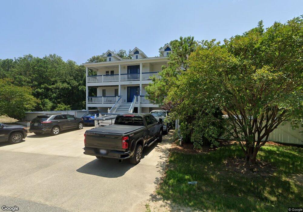
115 Osprey Ridge Rd Unit 13 Kitty Hawk, NC 27949
Estimated Value: $1,193,221 - $1,306,000
7
Beds
8
Baths
3,780
Sq Ft
$331/Sq Ft
Est. Value
About This Home
This home is located at 115 Osprey Ridge Rd Unit 13, Kitty Hawk, NC 27949 and is currently estimated at $1,250,805, approximately $330 per square foot. 115 Osprey Ridge Rd Unit 13 is a home located in Dare County with nearby schools including Kitty Hawk Elementary School, First Flight Middle School, and First Flight High School.
Ownership History
Date
Name
Owned For
Owner Type
Purchase Details
Closed on
Apr 4, 2024
Sold by
Mitchell Stephanie
Bought by
Markle John Steven and Endres Botiara Jean
Current Estimated Value
Purchase Details
Closed on
Jun 3, 2020
Sold by
Brinkmann Karen and Brinkmann Fred Dieter
Bought by
Mitchell Stephanie
Home Financials for this Owner
Home Financials are based on the most recent Mortgage that was taken out on this home.
Original Mortgage
$510,400
Interest Rate
3.2%
Mortgage Type
New Conventional
Purchase Details
Closed on
Nov 12, 2010
Sold by
Us Bank National Association
Bought by
Brinkman Karen and Johnsen Fred Deter
Purchase Details
Closed on
Aug 10, 2010
Sold by
Miller Carl S and Miller Valerie A
Bought by
Us Bank National Association
Create a Home Valuation Report for This Property
The Home Valuation Report is an in-depth analysis detailing your home's value as well as a comparison with similar homes in the area
Home Values in the Area
Average Home Value in this Area
Purchase History
| Date | Buyer | Sale Price | Title Company |
|---|---|---|---|
| Markle John Steven | $1,150,000 | None Listed On Document | |
| Markle John Steven | $1,150,000 | None Listed On Document | |
| Mitchell Stephanie | $658,000 | None Available | |
| Brinkman Karen | $500,000 | None Available | |
| Us Bank National Association | $556,147 | None Available |
Source: Public Records
Mortgage History
| Date | Status | Borrower | Loan Amount |
|---|---|---|---|
| Previous Owner | Mitchell Stephanie | $510,400 |
Source: Public Records
Tax History
| Year | Tax Paid | Tax Assessment Tax Assessment Total Assessment is a certain percentage of the fair market value that is determined by local assessors to be the total taxable value of land and additions on the property. | Land | Improvement |
|---|---|---|---|---|
| 2025 | $5,381 | $1,214,200 | $270,000 | $944,200 |
| 2024 | $4,439 | $660,300 | $108,000 | $552,300 |
| 2023 | $4,234 | $682,392 | $108,000 | $574,392 |
| 2022 | $4,234 | $682,392 | $108,000 | $574,392 |
| 2021 | $4,234 | $682,392 | $108,000 | $574,392 |
| 2020 | $4,073 | $682,392 | $108,000 | $574,392 |
| 2019 | $4,280 | $593,900 | $156,500 | $437,400 |
| 2018 | $4,280 | $593,900 | $156,500 | $437,400 |
| 2017 | $4,187 | $593,900 | $156,500 | $437,400 |
| 2016 | $3,941 | $593,900 | $156,500 | $437,400 |
| 2014 | $3,941 | $593,900 | $156,500 | $437,400 |
Source: Public Records
Map
Nearby Homes
- 119 Osprey Ridge Rd Unit Lot 11
- 102 Settlers Ln Unit Lot 7R
- 101 Georgetown Sands Rd Unit 47
- 102 Plover Dr Unit Lot 8
- 120 Tuckahoe Dr W Unit 75
- 102 Sea Hawk Dr E Unit Lot 19
- 131 Brandon Ct Unit Lot 35
- 126 Jay Crest Rd Unit 3
- 123 Georgetown Rd Unit 19
- 123 Georgetown Sands Rd Unit 24
- 123 Georgetown Sands Rd Unit 19
- 45 N Dune Loop Unit Lot 55
- 134 Scarborough Ln Unit 50
- 102 Winauk Ct Unit 71
- 103 Duck Landing Ln Unit Lot 49
- 30 11th Ave W Unit Lot 63
- 343 Sea Oats Trail Unit Lot 10
- 40 9th Ave W Unit Lot 45
- 316 Wax Myrtle Trail Unit Lot 20
- 310 Duck Rd Unit Lot 14
- 115 Osprey Ridge Rd
- 124 Sea Hawk Dr W
- 117 Osprey Ridge Rd
- 113 Osprey Ridge Rd
- 122 Sea Hawk Dr W
- 112 Osprey Ridge Rd Unit 6
- 112 Osprey Ridge Rd
- 120 Sea Hawk Dr W
- 114 Osprey Ridge Rd
- 110 Osprey Ridge Rd
- 111 Osprey Ridge Rd
- 126 Sea Hawk Dr W
- 119 Osprey Ridge Rd
- 116 Sea Hawk Dr W
- 106 Osprey Ridge Rd
- 109 Osprey Ridge Rd Unit Lot 16
- 109 Osprey Ridge Rd
- 120 Osprey Ridge Rd
- 128 Sea Hawk Dr W
- 102 Settlers Ln
Your Personal Tour Guide
Ask me questions while you tour the home.