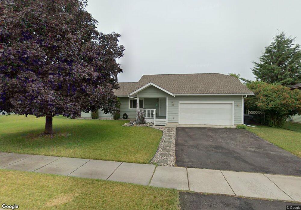
115 Quincy Loop Kalispell, MT 59901
Estimated Value: $440,575 - $468,000
4
Beds
2
Baths
1,388
Sq Ft
$327/Sq Ft
Est. Value
About This Home
This home is located at 115 Quincy Loop, Kalispell, MT 59901 and is currently estimated at $453,394, approximately $326 per square foot. 115 Quincy Loop is a home located in Flathead County with nearby schools including Cornelius Hedges School, Kalispell Middle School, and Flathead High School.
Ownership History
Date
Name
Owned For
Owner Type
Purchase Details
Closed on
Feb 24, 2020
Sold by
Edwards Carole J
Bought by
Edwards Carole J and Edwards Kearstin K
Current Estimated Value
Purchase Details
Closed on
Aug 1, 2005
Sold by
French James Ray and French Cynthia Ann
Bought by
Edwards Carole J
Home Financials for this Owner
Home Financials are based on the most recent Mortgage that was taken out on this home.
Original Mortgage
$100,000
Outstanding Balance
$51,922
Interest Rate
5.48%
Mortgage Type
New Conventional
Estimated Equity
$401,472
Create a Home Valuation Report for This Property
The Home Valuation Report is an in-depth analysis detailing your home's value as well as a comparison with similar homes in the area
Purchase History
| Date | Buyer | Sale Price | Title Company |
|---|---|---|---|
| Edwards Carole J | -- | None Available | |
| Edwards Carole J | -- | Compliments Of Sterling Titl |
Source: Public Records
Mortgage History
| Date | Status | Borrower | Loan Amount |
|---|---|---|---|
| Open | Edwards Carole J | $100,000 |
Source: Public Records
Tax History Compared to Growth
Tax History
| Year | Tax Paid | Tax Assessment Tax Assessment Total Assessment is a certain percentage of the fair market value that is determined by local assessors to be the total taxable value of land and additions on the property. | Land | Improvement |
|---|---|---|---|---|
| 2025 | $579 | $444,300 | $0 | $0 |
| 2024 | $814 | $384,500 | $0 | $0 |
| 2023 | $3,518 | $384,500 | $0 | $0 |
| 2022 | $3,255 | $264,300 | $0 | $0 |
| 2021 | $2,844 | $264,300 | $0 | $0 |
| 2020 | $3,067 | $234,300 | $0 | $0 |
| 2019 | $3,070 | $234,300 | $0 | $0 |
| 2018 | $2,620 | $185,000 | $0 | $0 |
| 2017 | $2,624 | $185,000 | $0 | $0 |
| 2016 | $2,315 | $177,000 | $0 | $0 |
| 2015 | $2,311 | $177,000 | $0 | $0 |
| 2014 | $2,357 | $109,233 | $0 | $0 |
Source: Public Records
Map
Nearby Homes
- 1717 S Woodland Dr Unit SPC -21
- 1687 Bull Run
- 1692 Bull Run
- 826 11th St E
- 1509 Eagle Dr
- 51 Selders Ln
- 1024 Woodland Ave
- 1403 & 1405 4th Ave E
- 141 Beargrass Ln
- 19 Muskrat Dr
- 835 7th Ave E
- 270 Caroline Rd
- 1225 2nd Ave E
- 1312 2nd Ave E
- 1227 1st Ave E
- 723 5th Ave E Unit 212C
- 220 Zimmerman Rd
- 2455 Us Highway 93 S
- 776 1st Ave E
- 209 12th St W
- 109 Quincy Loop
- 119 Quincy Loop
- 119 Quincy Loop
- 1565 Lehi Ln
- 116 Quincy Loop
- 1555 Lehi Ln
- 110 Quincy Loop
- 120 Quincy Loop
- 123 Quincy Loop
- 105 Quincy Loop
- 1525 S Woodland Dr
- 159 Quincy Loop
- 106 Quincy Loop
- 163 Quincy Loop
- 1545 Lehi Ln
- 1575 Lehi Ln
- 155 Quincy Loop
- 1525 S Woodland Dr
- 127 Quincy Loop
- 167 Quincy Loop