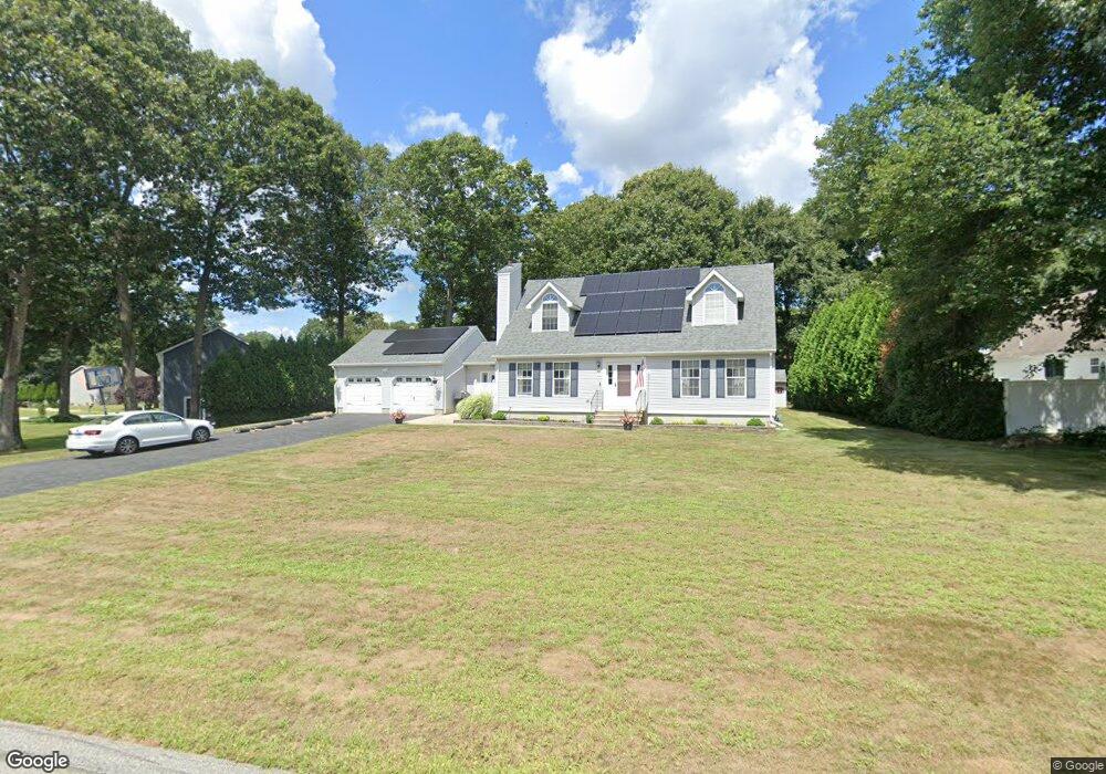
115 Richard Brown Dr Uncasville, CT 06382
Estimated Value: $410,000 - $467,177
5
Beds
3
Baths
2,058
Sq Ft
$217/Sq Ft
Est. Value
About This Home
This home is located at 115 Richard Brown Dr, Uncasville, CT 06382 and is currently estimated at $447,294, approximately $217 per square foot. 115 Richard Brown Dr is a home located in New London County with nearby schools including Leonard J. Tyl Middle School, Montville High School, and Mayflower Montessori School.
Ownership History
Date
Name
Owned For
Owner Type
Purchase Details
Closed on
Jun 29, 1998
Sold by
Pratt Clifford L and Pratt Lynn S
Bought by
Peltier Todd and Wilcox Denise
Current Estimated Value
Home Financials for this Owner
Home Financials are based on the most recent Mortgage that was taken out on this home.
Original Mortgage
$138,550
Interest Rate
7.09%
Mortgage Type
Unknown
Purchase Details
Closed on
Dec 19, 1995
Sold by
Rtt Dev Corp
Bought by
Platt Clifford L and Platt Lynn S
Home Financials for this Owner
Home Financials are based on the most recent Mortgage that was taken out on this home.
Original Mortgage
$147,750
Interest Rate
2.25%
Mortgage Type
Unknown
Create a Home Valuation Report for This Property
The Home Valuation Report is an in-depth analysis detailing your home's value as well as a comparison with similar homes in the area
Home Values in the Area
Average Home Value in this Area
Purchase History
| Date | Buyer | Sale Price | Title Company |
|---|---|---|---|
| Peltier Todd | $163,000 | -- | |
| Peltier Todd | $163,000 | -- | |
| Platt Clifford L | $160,625 | -- | |
| Platt Clifford L | $160,625 | -- |
Source: Public Records
Mortgage History
| Date | Status | Borrower | Loan Amount |
|---|---|---|---|
| Open | Platt Clifford L | $125,000 | |
| Closed | Platt Clifford L | $138,550 | |
| Previous Owner | Platt Clifford L | $147,750 |
Source: Public Records
Tax History Compared to Growth
Tax History
| Year | Tax Paid | Tax Assessment Tax Assessment Total Assessment is a certain percentage of the fair market value that is determined by local assessors to be the total taxable value of land and additions on the property. | Land | Improvement |
|---|---|---|---|---|
| 2025 | $7,021 | $243,180 | $35,070 | $208,110 |
| 2024 | $6,753 | $243,180 | $35,070 | $208,110 |
| 2023 | $6,753 | $243,180 | $35,070 | $208,110 |
| 2022 | $6,495 | $243,180 | $35,070 | $208,110 |
| 2021 | $6,166 | $194,200 | $34,760 | $159,440 |
| 2020 | $6,288 | $194,200 | $34,760 | $159,440 |
| 2019 | $6,313 | $194,200 | $34,760 | $159,440 |
| 2018 | $6,162 | $194,200 | $34,760 | $159,440 |
| 2017 | $6,156 | $194,200 | $34,760 | $159,440 |
| 2016 | $5,866 | $191,620 | $43,450 | $148,170 |
| 2015 | $5,866 | $191,620 | $43,450 | $148,170 |
| 2014 | $5,628 | $191,620 | $43,450 | $148,170 |
Source: Public Records
Map
Nearby Homes
- 124 Holly Hill Dr
- 19 Desjardins Dr
- 32 Cedar Ln
- 60 Fort Shantok Rd
- 61 Fort Shantok Rd
- 2057 Norwich New London Turnpike
- 87 Fort Shantok Rd
- 1622 Old Pond Ln Unit 1622
- 586 W Thames St Unit 610
- 527 W Thames St Unit 9
- 527 W Thames St Unit 27
- 4 Traders Ct
- 102 Lucas Park Rd
- 9 Thamesview Rd
- 4 Maplewood Ct
- 114 Park Ave
- 118 Sheraton Ln
- 26 Darling Crossing
- 31 Benedict Crossing
- 271 Leffingwell Rd Unit LOT 12
- 3 Benjamin Ct
- 121 Richard Brown Dr
- 7 Benjamin Ct
- 125 Richard Brown Dr
- 114 Richard Brown Dr
- 110 Richard Brown Dr
- 129 Richard Brown Dr
- 4 Benjamin Ct
- 11 Benjamin Ct
- 106 Richard Brown Dr
- 118 Richard Brown Dr
- 124 Richard Brown Dr
- 131 Richard Brown Dr
- 122 Richard Brown Dr
- 126 Richard Brown Dr
- 103 Richard Brown Dr
- 15 Benjamin Ct
- 8 Benjamin Ct
- 130 Richard Brown Dr
- 102 Richard Brown Dr