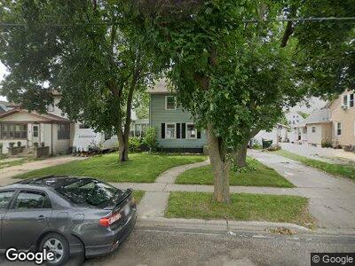
115 Robert St Fort Atkinson, WI 53538
Estimated Value: $214,000 - $256,000
3
Beds
2
Baths
1,456
Sq Ft
$165/Sq Ft
Est. Value
About This Home
This home is located at 115 Robert St, Fort Atkinson, WI 53538 and is currently estimated at $240,780, approximately $165 per square foot. 115 Robert St is a home located in Jefferson County with nearby schools including Barrie Elementary School, Fort Atkinson Middle School, and Fort Atkinson High School.
Ownership History
Date
Name
Owned For
Owner Type
Purchase Details
Closed on
Apr 28, 2022
Sold by
Hickling Aaron A
Bought by
Hickling Lori A
Current Estimated Value
Purchase Details
Closed on
Apr 8, 2011
Sold by
Fannie Mae
Bought by
Hickling Aaron A and Hickling Lori A
Home Financials for this Owner
Home Financials are based on the most recent Mortgage that was taken out on this home.
Original Mortgage
$63,600
Interest Rate
4.86%
Mortgage Type
Purchase Money Mortgage
Create a Home Valuation Report for This Property
The Home Valuation Report is an in-depth analysis detailing your home's value as well as a comparison with similar homes in the area
Home Values in the Area
Average Home Value in this Area
Purchase History
| Date | Buyer | Sale Price | Title Company |
|---|---|---|---|
| Hickling Lori A | $133,000 | Toby Tully | |
| Hickling Aaron A | -- | None Available |
Source: Public Records
Mortgage History
| Date | Status | Borrower | Loan Amount |
|---|---|---|---|
| Open | Hickling Lori A | $20,000 | |
| Previous Owner | Hickling Aaron A | $63,600 | |
| Previous Owner | Schirott Suzanne T | $13,605 | |
| Previous Owner | Schirott Suzanne T | $88,000 |
Source: Public Records
Tax History Compared to Growth
Tax History
| Year | Tax Paid | Tax Assessment Tax Assessment Total Assessment is a certain percentage of the fair market value that is determined by local assessors to be the total taxable value of land and additions on the property. | Land | Improvement |
|---|---|---|---|---|
| 2024 | $3,755 | $201,600 | $37,500 | $164,100 |
| 2023 | $3,400 | $201,600 | $37,500 | $164,100 |
| 2022 | $3,395 | $133,000 | $25,500 | $107,500 |
| 2021 | $2,992 | $133,000 | $25,500 | $107,500 |
| 2020 | $2,948 | $133,000 | $25,500 | $107,500 |
| 2019 | $2,815 | $133,000 | $25,500 | $107,500 |
| 2018 | $2,718 | $133,000 | $25,500 | $107,500 |
| 2017 | $2,680 | $133,000 | $25,500 | $107,500 |
| 2016 | $2,588 | $124,300 | $23,700 | $100,600 |
| 2015 | $2,711 | $124,300 | $23,700 | $100,600 |
| 2014 | $2,618 | $124,300 | $23,700 | $100,600 |
| 2013 | $2,687 | $124,300 | $23,700 | $100,600 |
Source: Public Records
Map
Nearby Homes
- 817 Van Buren St
- 351 Monroe St
- 320 Grove St
- 311 N Main St
- 521 Adams St
- 407 Janesville Ave
- 100 Edward St Unit 6
- 916 Madison Ave
- 102 Clarence St
- 101 N 4th St Unit 103
- 716 Messmer St
- 1222 Sherman Ave W
- 233 S Water St E
- 430 Whitewater Ave
- 617 Grant St
- 424 Foster St
- 622 Maple St
- 616 Maple St
- 612 Maple St
- 608 Maple St
- 115 Robert St
- 109 Robert St
- 119 Robert St
- 107 Robert St
- 112 Monroe St
- 108 Monroe St
- 116 Monroe St
- 101 Robert St
- 508 Van Buren St
- 125 Robert St
- 509 Sherman Ave W
- 114 Robert St
- 110 Robert St
- 512 Van Buren St
- 118 Robert St
- 120 Monroe St
- 514 Van Buren St
- 431 Sherman Ave W
- 511 Sherman Ave W
- 332 Riverside Dr