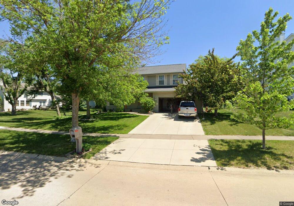
115 Rockhurst Dr SW Cedar Rapids, IA 52404
Cherry Hill Park NeighborhoodEstimated Value: $313,000 - $356,000
4
Beds
4
Baths
2,077
Sq Ft
$161/Sq Ft
Est. Value
About This Home
This home is located at 115 Rockhurst Dr SW, Cedar Rapids, IA 52404 and is currently estimated at $333,984, approximately $160 per square foot. 115 Rockhurst Dr SW is a home located in Linn County with nearby schools including Junction City Elementary School, West Willow Elementary School, and Bourbon Central Elementary School.
Ownership History
Date
Name
Owned For
Owner Type
Purchase Details
Closed on
Nov 20, 1998
Sold by
Midwest Development Co
Bought by
Kokontis Steven L and Baldus Kokontis Theresa A
Current Estimated Value
Home Financials for this Owner
Home Financials are based on the most recent Mortgage that was taken out on this home.
Original Mortgage
$147,270
Outstanding Balance
$33,336
Interest Rate
7.01%
Estimated Equity
$300,648
Create a Home Valuation Report for This Property
The Home Valuation Report is an in-depth analysis detailing your home's value as well as a comparison with similar homes in the area
Home Values in the Area
Average Home Value in this Area
Purchase History
| Date | Buyer | Sale Price | Title Company |
|---|---|---|---|
| Kokontis Steven L | $184,000 | -- |
Source: Public Records
Mortgage History
| Date | Status | Borrower | Loan Amount |
|---|---|---|---|
| Open | Kokontis Steven L | $147,270 |
Source: Public Records
Tax History Compared to Growth
Tax History
| Year | Tax Paid | Tax Assessment Tax Assessment Total Assessment is a certain percentage of the fair market value that is determined by local assessors to be the total taxable value of land and additions on the property. | Land | Improvement |
|---|---|---|---|---|
| 2025 | $4,190 | $295,800 | $66,000 | $229,800 |
| 2024 | $4,764 | $272,400 | $60,200 | $212,200 |
| 2023 | $4,764 | $254,300 | $56,300 | $198,000 |
| 2022 | $4,396 | $234,700 | $52,400 | $182,300 |
| 2021 | $4,394 | $221,200 | $46,600 | $174,600 |
| 2020 | $4,394 | $207,700 | $46,600 | $161,100 |
| 2019 | $3,948 | $191,700 | $38,800 | $152,900 |
| 2018 | $3,836 | $191,700 | $38,800 | $152,900 |
| 2017 | $3,877 | $189,900 | $38,800 | $151,100 |
| 2016 | $3,877 | $182,400 | $38,800 | $143,600 |
| 2015 | $3,839 | $180,377 | $38,830 | $141,547 |
| 2014 | $3,654 | $189,998 | $38,830 | $151,168 |
| 2013 | $3,770 | $189,998 | $38,830 | $151,168 |
Source: Public Records
Map
Nearby Homes
- 509 Grey Slate Dr SW
- 6812 Underwood Ave SW
- 614 Grey Slate Dr SW
- 620 Grey Slate Dr SW
- 7806 Hillsboro Dr SW
- 6916 Rock Wood Dr SW
- 6907 Rock Wood Dr SW
- 6608 Limestone Ct NW
- 1590 Stoney Pt Rd & 6600 16th Ave SW
- 916 Blue Stone St NW
- 6305 Greenbriar Ln SW Unit B
- 6118 Greenbriar Ln SW Unit D
- 6008 Eastview Ave SW
- 5918 Sharon Ln NW
- 200 Cherry Park Dr NW
- 164 Cherry Hill Rd NW
- 323 Norwick Rd SW
- 150 Meadowlark Ln NW
- 106 Leroy St NW
- 5127 Holly Ave NW
- 121 Rockhurst Dr SW
- 7145 1st Ave SW
- 7137 1st Ave SW
- 7120 Pleasant Ridge Dr SW
- 7129 1st Ave SW
- 104 Rockhurst Dr SW
- 7114 Pleasant Ridge Dr SW
- 7121 1st Ave SW
- 118 Rockhurst Dr SW
- 203 Rockhurst Dr SW
- 7211 1st Ave SW
- 7108 Pleasant Ridge Dr SW
- 7113 1st Ave SW
- 7117 Pleasant Ridge Dr SW
- 7130 1st Ave NW
- 7122 1st Ave NW
- 7200 1st Ave NW
- 209 Rockhurst Dr SW
- 7114 1st Ave NW
- 7219 1st Ave SW