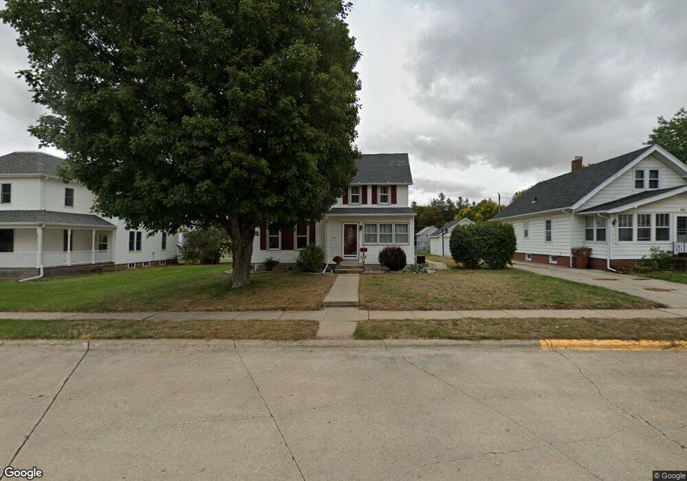
115 S Maple St Carroll, IA 51401
Estimated Value: $150,000 - $173,000
3
Beds
2
Baths
1,606
Sq Ft
$98/Sq Ft
Est. Value
About This Home
This home is located at 115 S Maple St, Carroll, IA 51401 and is currently estimated at $156,789, approximately $97 per square foot. 115 S Maple St is a home located in Carroll County with nearby schools including Fairview Elementary School, Adams Elementary School, and Carroll Middle School.
Ownership History
Date
Name
Owned For
Owner Type
Purchase Details
Closed on
Dec 26, 2006
Sold by
Boes Richard H
Bought by
Lawler William J and Lawler Mandy J
Current Estimated Value
Home Financials for this Owner
Home Financials are based on the most recent Mortgage that was taken out on this home.
Original Mortgage
$90,500
Outstanding Balance
$54,263
Interest Rate
6.27%
Mortgage Type
New Conventional
Estimated Equity
$102,526
Create a Home Valuation Report for This Property
The Home Valuation Report is an in-depth analysis detailing your home's value as well as a comparison with similar homes in the area
Home Values in the Area
Average Home Value in this Area
Purchase History
| Date | Buyer | Sale Price | Title Company |
|---|---|---|---|
| Lawler William J | $90,500 | Security Title & Investment |
Source: Public Records
Mortgage History
| Date | Status | Borrower | Loan Amount |
|---|---|---|---|
| Open | Lawler William J | $90,500 |
Source: Public Records
Tax History
| Year | Tax Paid | Tax Assessment Tax Assessment Total Assessment is a certain percentage of the fair market value that is determined by local assessors to be the total taxable value of land and additions on the property. | Land | Improvement |
|---|---|---|---|---|
| 2025 | $1,334 | $128,790 | $18,330 | $110,460 |
| 2024 | $13 | $111,960 | $18,330 | $93,630 |
| 2023 | $1,529 | $111,960 | $18,330 | $93,630 |
| 2022 | $1,448 | $108,820 | $18,330 | $90,490 |
| 2021 | $1,448 | $108,820 | $18,330 | $90,490 |
| 2020 | $1,483 | $108,820 | $18,330 | $90,490 |
| 2019 | $1,416 | $108,820 | $18,330 | $90,490 |
| 2018 | $1,330 | $108,820 | $18,330 | $90,490 |
| 2017 | $1,324 | $101,543 | $12,487 | $89,056 |
| 2016 | $1,234 | $94,900 | $0 | $0 |
| 2015 | $1,234 | $94,540 | $0 | $0 |
| 2014 | $1,214 | $94,540 | $0 | $0 |
Source: Public Records
Map
Nearby Homes
- 519 E 1st St
- 409 E Valley Dr
- 222 W 2nd St
- 317 Arthur Neu Dr
- 121 S West St
- 804 N Clark St
- 19383 U S 30
- Deer Creek Ln Lot 36
- 332 N Crawford St
- 827 N Main St
- 926 N Court St
- 619 W 2nd St
- 110 E 10th St
- 479 Deer Creek Ln
- 629 Meadow Ln
- 0 Deer Creek Ln Unit 6302348
- 505 Parkview Dr
- 1015 N Adams St
- 1102 N Main St
- 1108 N Main St
Your Personal Tour Guide
Ask me questions while you tour the home.