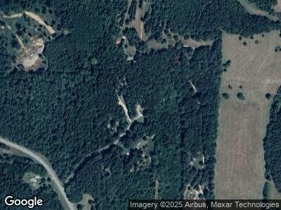
115 Striker Rd Cedartown, GA 30125
Estimated Value: $59,537 - $219,000
2
Beds
2
Baths
924
Sq Ft
$137/Sq Ft
Est. Value
About This Home
This home is located at 115 Striker Rd, Cedartown, GA 30125 and is currently estimated at $126,384, approximately $136 per square foot. 115 Striker Rd is a home with nearby schools including Cedar Christian School.
Ownership History
Date
Name
Owned For
Owner Type
Purchase Details
Closed on
Feb 16, 2024
Sold by
Knight David W
Bought by
Borders Ray E and Borders Shirley M
Current Estimated Value
Purchase Details
Closed on
Apr 15, 2008
Sold by
Cuzzort Denny Joe
Bought by
Knight David W
Purchase Details
Closed on
Oct 1, 2004
Sold by
Hamby Margaret L
Bought by
Cuzzort Amy R and Denny Joe
Purchase Details
Closed on
Dec 9, 2000
Sold by
Maddox Bradley and Maddox Kawna
Bought by
Hamby Margaret L
Purchase Details
Closed on
Oct 22, 1998
Sold by
Wallace Margaret L
Bought by
Maddox Bradley and Maddox Kawna
Purchase Details
Closed on
Sep 20, 1993
Sold by
Paris Hoyt J
Bought by
Wallace Margaret L
Create a Home Valuation Report for This Property
The Home Valuation Report is an in-depth analysis detailing your home's value as well as a comparison with similar homes in the area
Home Values in the Area
Average Home Value in this Area
Purchase History
| Date | Buyer | Sale Price | Title Company |
|---|---|---|---|
| Borders Ray E | $13,530 | -- | |
| Knight David W | $18,500 | -- | |
| Cuzzort Amy R | -- | -- | |
| Hamby Margaret L | -- | -- | |
| Maddox Bradley | $2,000 | -- | |
| Wallace Margaret L | $1,300 | -- |
Source: Public Records
Tax History Compared to Growth
Tax History
| Year | Tax Paid | Tax Assessment Tax Assessment Total Assessment is a certain percentage of the fair market value that is determined by local assessors to be the total taxable value of land and additions on the property. | Land | Improvement |
|---|---|---|---|---|
| 2024 | $72 | $3,423 | $2,308 | $1,115 |
| 2023 | $72 | $4,298 | $0 | $4,298 |
| 2022 | $63 | $3,715 | $0 | $3,715 |
| 2021 | $64 | $3,715 | $0 | $3,715 |
| 2020 | $40 | $3,715 | $0 | $3,715 |
| 2019 | $44 | $3,715 | $0 | $3,715 |
| 2018 | $46 | $1,653 | $1,538 | $115 |
| 2017 | $45 | $1,653 | $1,538 | $115 |
| 2016 | $58 | $2,115 | $2,000 | $115 |
| 2015 | $58 | $2,115 | $2,000 | $115 |
| 2014 | $58 | $2,115 | $2,000 | $115 |
Source: Public Records
Map
Nearby Homes
- 0 Mountain Home Rd Unit 7532284
- 0 Mountain Home Rd Unit 10467104
- 0 Mountain Home Rd Unit 1020-C 10351948
- 0 Mountain Home Rd Unit 1020-B 10351940
- 0 Mountain Home Rd Unit 1020-A 10351930
- 1705 6th Street Rd
- 253 Dry Creek Rd
- 510 Parrish Rd
- 1849 Prior Station Rd Unit 76 ACRES
- 1849 Prior Station Rd
- 257 Potash Spur
- 0 Cave Springs Rd Unit 10350694
- 28 Summerwind Dr
- 18 Old Potash Rd
- 645 West Ave
- 516 Branch St
- 512 Branch St
- 508 Branch St
- 0 Old Potash Rd Unit 10517451
- 0 Old Potash Rd Unit 7575737
- 115 Striker Rd
- 0 Striker Rd Unit 8235720
- 0 Striker Rd Unit 8047021
- 0 Striker Rd Unit 7183048
- 0 Striker Rd
- 107 Striker Rd
- 90 Striker Rd
- 716 Mountain Home Rd
- 153 Striker Rd
- 150 Striker Rd
- 722 Mountain Home Rd
- 714 Mountain Home Rd
- 714 Mountain Home Rd
- 771 Mountain Home Rd
- 698 Mountain Home Rd
- 680 Mountain Home Rd
- 0 Mountain View Ct Unit 23 8386938
- 0 Mountain View Ct Unit 6017662
- 0 Mountain View Ct Unit 23
- 0 Mountain View Ct Unit 8788214
