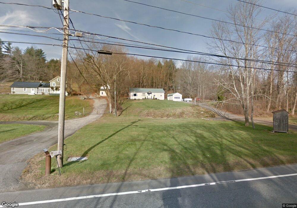
1150 Bantam Rd Bantam, CT 06750
Estimated Value: $305,550 - $393,000
2
Beds
1
Bath
1,012
Sq Ft
$334/Sq Ft
Est. Value
About This Home
This home is located at 1150 Bantam Rd, Bantam, CT 06750 and is currently estimated at $338,388, approximately $334 per square foot. 1150 Bantam Rd is a home located in Litchfield County with nearby schools including Center School, Litchfield Intermediate School, and Litchfield High School.
Ownership History
Date
Name
Owned For
Owner Type
Purchase Details
Closed on
Oct 28, 2020
Sold by
Orsino Paul
Bought by
Orsino Paul and Orsino Suzanne
Current Estimated Value
Purchase Details
Closed on
Oct 26, 2020
Sold by
Orsino Paul and Orsino Suzanne
Bought by
Orsuno Paul
Purchase Details
Closed on
Jul 24, 2015
Sold by
Est Jene Arthur
Bought by
Orsino Paul T and Moss-Orsino Suzanne
Purchase Details
Closed on
Mar 1, 2007
Sold by
Lillis Edward and Lillis Jody
Bought by
Orsino 2Nd Paul and Orsino Suzanne
Home Financials for this Owner
Home Financials are based on the most recent Mortgage that was taken out on this home.
Original Mortgage
$247,350
Interest Rate
6.27%
Create a Home Valuation Report for This Property
The Home Valuation Report is an in-depth analysis detailing your home's value as well as a comparison with similar homes in the area
Home Values in the Area
Average Home Value in this Area
Purchase History
| Date | Buyer | Sale Price | Title Company |
|---|---|---|---|
| Orsino Paul | -- | None Available | |
| Orsuno Paul | -- | None Available | |
| Orsino Paul T | -- | -- | |
| Orsino 2Nd Paul | $255,000 | -- |
Source: Public Records
Mortgage History
| Date | Status | Borrower | Loan Amount |
|---|---|---|---|
| Previous Owner | Orsino 2Nd Paul | $247,350 | |
| Previous Owner | Orsino 2Nd Paul | $145,000 | |
| Previous Owner | Orsino 2Nd Paul | $94,500 |
Source: Public Records
Tax History
| Year | Tax Paid | Tax Assessment Tax Assessment Total Assessment is a certain percentage of the fair market value that is determined by local assessors to be the total taxable value of land and additions on the property. | Land | Improvement |
|---|---|---|---|---|
| 2025 | $3,943 | $186,010 | $58,500 | $127,510 |
| 2024 | $3,664 | $186,010 | $58,500 | $127,510 |
| 2023 | $3,170 | $112,400 | $43,580 | $68,820 |
| 2022 | $3,181 | $112,400 | $43,580 | $68,820 |
| 2021 | $3,271 | $112,400 | $43,580 | $68,820 |
| 2020 | $3,282 | $112,400 | $43,580 | $68,820 |
| 2019 | $3,338 | $112,400 | $43,580 | $68,820 |
| 2018 | $3,464 | $118,640 | $52,350 | $66,290 |
| 2017 | $3,434 | $118,020 | $52,350 | $65,670 |
| 2016 | $3,328 | $118,020 | $52,350 | $65,670 |
| 2015 | -- | $118,020 | $52,350 | $65,670 |
| 2014 | -- | $118,020 | $52,350 | $65,670 |
Source: Public Records
Map
Nearby Homes
- 28 Trumbull St
- 161 Circle Dr
- 38 Old Turnpike Rd
- 700 Bantam Rd
- 262 Stoddard Rd
- 44 Bantam Lake Heights
- 10 Gate Post Ln
- 107 Island Trail
- 7 Hill Top Rd
- 115 Alain White Rd
- 28 Headquarters Rd
- 298 Kenyon Rd
- 137 Old South Rd
- 429 Lakeside Rd
- 447 South St
- 415 South St
- 44 South St
- 91 North St
- 00 Torrington Rd
- 124 North St
- 1160 Bantam Rd
- 1134 Bantam Rd
- 1120 Bantam Rd
- 1186 Bantam Rd
- 1191 Bantam Rd
- 00 W Morris Rd
- 0 W Morris Rd
- 1192 Bantam Rd
- 4 W Morris Rd
- 1201 Bantam Rd
- 1104 Bantam Rd
- 1198 Bantam Rd
- 10 W Morris Rd
- 1202 Bantam Rd
- 14 W Morris Rd
- 1174 Bantam Rd
- 1101 Bantam Rd
- 1092 Bantam Rd Unit 2 W
- 1092 Bantam Rd
- 1092 Bantam Rd Unit 3
Your Personal Tour Guide
Ask me questions while you tour the home.