Estimated Value: $58,646 - $195,000
3
Beds
1
Bath
832
Sq Ft
$141/Sq Ft
Est. Value
About This Home
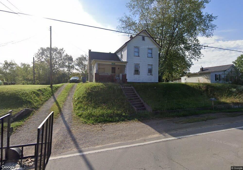
This home is located at 1150 Us Highway 52, Stout, OH 45684 and is currently estimated at $116,912, approximately $140 per square foot. 1150 Us Highway 52 is a home located in Scioto County with nearby schools including Portsmouth West Elementary School, Portsmouth West Middle School, and Portsmouth West High School.
Ownership History
Date
Name
Owned For
Owner Type
Purchase Details
Closed on
Feb 28, 2022
Sold by
Dorothy Cook
Bought by
Fegly Lester
Current Estimated Value
Purchase Details
Closed on
Jun 18, 2014
Sold by
Connie Connie
Bought by
Cook Dorothy
Purchase Details
Closed on
Oct 3, 2012
Sold by
Cook Mildred I
Bought by
Cook Connie
Purchase Details
Closed on
Apr 20, 2010
Sold by
Cook Ronald S and Cook Connie
Bought by
Cook Ronald S and Cook Connie
Purchase Details
Closed on
Sep 29, 2004
Bought by
Cook Mildred I
Create a Home Valuation Report for This Property
The Home Valuation Report is an in-depth analysis detailing your home's value as well as a comparison with similar homes in the area
Home Values in the Area
Average Home Value in this Area
Purchase History
| Date | Buyer | Sale Price | Title Company |
|---|---|---|---|
| Fegly Lester | -- | Stevenson John R | |
| Cook Dorothy | -- | -- | |
| Cook Connie | $10,750 | -- | |
| Cook Ronald S | -- | Allen, Yurasek, Merklin & Ow | |
| Cook Mildred I | -- | -- |
Source: Public Records
Tax History Compared to Growth
Tax History
| Year | Tax Paid | Tax Assessment Tax Assessment Total Assessment is a certain percentage of the fair market value that is determined by local assessors to be the total taxable value of land and additions on the property. | Land | Improvement |
|---|---|---|---|---|
| 2024 | $637 | $12,410 | $2,170 | $10,240 |
| 2023 | $606 | $12,410 | $2,170 | $10,240 |
| 2022 | $177 | $12,420 | $2,170 | $10,250 |
| 2021 | $118 | $11,060 | $1,910 | $9,150 |
| 2020 | $118 | $11,060 | $1,910 | $9,150 |
| 2019 | $119 | $11,060 | $1,910 | $9,150 |
| 2018 | $75 | $10,050 | $1,730 | $8,320 |
| 2017 | $73 | $10,050 | $1,730 | $8,320 |
| 2016 | $38 | $9,450 | $1,730 | $7,720 |
| 2015 | $41 | $9,450 | $1,730 | $7,720 |
| 2013 | $38 | $9,450 | $1,730 | $7,720 |
Source: Public Records
Map
Nearby Homes
- 1178 Us Highway 52
- 1126 Us Highway 52
- 1104 Us Highway 52
- 1104 U S 52
- 1070 Us Highway 52
- 1229 Us Highway 52
- 1109 Us Highway 52
- 1353 Us Highway 52
- 266 4th St
- 210 4th St
- 1417 Us Highway 52
- 249 Tucker St
- 205 Tucker St
- 175 Tucker St
- 109 Twin St
- 109 Twin St
- 1499 Uc 52
- 1499 U S 52
- 736 Us Highway 52
- 59 Twin St