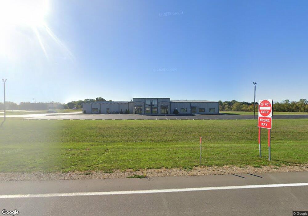
11500 N Us Highway 131 Schoolcraft, MI 49087
Estimated Value: $1,698,442
--
Bed
1
Bath
1,296
Sq Ft
$1,311/Sq Ft
Est. Value
About This Home
This home is located at 11500 N Us Highway 131, Schoolcraft, MI 49087 and is currently estimated at $1,698,442, approximately $1,310 per square foot. 11500 N Us Highway 131 is a home located in Kalamazoo County with nearby schools including Clopton Elementary School, Schoolcraft Upper Elementary School, and Schoolcraft Middle School.
Ownership History
Date
Name
Owned For
Owner Type
Purchase Details
Closed on
Jan 16, 2007
Sold by
Mcnamara Michael P and Mcnamara Julie A
Bought by
The Prairie Chapel
Current Estimated Value
Home Financials for this Owner
Home Financials are based on the most recent Mortgage that was taken out on this home.
Original Mortgage
$500,000
Outstanding Balance
$298,799
Interest Rate
6.21%
Mortgage Type
Purchase Money Mortgage
Estimated Equity
$1,399,644
Create a Home Valuation Report for This Property
The Home Valuation Report is an in-depth analysis detailing your home's value as well as a comparison with similar homes in the area
Home Values in the Area
Average Home Value in this Area
Purchase History
| Date | Buyer | Sale Price | Title Company |
|---|---|---|---|
| The Prairie Chapel | $790,000 | Devon Title |
Source: Public Records
Mortgage History
| Date | Status | Borrower | Loan Amount |
|---|---|---|---|
| Open | The Prairie Chapel | $500,000 |
Source: Public Records
Tax History Compared to Growth
Tax History
| Year | Tax Paid | Tax Assessment Tax Assessment Total Assessment is a certain percentage of the fair market value that is determined by local assessors to be the total taxable value of land and additions on the property. | Land | Improvement |
|---|---|---|---|---|
| 2025 | -- | $0 | $0 | $0 |
| 2024 | -- | $0 | $0 | $0 |
| 2023 | -- | $0 | $0 | $0 |
| 2022 | $0 | $0 | $0 | $0 |
| 2021 | $0 | $0 | $0 | $0 |
| 2020 | $0 | $0 | $0 | $0 |
| 2019 | $0 | $0 | $0 | $0 |
| 2018 | $0 | $0 | $0 | $0 |
| 2017 | $0 | $0 | $0 | $0 |
| 2016 | -- | $0 | $0 | $0 |
| 2015 | -- | $0 | $0 | $0 |
| 2014 | -- | $0 | $0 | $0 |
Source: Public Records
Map
Nearby Homes
- 2950 W U Ave
- 11025 Higley Cir W
- 2223 Surry
- VL W V Ave W
- 526 N Cedar St
- 455 N Centre St
- 2633 Rolling Hill Ave
- 324 N Hayward St
- 6395 W U Ave
- 512 E Cass St
- 10476 Schrier Ln
- 1817 Alder Ave
- 503 E Eliza St
- 10025 Shuman St
- 10381 Schrier Ln
- 10382 Pennridge Dr
- 218 S Robinson St
- Integrity 1800 Plan at Pennridge Trail North
- Integrity 2085 Plan at Pennridge Trail North
- Integrity 1910 Plan at Pennridge Trail North
- 4167 W U Ave
- 4261 W U Ave
- 4200 W U Ave
- 12074 U S 131
- 11981 U S 131
- 4371 W U Ave
- 4009 W U Ave
- 11981 Us-131
- 12033 U S 131 Unit 7
- 12033 U S 131 Unit 4
- 12033 U S 131 Unit 5
- 12033 U S 131 Unit 2
- 12033 U S 131
- 12033 U S 131 Unit 1
- 12033 U S 131 Unit 3
- 12033 U S 131 Unit 6
- 11847 S Shaver Rd
- 3800 W U Ave
- 12033 N Us Highway 131 Unit 7
- 12033 N Us Highway 131 Unit 4