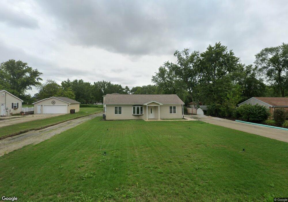
11502 194th St Mokena, IL 60448
Estimated Value: $235,000 - $315,000
3
Beds
1
Bath
1,130
Sq Ft
$255/Sq Ft
Est. Value
About This Home
This home is located at 11502 194th St, Mokena, IL 60448 and is currently estimated at $288,230, approximately $255 per square foot. 11502 194th St is a home located in Will County with nearby schools including Mokena Elementary School, Mokena Intermediate School, and Mokena Jr High School.
Ownership History
Date
Name
Owned For
Owner Type
Purchase Details
Closed on
Oct 23, 2014
Sold by
U S Bank National Association
Bought by
Soyak Adam A
Current Estimated Value
Purchase Details
Closed on
Apr 23, 1998
Sold by
Babbe Edward A and Babbe Mary Ann
Bought by
Debickero Elizabeth
Purchase Details
Closed on
Mar 24, 1998
Sold by
Porick Gertrude and Yarger William
Bought by
Babbe Edward A and Babbe Mary Anne
Create a Home Valuation Report for This Property
The Home Valuation Report is an in-depth analysis detailing your home's value as well as a comparison with similar homes in the area
Home Values in the Area
Average Home Value in this Area
Purchase History
| Date | Buyer | Sale Price | Title Company |
|---|---|---|---|
| Soyak Adam A | $155,100 | Servicelink Llc | |
| Debickero Elizabeth | -- | -- | |
| Babbe Edward A | $9,500 | -- |
Source: Public Records
Tax History
| Year | Tax Paid | Tax Assessment Tax Assessment Total Assessment is a certain percentage of the fair market value that is determined by local assessors to be the total taxable value of land and additions on the property. | Land | Improvement |
|---|---|---|---|---|
| 2024 | $5,855 | $87,325 | $20,415 | $66,910 |
| 2023 | $5,855 | $77,990 | $18,233 | $59,757 |
| 2022 | $5,604 | $71,035 | $16,607 | $54,428 |
| 2021 | $3,520 | $66,457 | $15,537 | $50,920 |
| 2020 | $3,427 | $64,584 | $15,099 | $49,485 |
| 2019 | $3,252 | $62,856 | $14,695 | $48,161 |
| 2018 | $3,097 | $61,049 | $14,273 | $46,776 |
| 2017 | $3,003 | $43,291 | $13,940 | $29,351 |
| 2016 | $2,909 | $41,807 | $13,462 | $28,345 |
| 2015 | $2,761 | $40,335 | $12,988 | $27,347 |
| 2014 | $2,761 | $40,055 | $12,898 | $27,157 |
| 2013 | $2,761 | $40,574 | $13,065 | $27,509 |
Source: Public Records
Map
Nearby Homes
- 19511 116th Ave Unit D
- 19502 116th Ave Unit C
- 19545 116th Ave Unit A
- 11617 Parkside Ln
- 19380 Wolf Rd Unit 6
- 11254 192nd St
- 11608 197th St
- W Maple Rd
- 11321 1st St
- 11325 1st St
- 11317 1st St
- 11329 1st St
- 11319 1st St
- 11323 1st St
- 11315 1st St
- 11550 Francis Rd
- Lot 7 Block 3 McGovn Mcgovney St
- 11144 Denny Ave
- 10928 3rd St
- 11125 Denny Ave
Your Personal Tour Guide
Ask me questions while you tour the home.