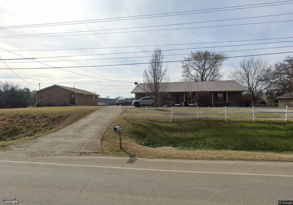
1151 N Chucky Pike Jefferson City, TN 37760
Estimated Value: $256,911 - $307,000
--
Bed
2
Baths
1,860
Sq Ft
$153/Sq Ft
Est. Value
About This Home
This home is located at 1151 N Chucky Pike, Jefferson City, TN 37760 and is currently estimated at $284,637, approximately $153 per square foot. 1151 N Chucky Pike is a home located in Jefferson County with nearby schools including Heritage Christian Academy.
Ownership History
Date
Name
Owned For
Owner Type
Purchase Details
Closed on
Jun 2, 2006
Sold by
Paxton Robert L
Bought by
The William C Wolfe Revocable
Current Estimated Value
Purchase Details
Closed on
Aug 30, 1999
Bought by
Paxton Robert L and Paxton Carolyn C
Purchase Details
Closed on
Aug 5, 1994
Bought by
Plan Housing Devel Inc A Tn Corp
Purchase Details
Closed on
Aug 5, 1992
Bought by
Brown Frank W and Peoples James R
Purchase Details
Closed on
May 11, 1992
Bought by
Brown Frank W and Pe Ron C James R
Purchase Details
Closed on
Apr 30, 1990
Bought by
Hayes Hayes H and Hayes Sharon C
Create a Home Valuation Report for This Property
The Home Valuation Report is an in-depth analysis detailing your home's value as well as a comparison with similar homes in the area
Home Values in the Area
Average Home Value in this Area
Purchase History
| Date | Buyer | Sale Price | Title Company |
|---|---|---|---|
| The William C Wolfe Revocable | $125,500 | -- | |
| Paxton Robert L | $76,500 | -- | |
| Plan Housing Devel Inc A Tn Corp | $79,900 | -- | |
| Brown Frank W | -- | -- | |
| Brown Frank W | $8,500 | -- | |
| Hayes Hayes H | -- | -- |
Source: Public Records
Tax History Compared to Growth
Tax History
| Year | Tax Paid | Tax Assessment Tax Assessment Total Assessment is a certain percentage of the fair market value that is determined by local assessors to be the total taxable value of land and additions on the property. | Land | Improvement |
|---|---|---|---|---|
| 2025 | $1,122 | $93,520 | $14,400 | $79,120 |
| 2023 | $1,586 | $45,320 | $0 | $0 |
| 2022 | $1,537 | $45,320 | $10,000 | $35,320 |
| 2021 | $1,537 | $45,320 | $10,000 | $35,320 |
| 2020 | $1,537 | $45,320 | $10,000 | $35,320 |
| 2019 | $1,537 | $45,320 | $10,000 | $35,320 |
| 2018 | $1,419 | $39,960 | $7,200 | $32,760 |
| 2017 | $1,419 | $39,960 | $7,200 | $32,760 |
| 2016 | $1,419 | $39,960 | $7,200 | $32,760 |
| 2015 | $1,399 | $39,960 | $7,200 | $32,760 |
| 2014 | $1,379 | $39,960 | $7,200 | $32,760 |
Source: Public Records
Map
Nearby Homes
- 431 Clearbrook Dr
- 409 Clearbrook Dr
- 230 Fieldcrest Dr
- 1819 Brookline Ct
- 1366 Clinch View Cir
- 1015 Battle Ridge
- Macon Plan at Battle Ridge
- Cabral Plan at Battle Ridge
- Cali Plan at Battle Ridge
- Glendale Plan at Battle Ridge
- Freeport Plan at Battle Ridge
- Belhaven Plan at Battle Ridge
- 1004 Battle Ridge
- Sullivan Plan at Battle Ridge
- Aria Plan at Battle Ridge
- 902 N College St
- 1905 Walnut Ave
- 3011 Mason Ave
- 846 N Chucky Pike
- Parcel 086 N Chucky Pike
- 1903 Alcorn Dr
- 1802 Clover Brook Dr
- 1907 Alcorn Dr
- 1806 Clover Brook Dr
- 1810 Clover Brook Dr
- 1911 Alcorn Dr
- 1902 Alcorn Dr
- 1906 Alcorn Dr
- 1803 Clover Brook Dr
- 1807 Clover Brook Dr
- 1910 Alcorn Dr
- 1915 Alcorn Dr
- 1811 Clover Brook Dr
- 1815 Clover Brook Dr
- 1914 Alcorn Dr
- 0 Broadway Blvd E Off Blvd Unit 1104088
- 1819 Clover Brook Dr
- 1065 Martha Glass Dr
- 1826 Clover Brook Dr
- 1823 Clover Brook Dr