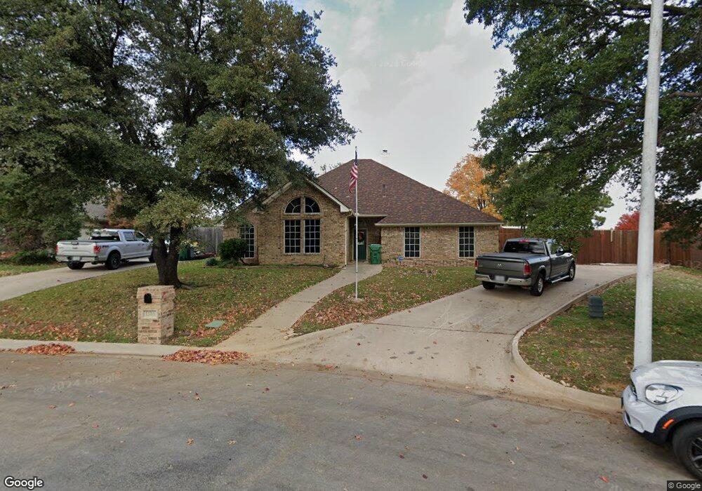
1151 Oakhurst St Denton, TX 76210
South Denton NeighborhoodEstimated Value: $393,000 - $418,340
4
Beds
2
Baths
2,035
Sq Ft
$202/Sq Ft
Est. Value
About This Home
This home is located at 1151 Oakhurst St, Denton, TX 76210 and is currently estimated at $410,085, approximately $201 per square foot. 1151 Oakhurst St is a home located in Denton County with nearby schools including Houston Elementary School, McMath Middle School, and Denton High School.
Ownership History
Date
Name
Owned For
Owner Type
Purchase Details
Closed on
Jan 14, 2019
Sold by
Morriss Stephen H and Morriss Katherine C
Bought by
Morriss Stephen H and Morriss Katherine C
Current Estimated Value
Home Financials for this Owner
Home Financials are based on the most recent Mortgage that was taken out on this home.
Original Mortgage
$388,500
Outstanding Balance
$339,203
Interest Rate
4.46%
Mortgage Type
FHA
Estimated Equity
$70,882
Purchase Details
Closed on
Sep 14, 2010
Sold by
Newton Katherine Chaney
Bought by
Morriss Stephen H
Purchase Details
Closed on
Oct 20, 2009
Sold by
Petula Associates Llc
Bought by
Dbt Porcupine L1
Purchase Details
Closed on
Jul 28, 2009
Sold by
Rhodes Geoffrey S
Bought by
Newton Katherine Chaney
Home Financials for this Owner
Home Financials are based on the most recent Mortgage that was taken out on this home.
Original Mortgage
$142,940
Interest Rate
5.44%
Mortgage Type
Purchase Money Mortgage
Purchase Details
Closed on
Apr 27, 2007
Sold by
Picaso Thomas W
Bought by
Rhodes Geoffrey S
Purchase Details
Closed on
Sep 30, 2005
Sold by
St John Deborah Anne
Bought by
Picaso Thomas W
Home Financials for this Owner
Home Financials are based on the most recent Mortgage that was taken out on this home.
Original Mortgage
$136,824
Interest Rate
5.73%
Mortgage Type
Fannie Mae Freddie Mac
Purchase Details
Closed on
Mar 27, 2000
Sold by
Maxwell John G and Parson Maxwell Jennifer A
Bought by
Stjohn Deborah Anne
Home Financials for this Owner
Home Financials are based on the most recent Mortgage that was taken out on this home.
Original Mortgage
$105,000
Interest Rate
8.36%
Purchase Details
Closed on
Feb 27, 1995
Sold by
Harrison Manning David and Harrison Blake W
Bought by
Maxwell John G and Parson Jennifer A
Home Financials for this Owner
Home Financials are based on the most recent Mortgage that was taken out on this home.
Original Mortgage
$126,711
Interest Rate
9%
Create a Home Valuation Report for This Property
The Home Valuation Report is an in-depth analysis detailing your home's value as well as a comparison with similar homes in the area
Home Values in the Area
Average Home Value in this Area
Purchase History
| Date | Buyer | Sale Price | Title Company |
|---|---|---|---|
| Morriss Stephen H | -- | Title Source Inc | |
| Morriss Stephen H | -- | None Available | |
| Dbt Porcupine L1 | -- | None Available | |
| Newton Katherine Chaney | -- | Fntg | |
| Rhodes Geoffrey S | -- | Fatco | |
| Picaso Thomas W | -- | Fatco | |
| Stjohn Deborah Anne | -- | -- | |
| Stjohn Deborah Anne | -- | -- | |
| Maxwell John G | -- | First American Title Ins | |
| Maxwell John G | -- | First American Title Ins |
Source: Public Records
Mortgage History
| Date | Status | Borrower | Loan Amount |
|---|---|---|---|
| Open | Morriss Stephen H | $388,500 | |
| Previous Owner | Newton Katherine Chaney | $142,940 | |
| Previous Owner | Picaso Thomas W | $136,824 | |
| Previous Owner | Stjohn Deborah Anne | $105,000 | |
| Previous Owner | Maxwell John G | $126,711 |
Source: Public Records
Tax History Compared to Growth
Tax History
| Year | Tax Paid | Tax Assessment Tax Assessment Total Assessment is a certain percentage of the fair market value that is determined by local assessors to be the total taxable value of land and additions on the property. | Land | Improvement |
|---|---|---|---|---|
| 2025 | $2,087 | $409,362 | $103,870 | $305,492 |
| 2024 | $7,698 | $398,807 | $0 | $0 |
| 2023 | $2,093 | $362,552 | $103,870 | $320,093 |
| 2022 | $6,997 | $329,593 | $89,706 | $276,460 |
| 2021 | $6,661 | $299,630 | $56,657 | $242,973 |
| 2020 | $6,849 | $299,626 | $56,657 | $242,969 |
| 2019 | $6,570 | $275,371 | $56,657 | $241,598 |
| 2018 | $6,047 | $250,337 | $56,657 | $196,243 |
| 2017 | $5,625 | $227,579 | $56,657 | $176,697 |
| 2016 | $3,890 | $206,890 | $35,410 | $171,480 |
| 2015 | $3,826 | $196,442 | $35,410 | $161,032 |
| 2014 | $3,826 | $189,443 | $35,410 | $154,033 |
| 2013 | -- | $186,062 | $38,087 | $147,975 |
Source: Public Records
Map
Nearby Homes
- 2000 Lamprey Cir
- 1108 Ellison Park Cir
- 3432 Sundown Blvd
- 720 Smokerise Cir
- 2009 Lake Fork Ct
- 2209 Loon Lake Rd
- 2008 Moonsail Ln
- 1012 Indian Ridge Dr
- 916 Smokerise Cir
- 2312 Caddo Cir
- 2409 Loon Lake Rd
- 2505 Pioneer Dr
- 2508 Pioneer Dr
- 3601 Monte Carlo Ln
- 2600 Pioneer Dr
- 2601 Pinto Dr
- 1313 Lorelei Ln
- 816 Chapel Dr
- 824 Sandpiper Dr
- 1000 Lynhurst Ln
- 3001 Oakhurst St
- 1149 Oakhurst St
- 3003 Oakhurst St
- 3005 Oakhurst St
- 1150 Oakhurst St
- 1143 Oakhurst St
- 3007 Oakhurst St
- 1146 Oakhurst St
- 3006 Manor Ct N Unit N
- 3002 Manor Ct N Unit N
- 1144 Oakhurst St
- 3009 Oakhurst St
- 1142 Oakhurst St
- 1139 Oakhurst St
- 1151 Bent Oaks Dr
- 3010 Manor Ct N Unit N
- 1147 Bent Oaks Dr
- 1138 Oakhurst St
- 3001 Manor Ct N Unit N
- 1143 Bent Oaks Dr