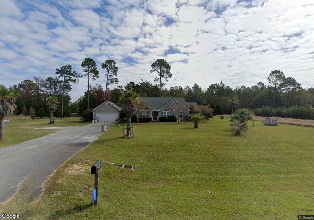
1151 S Highway 129 Stockton, GA 31649
Estimated Value: $170,000 - $266,536
--
Bed
--
Bath
1,816
Sq Ft
$122/Sq Ft
Est. Value
About This Home
This home is located at 1151 S Highway 129, Stockton, GA 31649 and is currently estimated at $221,634, approximately $122 per square foot. 1151 S Highway 129 is a home with nearby schools including Lanier County Elementary School, Lanier County Middle School, and Lanier County High School.
Ownership History
Date
Name
Owned For
Owner Type
Purchase Details
Closed on
Oct 18, 2023
Sold by
Livingston Norman
Bought by
Livingston Darsey Lynn and Livingston Trevor Wayne
Current Estimated Value
Home Financials for this Owner
Home Financials are based on the most recent Mortgage that was taken out on this home.
Original Mortgage
$154,330
Interest Rate
7.19%
Mortgage Type
New Conventional
Purchase Details
Closed on
May 8, 2009
Sold by
Mcdaniel James Earl
Bought by
Livingston Norman
Purchase Details
Closed on
May 19, 2008
Sold by
Farmers & Merchants Bank
Bought by
Mcdaniel James Earl
Create a Home Valuation Report for This Property
The Home Valuation Report is an in-depth analysis detailing your home's value as well as a comparison with similar homes in the area
Home Values in the Area
Average Home Value in this Area
Purchase History
| Date | Buyer | Sale Price | Title Company |
|---|---|---|---|
| Livingston Darsey Lynn | $115,000 | -- | |
| Livingston Norman | $135,000 | -- | |
| Mcdaniel James Earl | $129,900 | -- |
Source: Public Records
Mortgage History
| Date | Status | Borrower | Loan Amount |
|---|---|---|---|
| Closed | Livingston Darsey Lynn | $154,330 |
Source: Public Records
Tax History Compared to Growth
Tax History
| Year | Tax Paid | Tax Assessment Tax Assessment Total Assessment is a certain percentage of the fair market value that is determined by local assessors to be the total taxable value of land and additions on the property. | Land | Improvement |
|---|---|---|---|---|
| 2024 | $2,512 | $94,680 | $8,800 | $85,880 |
| 2023 | $1,636 | $53,520 | $5,480 | $48,040 |
| 2022 | $1,636 | $53,520 | $5,480 | $48,040 |
| 2021 | $1,670 | $53,520 | $5,480 | $48,040 |
| 2020 | $1,749 | $53,520 | $5,480 | $48,040 |
| 2019 | $1,684 | $53,520 | $5,480 | $48,040 |
| 2018 | $1,749 | $53,520 | $5,480 | $48,040 |
| 2017 | $1,685 | $53,520 | $5,480 | $48,040 |
| 2016 | $1,757 | $55,520 | $5,480 | $50,040 |
| 2015 | -- | $55,520 | $5,480 | $50,040 |
| 2014 | -- | $56,520 | $5,480 | $51,040 |
| 2013 | -- | $56,520 | $5,480 | $51,040 |
Source: Public Records
Map
Nearby Homes
- TBA S Highway 129
- TBD Church Rd
- 89 Mann Rd
- 35 Tyler Rd
- TBA Us 129
- 743 Old Stockton Rd
- 150+/- Ganas Rd
- 6585 Good Hope Cir
- 6069 Mullins Ln
- 339 Old Stockton Rd
- 70 Oscar Carter Ln
- 106 Quail Run
- 0 Patten Ln
- 6377 Lake Alapaha Blvd
- 6447 Lake Alapaha Blvd
- 108 Pine Dr
- LT 85 B River Trail
- 6441 Lake Alapaha Blvd
- 13 Oak Bend Dr
- 6429 Lake Alapaha Blvd
- 1169 S Highway 129
- 1142 S Highway 129
- 1138 S Highway 129
- 1162 S Highway 129
- 1189 S Highway 129
- 1146 S Highway 129
- 4 Branch Dr
- 20 Branch Dr
- 1186 S Highway 129
- 1203 S Highway 129
- 1156 S Highway 129
- 1204 S Highway 129
- 60 Bennett Rd
- 41 Bennett Rd
- 1213 S Highway 129
- 1216 S Highway 129
- 33 Bennett Rd
- 1081 S Highway 129
- 1226 S Highway 129
- 1235 S Highway 129