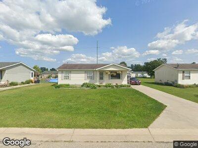
1152 Quain Ln Unit Bldg-Unit Port Huron, MI 48060
Estimated Value: $170,000 - $216,000
3
Beds
2
Baths
960
Sq Ft
$210/Sq Ft
Est. Value
About This Home
This home is located at 1152 Quain Ln Unit Bldg-Unit, Port Huron, MI 48060 and is currently estimated at $201,240, approximately $209 per square foot. 1152 Quain Ln Unit Bldg-Unit is a home located in St. Clair County with nearby schools including Kimball Elementary School, Central Middle School, and Port Huron High School.
Ownership History
Date
Name
Owned For
Owner Type
Purchase Details
Closed on
Dec 29, 2017
Sold by
Berish Kelly L and Willey Shannon T
Bought by
Fetko Jordan
Current Estimated Value
Home Financials for this Owner
Home Financials are based on the most recent Mortgage that was taken out on this home.
Original Mortgage
$129,000
Outstanding Balance
$111,008
Interest Rate
3.9%
Mortgage Type
New Conventional
Estimated Equity
$105,264
Purchase Details
Closed on
Jun 23, 2017
Sold by
Feeny James
Bought by
Feeny James and Berish Kelly L
Create a Home Valuation Report for This Property
The Home Valuation Report is an in-depth analysis detailing your home's value as well as a comparison with similar homes in the area
Home Values in the Area
Average Home Value in this Area
Purchase History
| Date | Buyer | Sale Price | Title Company |
|---|---|---|---|
| Fetko Jordan | $133,000 | Maritime Title | |
| Feeny James | -- | None Available |
Source: Public Records
Mortgage History
| Date | Status | Borrower | Loan Amount |
|---|---|---|---|
| Open | Fetko Jordan | $129,000 | |
| Previous Owner | Feeny James | $85,000 |
Source: Public Records
Tax History Compared to Growth
Tax History
| Year | Tax Paid | Tax Assessment Tax Assessment Total Assessment is a certain percentage of the fair market value that is determined by local assessors to be the total taxable value of land and additions on the property. | Land | Improvement |
|---|---|---|---|---|
| 2024 | $1,175 | $82,700 | $0 | $0 |
| 2023 | $1,084 | $78,400 | $0 | $0 |
| 2022 | $2,003 | $75,500 | $0 | $0 |
| 2021 | $1,834 | $70,800 | $0 | $0 |
| 2020 | $1,834 | $65,100 | $65,100 | $0 |
| 2019 | $1,800 | $48,000 | $0 | $0 |
| 2018 | $1,757 | $48,000 | $0 | $0 |
| 2017 | $1,373 | $47,400 | $0 | $0 |
| 2016 | $711 | $47,400 | $0 | $0 |
| 2015 | -- | $44,600 | $44,600 | $0 |
| 2014 | -- | $40,700 | $40,700 | $0 |
| 2013 | -- | $39,400 | $0 | $0 |
Source: Public Records
Map
Nearby Homes
- 1152 Quain Ln Unit Bldg-Unit
- 1152 Quain Ln
- 1146 Quain Ln
- 1160 Quain Ln
- 1166 Quain Ln
- 1140 Quain Ln
- 1157 Quain Ln
- 1151 Quain Ln
- 1165 Quain Ln
- 1145 Quain Ln
- 1132 Quain Ln
- 1172 Quain Ln
- 1171 Quain Ln Unit Bldg-Unit
- 1171 Quain Ln
- 1177 Quain Ln
- 1126 Quain Ln
- 1180 Quain Ln
- 1131 Quain Ln
- 1185 Quain Ln
- 1186 Quain Ln