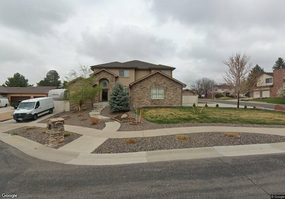
11523 W 73rd Dr Arvada, CO 80005
Harvest Lane NeighborhoodEstimated Value: $859,000 - $1,222,000
4
Beds
3
Baths
3,262
Sq Ft
$312/Sq Ft
Est. Value
About This Home
This home is located at 11523 W 73rd Dr, Arvada, CO 80005 and is currently estimated at $1,016,382, approximately $311 per square foot. 11523 W 73rd Dr is a home with nearby schools including Fremont Elementary School, Oberon Middle School, and Arvada West High School.
Ownership History
Date
Name
Owned For
Owner Type
Purchase Details
Closed on
Jan 9, 2023
Sold by
Shcherbakov Vladimir
Bought by
Shcherbakov Family Trust
Current Estimated Value
Purchase Details
Closed on
Mar 11, 2016
Sold by
Shcherbakov Vladimir and Shcherbakov Galina
Bought by
Shcherbakov Vladimir
Home Financials for this Owner
Home Financials are based on the most recent Mortgage that was taken out on this home.
Original Mortgage
$160,000
Interest Rate
3.72%
Mortgage Type
New Conventional
Purchase Details
Closed on
Apr 13, 2012
Sold by
Burquest James W
Bought by
Shcherbakov Vladimir and Shcherbakov Galina
Create a Home Valuation Report for This Property
The Home Valuation Report is an in-depth analysis detailing your home's value as well as a comparison with similar homes in the area
Home Values in the Area
Average Home Value in this Area
Purchase History
| Date | Buyer | Sale Price | Title Company |
|---|---|---|---|
| Shcherbakov Family Trust | -- | -- | |
| Shcherbakov Vladimir | -- | None Available | |
| Shcherbakov Vladimir | $60,000 | None Available |
Source: Public Records
Mortgage History
| Date | Status | Borrower | Loan Amount |
|---|---|---|---|
| Previous Owner | Shcherbakov Vladimir | $160,000 |
Source: Public Records
Tax History
| Year | Tax Paid | Tax Assessment Tax Assessment Total Assessment is a certain percentage of the fair market value that is determined by local assessors to be the total taxable value of land and additions on the property. | Land | Improvement |
|---|---|---|---|---|
| 2024 | $6,373 | $65,700 | $23,305 | $42,395 |
| 2023 | $6,373 | $65,700 | $23,305 | $42,395 |
| 2022 | $5,501 | $56,171 | $15,009 | $41,162 |
| 2021 | $5,592 | $57,788 | $15,441 | $42,347 |
| 2020 | $5,102 | $52,872 | $14,609 | $38,263 |
| 2019 | $5,033 | $52,872 | $14,609 | $38,263 |
| 2018 | $4,749 | $48,497 | $12,537 | $35,960 |
| 2017 | $4,347 | $48,497 | $12,537 | $35,960 |
| 2016 | $4,516 | $34,878 | $34,878 | $0 |
| 2015 | $3,237 | $34,878 | $34,878 | $0 |
| 2014 | $3,237 | $31,973 | $31,973 | $0 |
Source: Public Records
Map
Nearby Homes
- 7528 Queen Cir
- 7482 Routt Ln
- 11825 W 73rd Dr
- 7255 Taft Ct
- 7130 Simms St Unit 207
- 7120 Simms St Unit 202
- 7080 Simms St Unit 204
- 11921 W 70th Place
- 11290 W 77th Dr
- 7181 Van Gordon St
- 6956 Robb St
- 10250 W 73rd Place
- 11003 W 78th Ave
- 7154 Welch Ct
- 10512 W 75th Ave
- 6810 Simms Ct
- 11802 W 77th Dr
- 6943 Oak Way
- 7296 Xenophon Ct
- 7622 Miller Ct
- 7385 Routt St
- 11543 W 73rd Dr
- 11466 W 74th Ave
- 11524 W 73rd Dr
- 7370 Routt St
- 11553 W 73rd Dr
- 11487 W 74th Ave
- 11517 W 74th Ave
- 11544 W 73rd Dr
- 11447 W 74th Ave
- 7360 Routt St
- 11406 W 74th Ave
- 11537 W 74th Ave
- 7524 Queen Cir
- 7387 Robb St
- 7527 Queen Cir
- 7472 Routt Ln
- 11427 W 74th Ave
- 11605 W 74th Ave
- 7377 Robb St