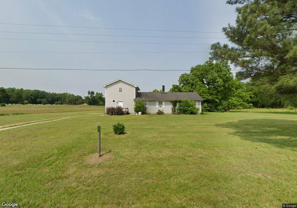
11536 Cemetery Rd Hillsboro, MD 21641
Estimated Value: $225,000 - $308,000
--
Bed
--
Bath
2,288
Sq Ft
$121/Sq Ft
Est. Value
About This Home
This home is located at 11536 Cemetery Rd, Hillsboro, MD 21641 and is currently estimated at $277,707, approximately $121 per square foot. 11536 Cemetery Rd is a home located in Caroline County with nearby schools including Ridgely Elementary School, Lockerman Middle School, and North Caroline High School.
Ownership History
Date
Name
Owned For
Owner Type
Purchase Details
Closed on
Jun 29, 2017
Sold by
Garrett Maribeth
Bought by
Garrett Michael T and Pepper Mary V
Current Estimated Value
Home Financials for this Owner
Home Financials are based on the most recent Mortgage that was taken out on this home.
Original Mortgage
$80,000
Outstanding Balance
$66,703
Interest Rate
4.02%
Mortgage Type
Commercial
Estimated Equity
$211,004
Create a Home Valuation Report for This Property
The Home Valuation Report is an in-depth analysis detailing your home's value as well as a comparison with similar homes in the area
Home Values in the Area
Average Home Value in this Area
Purchase History
| Date | Buyer | Sale Price | Title Company |
|---|---|---|---|
| Garrett Michael T | $100,000 | None Available |
Source: Public Records
Mortgage History
| Date | Status | Borrower | Loan Amount |
|---|---|---|---|
| Open | Garrett Michael T | $80,000 |
Source: Public Records
Tax History Compared to Growth
Tax History
| Year | Tax Paid | Tax Assessment Tax Assessment Total Assessment is a certain percentage of the fair market value that is determined by local assessors to be the total taxable value of land and additions on the property. | Land | Improvement |
|---|---|---|---|---|
| 2025 | $2,366 | $221,000 | $72,800 | $148,200 |
| 2024 | $2,366 | $211,200 | $0 | $0 |
| 2023 | $2,259 | $201,400 | $0 | $0 |
| 2022 | $2,152 | $191,600 | $72,800 | $118,800 |
| 2021 | $1,080 | $188,600 | $0 | $0 |
| 2020 | $2,087 | $185,600 | $0 | $0 |
| 2019 | $2,054 | $182,600 | $65,800 | $116,800 |
| 2018 | $1,994 | $182,600 | $65,800 | $116,800 |
| 2017 | $2,054 | $182,600 | $0 | $0 |
| 2016 | -- | $184,800 | $0 | $0 |
| 2015 | -- | $183,700 | $0 | $0 |
| 2014 | $1,812 | $182,600 | $0 | $0 |
Source: Public Records
Map
Nearby Homes
- 21948 Main St
- 22005 Main St
- 13513 1st St
- E/S MD RT480 Unknown
- 13500 1st St
- 13603 Main St
- 13404 Cannery Rd
- 32115 Park Ave
- 12615 Eveland Rd
- 11142 Log Cabin Rd
- 208 Oriole Ave
- 12087 Wayman St
- 506 Park Ave
- 505 Maryland Ave
- 202 Maryland Ave
- 7 W Belle St
- 8 W Liberty St
- 301 Central Ave
- 305 Central Ave
- 6 N Central Ave
- 11570 Cemetery Rd
- 11500 Cemetery Rd
- 0 Shore Hwy Unit CM7478068
- 0 Shore Hwy Unit CM7489778
- 21933 Shore Hwy
- 21913 Shore Hwy
- 21859 Shore Hwy
- 2030 Queen Anne Hwy
- 0 Shore Hwy Unit 1000190534
- 0 Shore Hwy Unit MDCM2005218
- 13621 1st St
- 13619 1st St
- 0 Morgan St Unit QA7950895
- 0 Wes St
- 22151 Wes St
- 11263 Cemetery Rd
- 21908 Main St
- 32500 Morgan St
- 21936 Main St
- 21914 Main St