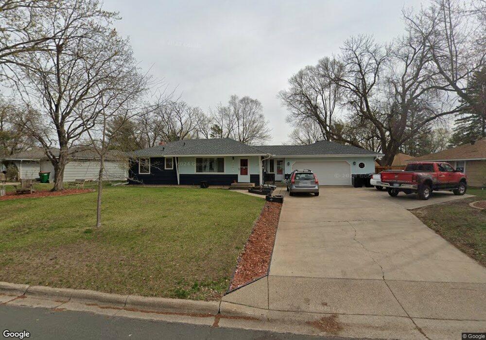
11541 Xavis St NW Coon Rapids, MN 55433
Estimated Value: $316,000 - $361,000
3
Beds
2
Baths
1,794
Sq Ft
$185/Sq Ft
Est. Value
About This Home
This home is located at 11541 Xavis St NW, Coon Rapids, MN 55433 and is currently estimated at $331,328, approximately $184 per square foot. 11541 Xavis St NW is a home located in Anoka County with nearby schools including Lucile Bruner Elementary School, Morris Bye Elementary School, and Laughlin Junior/Senior High School.
Ownership History
Date
Name
Owned For
Owner Type
Purchase Details
Closed on
Mar 15, 2011
Sold by
Shannon Porter Zahler and Zahler Shane
Bought by
Loftus David M and Miller Lisa A
Current Estimated Value
Home Financials for this Owner
Home Financials are based on the most recent Mortgage that was taken out on this home.
Original Mortgage
$147,658
Outstanding Balance
$101,837
Interest Rate
4.87%
Mortgage Type
FHA
Estimated Equity
$229,491
Purchase Details
Closed on
Mar 22, 2000
Sold by
Devine James W
Bought by
Porter George E and Sellars Shannon M
Create a Home Valuation Report for This Property
The Home Valuation Report is an in-depth analysis detailing your home's value as well as a comparison with similar homes in the area
Home Values in the Area
Average Home Value in this Area
Purchase History
| Date | Buyer | Sale Price | Title Company |
|---|---|---|---|
| Loftus David M | $151,500 | -- | |
| Porter George E | $129,900 | -- |
Source: Public Records
Mortgage History
| Date | Status | Borrower | Loan Amount |
|---|---|---|---|
| Open | Loftus David M | $147,658 |
Source: Public Records
Tax History Compared to Growth
Tax History
| Year | Tax Paid | Tax Assessment Tax Assessment Total Assessment is a certain percentage of the fair market value that is determined by local assessors to be the total taxable value of land and additions on the property. | Land | Improvement |
|---|---|---|---|---|
| 2025 | $3,049 | $298,300 | $84,000 | $214,300 |
| 2024 | $3,049 | $296,600 | $87,000 | $209,600 |
| 2023 | $2,790 | $287,100 | $76,000 | $211,100 |
| 2022 | $2,625 | $289,200 | $67,000 | $222,200 |
| 2021 | $2,515 | $244,400 | $67,000 | $177,400 |
| 2020 | $2,367 | $230,000 | $62,000 | $168,000 |
| 2019 | $2,214 | $209,800 | $60,000 | $149,800 |
| 2018 | $2,137 | $192,400 | $0 | $0 |
| 2017 | $1,832 | $181,300 | $0 | $0 |
| 2016 | $1,834 | $154,100 | $0 | $0 |
| 2015 | -- | $154,100 | $45,000 | $109,100 |
| 2014 | -- | $128,200 | $36,500 | $91,700 |
Source: Public Records
Map
Nearby Homes
- 11809 Zion St NW
- 11409 Quinn St NW
- 11835 Crocus St NW
- 11749 Crooked Lake Blvd NW
- 11444 Hanson Blvd NW
- 11424 Hanson Blvd NW
- 12019 Zion St NW
- 11000 Swallow St NW
- 3020 117th Ave NW
- 2500 110th Ave NW
- 11350 Jay St NW
- 11361 Jay St NW
- 2400 108th Ave NW
- 11036 Hanson Blvd NW Unit 20
- 2728 109th Ln NW
- 2721 109th Ave NW
- 3074 121st Ave NW
- 11734 Marigold St NW
- 1660 Northdale Blvd NW
- 1830 121st Ln NW Unit 611
- 11527 Xavis St NW
- 11555 Xavis St NW
- 11556 Wren St NW
- 11548 Xavis St NW
- 11534 Xavis St NW
- 11567 Xavis St NW
- 11562 Xavis St NW
- 11549 Wren St NW
- 11570 Wren St NW
- 11541 Wren St NW
- 11557 Wren St NW
- 11577 Xavis St NW
- 11566 Xavis St NW
- 11560 Xavis Cir NW
- 11563 Wren St NW
- 11533 Wren St NW
- 11516 Wren St NW
- 11552 Xavis Cir NW
- 11525 Wren St NW
- 11600 Wren St NW