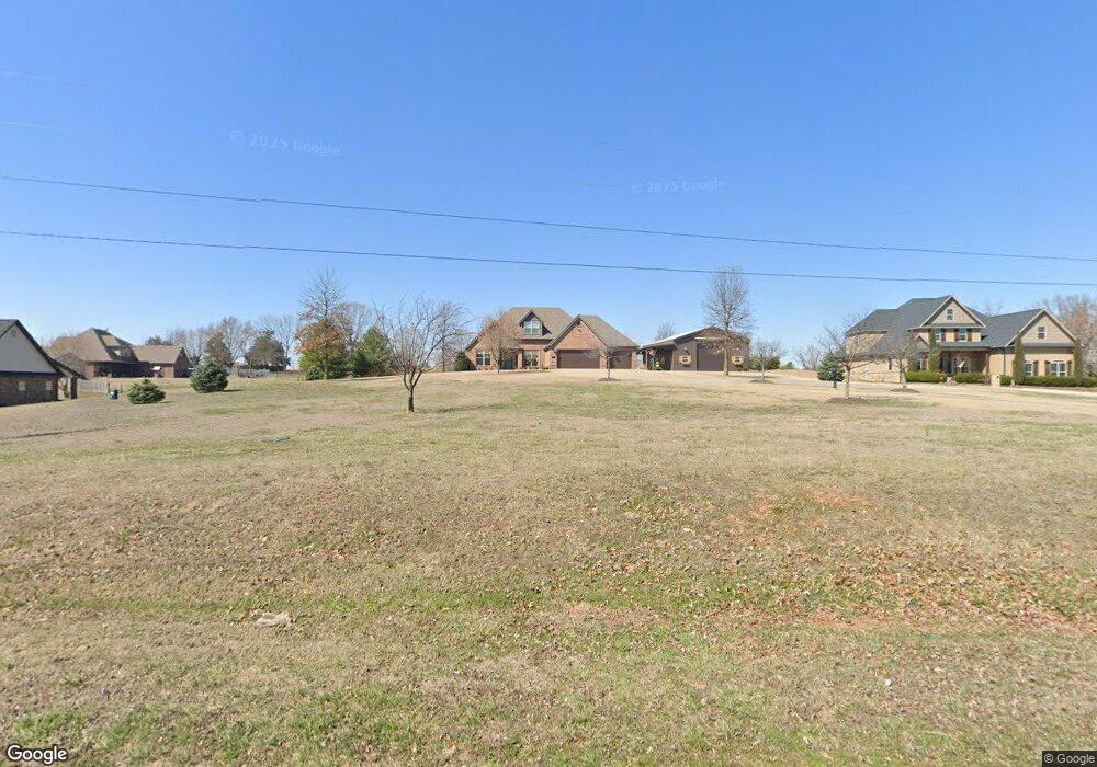
1157 N Barrington Rd Tontitown, AR 72762
Estimated Value: $655,000 - $712,000
--
Bed
--
Bath
2,925
Sq Ft
$229/Sq Ft
Est. Value
About This Home
This home is located at 1157 N Barrington Rd, Tontitown, AR 72762 and is currently estimated at $671,092, approximately $229 per square foot. 1157 N Barrington Rd is a home with nearby schools including Willis Shaw Elementary School, Hellstern Middle School, and Central Junior High School.
Ownership History
Date
Name
Owned For
Owner Type
Purchase Details
Closed on
Jul 10, 2025
Sold by
Strobbe Family Revocable Trust and Strobbe Dale L
Bought by
Arkansas State Highway Commission
Current Estimated Value
Purchase Details
Closed on
Sep 7, 2023
Sold by
Gamble John and Gamble Therese
Bought by
Strobbe Dale and Strobbe Jocelyn
Purchase Details
Closed on
Oct 23, 2014
Sold by
Strobbe Dale and Strobbe Jocelyn
Bought by
Strobbe Dale and Strobbe Jocelyn
Purchase Details
Closed on
Aug 7, 2012
Sold by
Penzo Celester and Penso Rita
Bought by
Strobbe Dale and Strobbe Jocelyn
Home Financials for this Owner
Home Financials are based on the most recent Mortgage that was taken out on this home.
Original Mortgage
$35,485
Interest Rate
3.68%
Mortgage Type
New Conventional
Create a Home Valuation Report for This Property
The Home Valuation Report is an in-depth analysis detailing your home's value as well as a comparison with similar homes in the area
Home Values in the Area
Average Home Value in this Area
Purchase History
| Date | Buyer | Sale Price | Title Company |
|---|---|---|---|
| Arkansas State Highway Commission | $3,050 | None Listed On Document | |
| Strobbe Dale | -- | None Listed On Document | |
| Strobbe Dale | -- | None Available | |
| Strobbe Dale | $35,000 | None Available |
Source: Public Records
Mortgage History
| Date | Status | Borrower | Loan Amount |
|---|---|---|---|
| Previous Owner | Strobbe Dale | $35,485 |
Source: Public Records
Tax History Compared to Growth
Tax History
| Year | Tax Paid | Tax Assessment Tax Assessment Total Assessment is a certain percentage of the fair market value that is determined by local assessors to be the total taxable value of land and additions on the property. | Land | Improvement |
|---|---|---|---|---|
| 2025 | $4,060 | $128,470 | $27,800 | $100,670 |
| 2024 | $3,958 | $128,620 | $27,950 | $100,670 |
| 2023 | $3,934 | $128,620 | $27,950 | $100,670 |
| 2022 | $3,767 | $86,150 | $19,570 | $66,580 |
| 2021 | $3,603 | $86,150 | $19,570 | $66,580 |
| 2020 | $3,069 | $78,970 | $19,570 | $59,400 |
| 2019 | $2,912 | $65,080 | $8,380 | $56,700 |
| 2018 | $2,937 | $65,080 | $8,380 | $56,700 |
| 2017 | $2,871 | $65,080 | $8,380 | $56,700 |
| 2016 | $2,871 | $65,080 | $8,380 | $56,700 |
| 2015 | $2,789 | $65,080 | $8,380 | $56,700 |
| 2014 | $2,579 | $7,780 | $7,780 | $0 |
Source: Public Records
Map
Nearby Homes
- 294 Arlington Way
- 720 Via Sangro Rd
- 8218 Anna Maria Ave
- 8100 Santa Clara Ave
- 695 Malbec Rd
- 1940 Ardemagni Rd
- 1563 Ardemagni Rd
- 773 Via Firenze Ave
- tbd E Lake Rd
- 862 Via Firenze Ave
- 7700 Cadence Ln
- 7690 Cadence Ln
- 847 Via Firenze Ave
- 7691 Cadence Ln
- 7669 W Gibbs Rd
- 1529 Ardemagni Rd
- 881 Pergola
- 945 Pergola
- 469 Brandons Loop
- 340 Brandons Loop
- 1201 N Barrington Rd
- 168 W Baker Ave
- 226 W Baker Ave
- 1.79 ac E Baker Ave
- 250 W Baker Ave
- 250 W Baker Ave
- 1093 N Barrington Rd
- 221 Baker
- 1064 N Barrington Rd
- 1025 N Barrington Rd
- 199 E Baker Ave
- 18863 Barrington
- 205 Baker Ave
- 1252 N Maestri Rd
- 1224 N Maestri Hwy
- 1020 N Barrington Rd
- 1087 N Maestri Rd
- 319 W Baker Ave
- 1190 Sabatini Rd
- 1166 Sabatini Rd