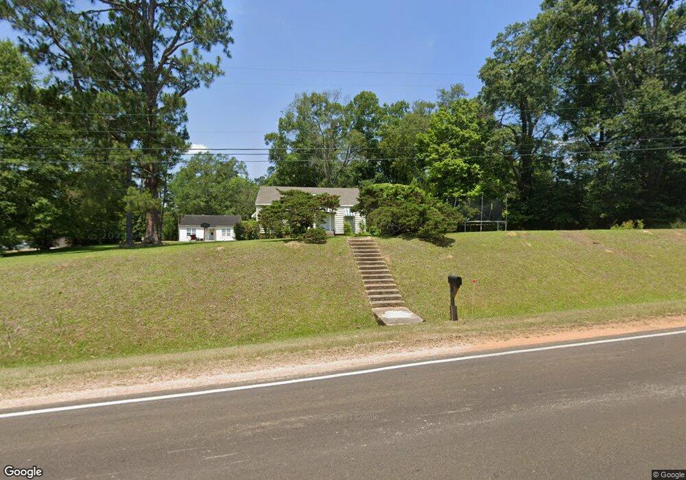
1159 Highway 51 Wesson, MS 39191
Estimated Value: $111,425 - $192,000
Studio
1
Bath
1,553
Sq Ft
$98/Sq Ft
Est. Value
About This Home
This home is located at 1159 Highway 51, Wesson, MS 39191 and is currently estimated at $151,713, approximately $97 per square foot. 1159 Highway 51 is a home.
Ownership History
Date
Name
Owned For
Owner Type
Purchase Details
Closed on
Feb 22, 2021
Sold by
Breann-Conn Skyler and Conn Crystal M
Bought by
Anter Rafat
Current Estimated Value
Home Financials for this Owner
Home Financials are based on the most recent Mortgage that was taken out on this home.
Original Mortgage
$95,959
Outstanding Balance
$85,825
Interest Rate
2.7%
Mortgage Type
New Conventional
Estimated Equity
$65,888
Purchase Details
Closed on
Jan 29, 2020
Sold by
Douglas John A
Bought by
Conn Skyler B and Conn Crystal M
Home Financials for this Owner
Home Financials are based on the most recent Mortgage that was taken out on this home.
Original Mortgage
$87,387
Interest Rate
3.72%
Mortgage Type
FHA
Create a Home Valuation Report for This Property
The Home Valuation Report is an in-depth analysis detailing your home's value as well as a comparison with similar homes in the area
Purchase History
| Date | Buyer | Sale Price | Title Company |
|---|---|---|---|
| Anter Rafat | -- | None Available | |
| Anter Rafat | -- | None Available | |
| Conn Skyler B | -- | None Available |
Source: Public Records
Mortgage History
| Date | Status | Borrower | Loan Amount |
|---|---|---|---|
| Open | Anter Rafat | $95,959 | |
| Closed | Anter Rafat | $95,959 | |
| Previous Owner | Conn Skyler B | $87,387 |
Source: Public Records
Tax History
| Year | Tax Paid | Tax Assessment Tax Assessment Total Assessment is a certain percentage of the fair market value that is determined by local assessors to be the total taxable value of land and additions on the property. | Land | Improvement |
|---|---|---|---|---|
| 2025 | $1,253 | $10,505 | $0 | $0 |
| 2024 | $13 | $8,759 | $0 | $0 |
| 2023 | $1,265 | $8,759 | $0 | $0 |
| 2022 | $1,276 | $8,759 | $0 | $0 |
| 2021 | $1,236 | $8,691 | $0 | $0 |
| 2020 | $564 | $5,400 | $0 | $0 |
| 2019 | $1,183 | $8,100 | $0 | $0 |
| 2018 | $888 | $8,100 | $0 | $0 |
| 2017 | $828 | $8,100 | $0 | $0 |
| 2016 | $828 | $7,704 | $0 | $0 |
| 2015 | -- | $7,704 | $0 | $0 |
| 2014 | -- | $7,704 | $0 | $0 |
Source: Public Records
Map
Nearby Homes
- 1079 Beech St
- 0 00 Milltowne Dr
- 1119 Milltowne Dr
- 0 Sawders Ln
- 1001 Lumley Ln
- 0 Milltownte Dr
- 0 David Britt St
- 0 Loom St
- 596 Mount Zion Rd
- 589 Mount Zion Rd
- 594 Mount Zion Rd
- 0 Furrs Mill Dr NE
- 2038 Rocky Hill Rd
- 3066 New Sight Dr NE
- 2548 Furrs Mill Dr NE
- 3085 Beauregard Rd
- 0 Anderson Rd
- 4001 Stegall Rd
- 0 Linwood Ln NE
- 0 Old Hwy 51 NE
- 1015 Robinson St
- 1151 Highway 51
- 1169 Highway 51
- 1181 U S 51
- 1027 Beech St
- 1025 Beech St
- 1173 Highway 51
- 1183 U S 51
- 1174 U S 51
- 1174 Highway 51
- 1185 Highway 51
- 1037 Beech St
- 1041 Beech St
- 1184 Highway 51
- 1047 Beech St
- 1014 Bayou Pierre St
- 1014 Bayou Pierre St
- 1038 Beech St
- 1193 Highway 51
- 1194 Highway 51
Your Personal Tour Guide
Ask me questions while you tour the home.