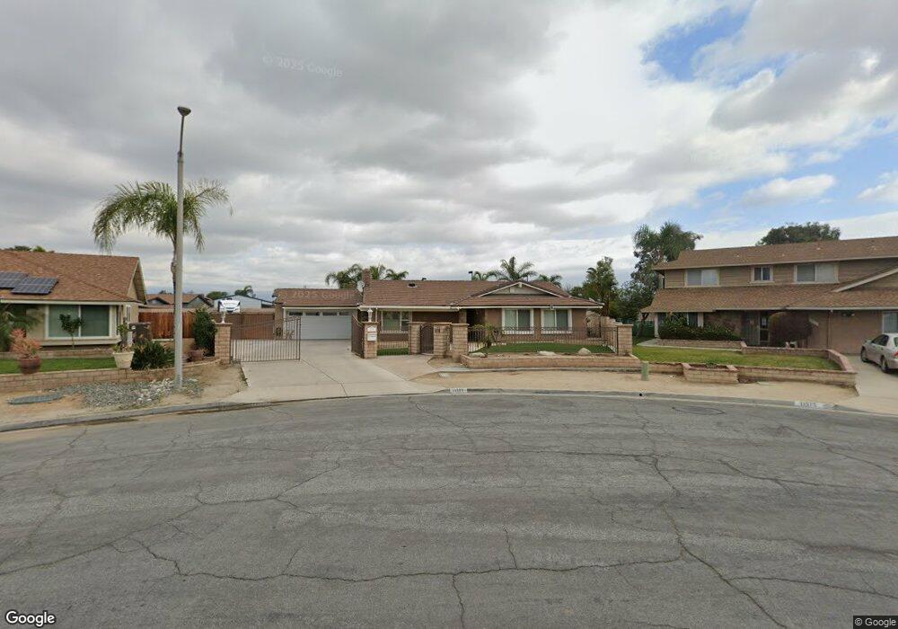
11591 Pampus Dr Mira Loma, CA 91752
Estimated Value: $822,072 - $915,000
4
Beds
2
Baths
1,749
Sq Ft
$487/Sq Ft
Est. Value
About This Home
This home is located at 11591 Pampus Dr, Mira Loma, CA 91752 and is currently estimated at $851,018, approximately $486 per square foot. 11591 Pampus Dr is a home located in Riverside County with nearby schools including Sky Country Elementary School, Mira Loma Middle School, and Jurupa Valley High School.
Ownership History
Date
Name
Owned For
Owner Type
Purchase Details
Closed on
Jun 12, 1998
Sold by
Hooker Darryl D
Bought by
Hooker Darryl D
Current Estimated Value
Home Financials for this Owner
Home Financials are based on the most recent Mortgage that was taken out on this home.
Original Mortgage
$100,000
Outstanding Balance
$20,110
Interest Rate
7.11%
Estimated Equity
$830,908
Purchase Details
Closed on
Mar 2, 1993
Sold by
Hooker Tonja
Bought by
Hooker Darryl D
Create a Home Valuation Report for This Property
The Home Valuation Report is an in-depth analysis detailing your home's value as well as a comparison with similar homes in the area
Home Values in the Area
Average Home Value in this Area
Purchase History
| Date | Buyer | Sale Price | Title Company |
|---|---|---|---|
| Hooker Darryl D | -- | Stewart Title | |
| Hooker Darryl D | -- | -- | |
| Hooker Darryl D | -- | -- |
Source: Public Records
Mortgage History
| Date | Status | Borrower | Loan Amount |
|---|---|---|---|
| Open | Hooker Darryl D | $100,000 |
Source: Public Records
Tax History Compared to Growth
Tax History
| Year | Tax Paid | Tax Assessment Tax Assessment Total Assessment is a certain percentage of the fair market value that is determined by local assessors to be the total taxable value of land and additions on the property. | Land | Improvement |
|---|---|---|---|---|
| 2025 | $2,980 | $276,582 | $93,806 | $182,776 |
| 2023 | $2,980 | $265,844 | $90,164 | $175,680 |
| 2022 | $2,926 | $260,633 | $88,397 | $172,236 |
| 2021 | $2,904 | $255,523 | $86,664 | $168,859 |
| 2020 | $2,878 | $252,904 | $85,776 | $167,128 |
| 2019 | $2,820 | $247,946 | $84,095 | $163,851 |
| 2018 | $2,730 | $243,086 | $82,447 | $160,639 |
| 2017 | $2,701 | $238,321 | $80,831 | $157,490 |
| 2016 | $2,663 | $233,649 | $79,247 | $154,402 |
| 2015 | $3,240 | $230,141 | $78,057 | $152,084 |
| 2014 | $3,392 | $225,634 | $76,529 | $149,105 |
Source: Public Records
Map
Nearby Homes
- 5853 Aurora Ave
- 5621 Avocet Dr
- 5599 Skimmer Dr
- 11686 Del Sur Dr
- 11877 Crossbill Way
- 11915 Berlyn Dove Ct
- 11187 58th St
- 0 Etiwanda Ave & 54th St Unit DW25195682
- 6323 Smith Ave
- 11913 Solitaire Ct
- 5685 Ptolemy Way
- 11958 Sunstone Ct
- 5286 Trail Canyon Dr
- 5344 Lucretia Ave
- 11101 Gemini Ct
- 6415 Etiwanda Ave
- 4983 Hydrangea Ln
- 11662 Salvia St
- 6093 Troth St
- 5800 Hamner Ave Unit 237
- 11575 Pampus Dr
- 11605 Pampus Dr
- 11630 Round Tree Ct
- 11624 Round Tree Ct
- 11621 Pampus Dr
- 11561 Pampus Dr
- 5839 Aurora Ave
- 11642 Round Tree Ct
- 11602 Round Tree Ct
- 11604 Pampus Dr
- 11624 Pampus Dr
- 11545 Pampus Dr
- 11635 Pampus Dr
- 5861 Aurora Ave
- 11634 Pampus Dr
- 11580 Round Tree Ct
- 11643 Round Tree Ct
- 11662 Tioga Ct
- 11682 Tioga Ct
- 5881 Aurora Ave
