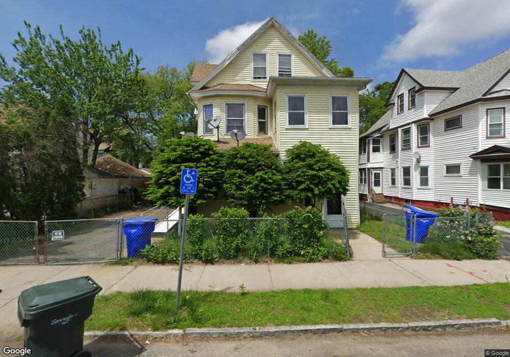
116 Bloomfield St Unit 118 Springfield, MA 01108
Forest Park NeighborhoodEstimated Value: $329,000 - $414,000
8
Beds
2
Baths
2,921
Sq Ft
$129/Sq Ft
Est. Value
About This Home
This home is located at 116 Bloomfield St Unit 118, Springfield, MA 01108 and is currently estimated at $375,975, approximately $128 per square foot. 116 Bloomfield St Unit 118 is a home located in Hampden County with nearby schools including White Street Elementary School, Forest Park Middle School, and High School Of Commerce.
Ownership History
Date
Name
Owned For
Owner Type
Purchase Details
Closed on
Apr 16, 2003
Sold by
Soto Wilson
Bought by
Alicea Maria M
Current Estimated Value
Purchase Details
Closed on
Apr 11, 2000
Sold by
Watters Mary
Bought by
Soto Wilson and Alicea Maria M
Home Financials for this Owner
Home Financials are based on the most recent Mortgage that was taken out on this home.
Original Mortgage
$71,300
Interest Rate
8.3%
Mortgage Type
Purchase Money Mortgage
Create a Home Valuation Report for This Property
The Home Valuation Report is an in-depth analysis detailing your home's value as well as a comparison with similar homes in the area
Home Values in the Area
Average Home Value in this Area
Purchase History
| Date | Buyer | Sale Price | Title Company |
|---|---|---|---|
| Alicea Maria M | -- | -- | |
| Soto Wilson | $84,000 | -- |
Source: Public Records
Mortgage History
| Date | Status | Borrower | Loan Amount |
|---|---|---|---|
| Previous Owner | Soto Wilson | $71,300 |
Source: Public Records
Tax History
| Year | Tax Paid | Tax Assessment Tax Assessment Total Assessment is a certain percentage of the fair market value that is determined by local assessors to be the total taxable value of land and additions on the property. | Land | Improvement |
|---|---|---|---|---|
| 2025 | $4,517 | $288,100 | $31,200 | $256,900 |
| 2024 | $4,431 | $275,900 | $31,200 | $244,700 |
| 2023 | $3,783 | $221,900 | $28,400 | $193,500 |
| 2022 | $3,314 | $176,100 | $26,500 | $149,600 |
| 2021 | $3,453 | $182,700 | $24,100 | $158,600 |
| 2020 | $2,914 | $149,200 | $24,100 | $125,100 |
| 2019 | $2,924 | $148,600 | $24,100 | $124,500 |
| 2018 | $2,840 | $144,300 | $24,100 | $120,200 |
| 2017 | $2,719 | $138,300 | $22,600 | $115,700 |
| 2016 | $2,328 | $118,400 | $22,600 | $95,800 |
| 2015 | $2,364 | $120,200 | $22,600 | $97,600 |
Source: Public Records
Map
Nearby Homes
- 243 Orange St
- 99 Wilmont St
- 192 White St
- 207-209 White St
- 115 Pasadena St
- 276 Dickinson St
- 233-235 White St
- 74 Kenwood Park
- 7-9 Glendell Terrace
- 32 Burton St
- 72 Hall St
- 15-19 Litchfield St
- 27 Chester St
- 47 Keith St
- 0 Allen St (Ss)
- 41 Euclid Ave
- 120-122 E Alvord St
- 122 Bellevue Ave
- 52 Orlando St
- 228 Belmont Ave
- 122 Bloomfield St Unit 124
- 51 Earl St
- 47 Earl St
- 55 Earl St
- 128 Bloomfield St Unit 130
- 43 Earl St Unit 45
- 43-45 Earl St
- 95 Kensington Ave
- 107 Kensington Ave Unit 3L
- 107 Kensington Ave Unit 3R
- 107 Kensington Ave Unit 2L
- 107 Kensington Ave Unit 4R
- 107 Kensington Ave
- 107 Kensington Ave Unit 1R
- 101 Kensington Ave Unit 2L
- 101 Kensington Ave Unit 1R
- 101 Kensington Ave Unit 2R
- 101 Kensington Ave Unit 1L
- 101 Kensington Ave
- 132 Bloomfield St Unit 134
Your Personal Tour Guide
Ask me questions while you tour the home.