H
Seller's Agent in 2025
Haschig Homes Group
William Raveis R.E. & Home Services
(978) 833-1363
1 in this area
157 Total Sales
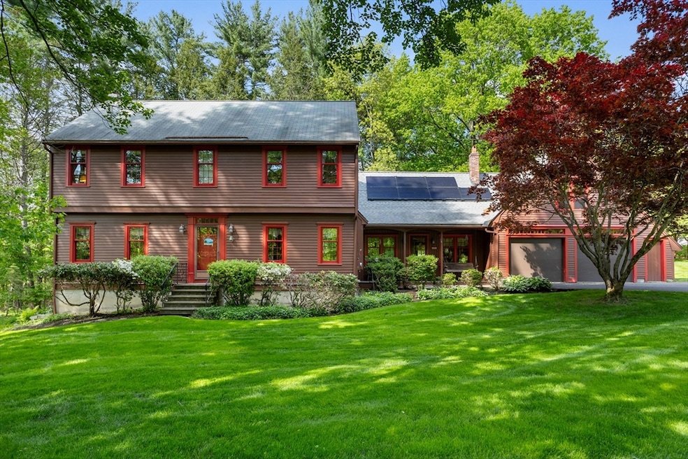
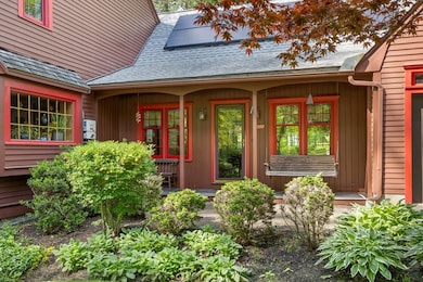
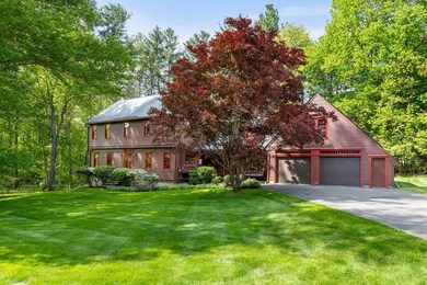
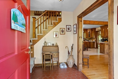
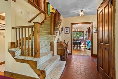
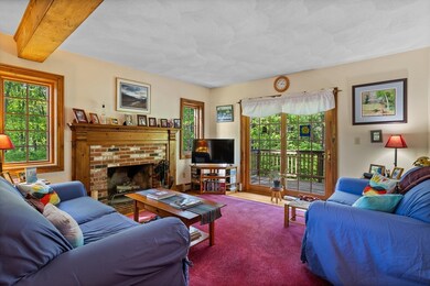
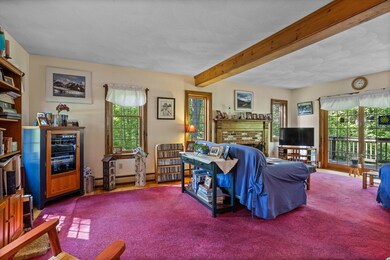
Welcome home to this sprawling 3-bedroom, 3.5-bath Colonial, privately nestled on over 2 acres of park-like lawns and mature plantings. The flexible floor plan features large rooms that exude warmth and charm. The formal living room boasts beautiful hardwood floors, a central fireplace, and a beamed ceiling, with access to the expansive back deck.The country kitchen includes an adjoining dining area and leads to a stunning family room with a cathedral ceiling, loft area, and full bath. Upstairs, you'll find three spacious bedrooms, including an oversized primary suite with a loft and walk-in closet, along with two full baths and bonus The large unfinished walkout basement offers customization potential, while central AC and solar panels enhance your energy efficiency. Ideally located near conservation areas, Route 3, and the New Hampshire border, this home is perfect for those seeking tranquility and convenience. Discover all the reasons you'll love this exceptional property!
Last Agent to Sell the Property
William Raveis R.E. & Home Services Listed on: 05/21/2025

| Date | Type | Sale Price | Title Company |
|---|---|---|---|
| Deed | $775,000 | -- | |
| Deed | $775,000 | -- | |
| Deed | $252,900 | -- | |
| Deed | $252,900 | -- | |
| Deed | $212,500 | -- | |
| Deed | $212,500 | -- |
| Date | Status | Loan Amount | Loan Type |
|---|---|---|---|
| Open | $465,000 | New Conventional | |
| Closed | $465,000 | New Conventional | |
| Previous Owner | $190,000 | No Value Available | |
| Previous Owner | $193,000 | No Value Available |
| Date | Event | Price | List to Sale | Price per Sq Ft |
|---|---|---|---|---|
| 07/30/2025 07/30/25 | Sold | $775,000 | 0.0% | $316 / Sq Ft |
| 06/09/2025 06/09/25 | Pending | -- | -- | -- |
| 05/21/2025 05/21/25 | For Sale | $775,000 | -- | $316 / Sq Ft |
| Year | Tax Paid | Tax Assessment Tax Assessment Total Assessment is a certain percentage of the fair market value that is determined by local assessors to be the total taxable value of land and additions on the property. | Land | Improvement |
|---|---|---|---|---|
| 2025 | $9,067 | $659,400 | $221,200 | $438,200 |
| 2024 | $8,629 | $618,100 | $202,800 | $415,300 |
| 2023 | $8,611 | $575,200 | $202,800 | $372,400 |
| 2022 | $7,938 | $520,500 | $202,800 | $317,700 |
| 2021 | $7,962 | $485,200 | $185,500 | $299,700 |
| 2020 | $7,834 | $465,200 | $177,300 | $287,900 |
| 2019 | $7,657 | $448,800 | $177,300 | $271,500 |
| 2018 | $11,336 | $428,600 | $176,300 | $252,300 |
| 2017 | $7,247 | $425,800 | $176,300 | $249,500 |
| 2016 | $7,062 | $426,700 | $176,300 | $250,400 |
| 2015 | $6,749 | $403,400 | $148,600 | $254,800 |
| 2014 | $6,362 | $403,400 | $148,600 | $254,800 |
H
Seller's Agent in 2025
Haschig Homes Group
William Raveis R.E. & Home Services
(978) 833-1363
1 in this area
157 Total Sales
Seller Co-Listing Agent in 2025
Dave Haschig
William Raveis R.E. & Home Services
(833) 544-7687
1 in this area
40 Total Sales
Buyer's Agent in 2025
Blood Team Realty Group
Keller Williams Realty - Merrimack
(978) 433-8800
4 in this area
596 Total Sales
Source: MLS Property Information Network (MLS PIN)
MLS Number: 73378408
APN: DUNS-000010-000021
Disclaimer: Certain information contained herein is derived from information provided by parties other than Homes.com. All information provided is deemed reliable, but is not guaranteed to be accurate and should be independently verified.
![]() The property listing data and information, or the Images, set forth herein were provided to MLS Property Information Network, Inc. from third party sources, including sellers, lessors and public records, and were compiled by MLS Property Information Network, Inc. The property listing data and information, and the Images, are for the personal, non-commercial use of consumers having a good faith interest in purchasing or leasing listed properties of the type displayed to them and may not be used for any purpose other than to identify prospective properties which such consumers may have a good faith interest in purchasing or leasing. MLS Property Information Network, Inc. and its subscribers disclaim any and all representations and warranties as to the accuracy of the property listing data and information, or as to the accuracy of any of the Images, set forth herein.
The property listing data and information, or the Images, set forth herein were provided to MLS Property Information Network, Inc. from third party sources, including sellers, lessors and public records, and were compiled by MLS Property Information Network, Inc. The property listing data and information, and the Images, are for the personal, non-commercial use of consumers having a good faith interest in purchasing or leasing listed properties of the type displayed to them and may not be used for any purpose other than to identify prospective properties which such consumers may have a good faith interest in purchasing or leasing. MLS Property Information Network, Inc. and its subscribers disclaim any and all representations and warranties as to the accuracy of the property listing data and information, or as to the accuracy of any of the Images, set forth herein.