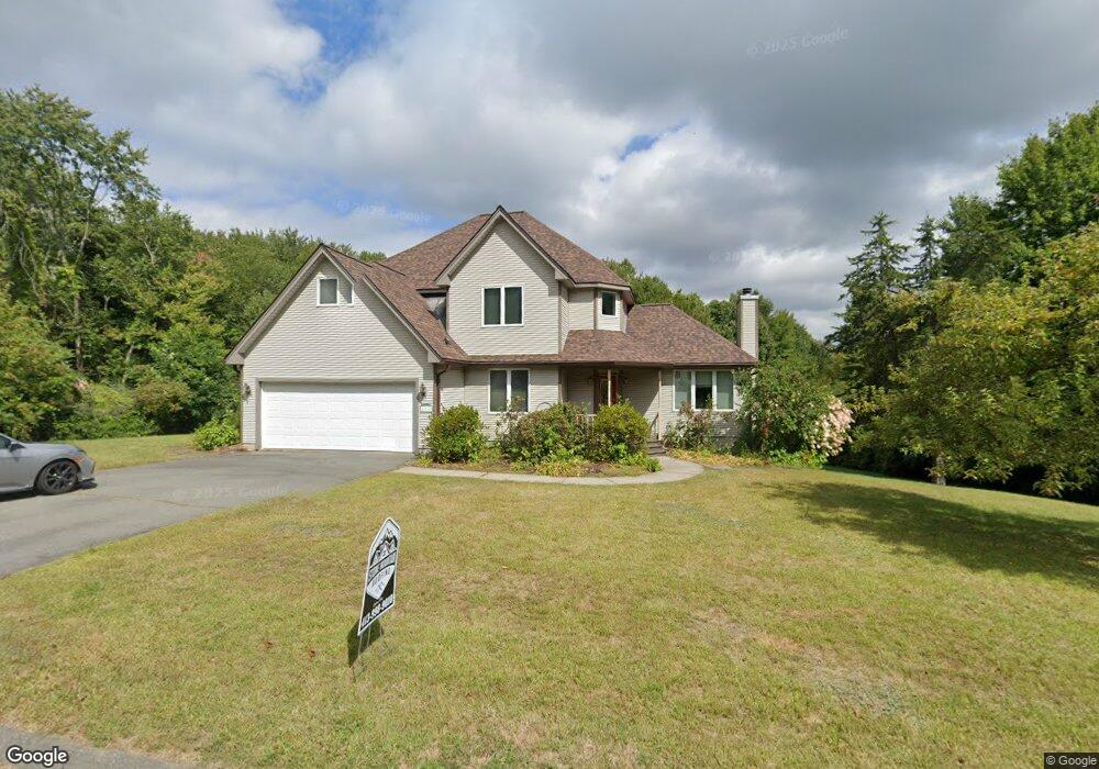
116 Cherry Ln Amherst, MA 01002
Estimated Value: $794,687 - $878,000
4
Beds
3
Baths
2,672
Sq Ft
$316/Sq Ft
Est. Value
About This Home
This home is located at 116 Cherry Ln, Amherst, MA 01002 and is currently estimated at $843,922, approximately $315 per square foot. 116 Cherry Ln is a home located in Hampshire County with nearby schools including Wildwood Elementary School, Amherst Regional Middle School, and Amherst Regional High School.
Ownership History
Date
Name
Owned For
Owner Type
Purchase Details
Closed on
May 18, 2022
Sold by
Wan Peter and Levine Adrienne
Bought by
Adrienne Levine Ret
Current Estimated Value
Purchase Details
Closed on
Apr 27, 2004
Sold by
Fincl Cendant Moblity
Bought by
Levine Adrienne and Wan Peter
Purchase Details
Closed on
Jul 11, 1995
Sold by
Jones Paul C and Patterson Robert K
Bought by
Lee Bonghack and Lee Junhee
Create a Home Valuation Report for This Property
The Home Valuation Report is an in-depth analysis detailing your home's value as well as a comparison with similar homes in the area
Home Values in the Area
Average Home Value in this Area
Purchase History
| Date | Buyer | Sale Price | Title Company |
|---|---|---|---|
| Adrienne Levine Ret | -- | None Available | |
| Levine Adrienne | $446,000 | -- | |
| Cendant Moblity Fncl C | $446,000 | -- | |
| Lee Bonghack | $73,000 | -- |
Source: Public Records
Mortgage History
| Date | Status | Borrower | Loan Amount |
|---|---|---|---|
| Previous Owner | Lee Bonghack | $300,000 | |
| Previous Owner | Lee Bonghack | $50,000 | |
| Previous Owner | Lee Bonghack | $40,000 |
Source: Public Records
Tax History
| Year | Tax Paid | Tax Assessment Tax Assessment Total Assessment is a certain percentage of the fair market value that is determined by local assessors to be the total taxable value of land and additions on the property. | Land | Improvement |
|---|---|---|---|---|
| 2025 | $133 | $743,200 | $211,500 | $531,700 |
| 2024 | $12,837 | $693,500 | $199,900 | $493,600 |
| 2023 | $12,183 | $606,100 | $182,300 | $423,800 |
| 2022 | $11,290 | $530,800 | $165,400 | $365,400 |
| 2021 | $10,766 | $493,400 | $153,500 | $339,900 |
| 2020 | $10,519 | $493,400 | $153,500 | $339,900 |
| 2019 | $10,122 | $464,300 | $153,500 | $310,800 |
| 2018 | $9,815 | $464,300 | $153,500 | $310,800 |
| 2017 | $9,583 | $439,000 | $146,500 | $292,500 |
| 2016 | $9,316 | $439,000 | $146,500 | $292,500 |
| 2015 | $9,017 | $439,000 | $146,500 | $292,500 |
Source: Public Records
Map
Nearby Homes
- 185 Cherry Ln
- Lot A Kingman Rd
- 12 Teawaddle Ln
- 167 Rolling Ridge Rd
- 208 Rolling Ridge Rd
- 60 Red Gate Ln
- 50 Mount Pleasant
- 0 Red Gate Ln Unit 73348273
- 242 N East St Unit 24
- 48 Gray St
- 174 Lincoln Ave
- 0 Main St
- Lot 3 Roosevelt St
- 75 Amity Place Unit 75
- 63 Amity Place Unit 63
- Lot A January Hills Rd
- 113 Juggler Meadow Rd
- 0 Amherst Rd
- 9 Harkness Rd
- 0 Heatherstone Rd
Your Personal Tour Guide
Ask me questions while you tour the home.