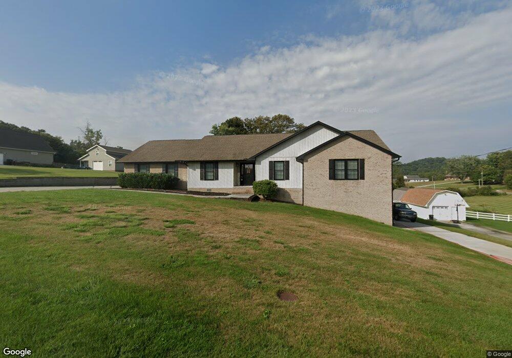
116 Farmers Grove Ln Clinton, TN 37716
South Clinton NeighborhoodEstimated Value: $394,278 - $549,000
--
Bed
2
Baths
2,502
Sq Ft
$196/Sq Ft
Est. Value
About This Home
This home is located at 116 Farmers Grove Ln, Clinton, TN 37716 and is currently estimated at $489,820, approximately $195 per square foot. 116 Farmers Grove Ln is a home located in Anderson County.
Ownership History
Date
Name
Owned For
Owner Type
Purchase Details
Closed on
May 13, 2020
Sold by
Harbin Betty Jo and Harbin Michael Ray
Bought by
Rauhuff Tony Aaron and Rauhuff Sarah Elizabeth
Current Estimated Value
Home Financials for this Owner
Home Financials are based on the most recent Mortgage that was taken out on this home.
Original Mortgage
$274,928
Outstanding Balance
$243,395
Interest Rate
3.25%
Mortgage Type
FHA
Estimated Equity
$246,425
Purchase Details
Closed on
Oct 25, 2017
Sold by
Harbin Betty Jo and Harbin Betty Jo
Bought by
Harbin Betty Jo and Harbin Michael Ray
Purchase Details
Closed on
Aug 23, 1994
Sold by
Harbin Daniel
Bought by
Harbin Kenneth
Create a Home Valuation Report for This Property
The Home Valuation Report is an in-depth analysis detailing your home's value as well as a comparison with similar homes in the area
Home Values in the Area
Average Home Value in this Area
Purchase History
| Date | Buyer | Sale Price | Title Company |
|---|---|---|---|
| Rauhuff Tony Aaron | $285,000 | None Available | |
| Harbin Betty Jo | -- | None Available | |
| Harbin Kenneth | -- | -- |
Source: Public Records
Mortgage History
| Date | Status | Borrower | Loan Amount |
|---|---|---|---|
| Open | Rauhuff Tony Aaron | $274,928 |
Source: Public Records
Tax History Compared to Growth
Tax History
| Year | Tax Paid | Tax Assessment Tax Assessment Total Assessment is a certain percentage of the fair market value that is determined by local assessors to be the total taxable value of land and additions on the property. | Land | Improvement |
|---|---|---|---|---|
| 2024 | $1,722 | $65,500 | $5,250 | $60,250 |
| 2023 | $1,722 | $65,500 | $0 | $0 |
| 2022 | $1,722 | $65,500 | $5,250 | $60,250 |
| 2021 | $1,722 | $65,500 | $5,250 | $60,250 |
| 2020 | $1,570 | $65,500 | $5,250 | $60,250 |
| 2019 | $1,626 | $56,250 | $4,750 | $51,500 |
| 2018 | $1,570 | $56,250 | $4,750 | $51,500 |
| 2017 | $1,544 | $55,350 | $4,750 | $50,600 |
| 2016 | $1,544 | $55,350 | $4,750 | $50,600 |
| 2015 | -- | $55,350 | $4,750 | $50,600 |
| 2014 | -- | $55,350 | $4,750 | $50,600 |
| 2013 | -- | $64,650 | $0 | $0 |
Source: Public Records
Map
Nearby Homes
- 3341 W Wolf Valley Rd
- 3315 W Wolf Valley Rd
- 3275 W Wolf Valley Rd
- 3225 W Wolf Valley Rd
- 113 Settlers Dr
- 101 Blossom Ln
- 219 Bunch Ln
- 780 Old Emory Rd
- 243 Bunch Ln
- Lot 5 St James Ln
- 0 Bunch Ln Unit LotWP001 24583488
- 0 Bunch Ln
- 0 Saint James Ln Unit 1313852
- Lot 6 St James Ln
- 0 St James Ln Unit 1303175
- 763 Blockhouse Valley Rd
- 39 Apple Tree Dr
- 113 Lakeview Place
- 572 Mariner Point Dr
- 3035 W Wolf Valley Rd
- 110 Farmers Grove Ln
- 124 Farmers Grove Ln
- 1233 Blockhouse Valley Rd
- 1196 Blockhouse Valley Rd
- 1224 Blockhouse Valley Rd
- 1249 Blockhouse Valley Rd
- 152 Farmers Grove Ln
- 1153 Blockhouse Valley Rd
- 1240 Blockhouse Valley Rd
- 1232 Blockhouse Valley Rd
- 1151 Blockhouse Valley Rd
- 1154 Blockhouse Valley Rd
- 1148 Blockhouse Valley Rd
- 1145 Blockhouse Valley Rd
- 105 Silas Ln
- 1158 Blockhouse Valley Rd
- 1141 Blockhouse Valley Rd
- 1142 Blockhouse Valley Rd
- 210 Farmers Grove Ln
- 110 Silas Ln