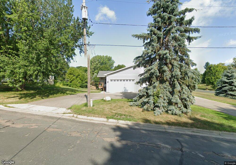
116 Forest Ave N Dundas, MN 55019
Estimated Value: $201,000 - $270,879
4
Beds
2
Baths
762
Sq Ft
$304/Sq Ft
Est. Value
About This Home
This home is located at 116 Forest Ave N, Dundas, MN 55019 and is currently estimated at $231,720, approximately $304 per square foot. 116 Forest Ave N is a home located in Rice County with nearby schools including Bridgewater Elementary School, Northfield Middle School, and Northfield Senior High School.
Ownership History
Date
Name
Owned For
Owner Type
Purchase Details
Closed on
Apr 13, 2022
Sold by
Olson Robert S and Olson Samantha J
Bought by
Mars I Properties Llc
Current Estimated Value
Purchase Details
Closed on
Nov 18, 2005
Sold by
Price Thomas K and Price Tamala L
Bought by
Olson Robert S and Olson Samantha J
Create a Home Valuation Report for This Property
The Home Valuation Report is an in-depth analysis detailing your home's value as well as a comparison with similar homes in the area
Purchase History
We collect this data history from publicly available records. To have your information removed, we recommend requesting removal directly through your county’s website.
| Date | Buyer | Sale Price | Title Company |
|---|---|---|---|
| Mars I Properties Llc | -- | None Listed On Document | |
| Olson Robert S | $131,632 | -- |
Source: Public Records
Tax History
| Year | Tax Paid | Tax Assessment Tax Assessment Total Assessment is a certain percentage of the fair market value that is determined by local assessors to be the total taxable value of land and additions on the property. | Land | Improvement |
|---|---|---|---|---|
| 2026 | $3,682 | $236,600 | $70,700 | $165,900 |
| 2025 | $3,462 | $232,400 | $70,700 | $161,700 |
| 2024 | $3,170 | $217,100 | $61,400 | $155,700 |
| 2023 | $3,188 | $217,100 | $61,400 | $155,700 |
| 2022 | $2,938 | $211,400 | $61,400 | $150,000 |
| 2021 | $2,762 | $180,900 | $55,800 | $125,100 |
| 2020 | $1,598 | $164,900 | $50,300 | $114,600 |
| 2019 | $1,812 | $94,600 | $44,700 | $49,900 |
| 2018 | $1,756 | $104,700 | $44,700 | $60,000 |
| 2017 | $1,490 | $99,300 | $44,700 | $54,600 |
| 2016 | $1,542 | $84,800 | $39,100 | $45,700 |
| 2015 | $1,518 | $81,800 | $39,100 | $42,700 |
| 2014 | -- | $82,400 | $39,100 | $43,300 |
Source: Public Records
Map
Nearby Homes
- 210 Mill St W
- xxx Weaver Rd
- TBD Minnesota 3
- 2068 Millersburg Blvd W
- Outlot Honeylocust Dr
- 2804 Oak Lawn Dr
- 5775 115th St E
- 380 Cross Cir
- 2300 Pepper Ridge Ln
- 9425 Edgebrook Dr
- 1900 Jefferson Rd
- 2204 Valley Dr
- 567 Vermillion Place
- 557 French Ln
- 10750 Farrel Ct
- 5035 124th St E
- 10545 First Timberlane Dr
- 32XX 121st St E
- 31XX 121st
- 2206 Grant Ct
- XXXX Mill St W
- XXXXX Mill St W
- 202 Mill St W
- 204 Forest Ave N
- 303 Hester St W
- 208 208 Forest Ave S
- 208 Forest Ave S
- 213 Mill St W
- 112 Forest Ave N
- 111 Depot St N
- 212 Forest Ave N
- 108 Forest Ave N
- 108 108 Forest-Avenue-n
- 117 Mill St W
- 112 Mill St W
- 113 Mill St W
- 113 Forest Ave N
- 104 Forest Ave N
- 303 Grindstone Ln
- 302 Waterwheel Dr
Your Personal Tour Guide
Ask me questions while you tour the home.