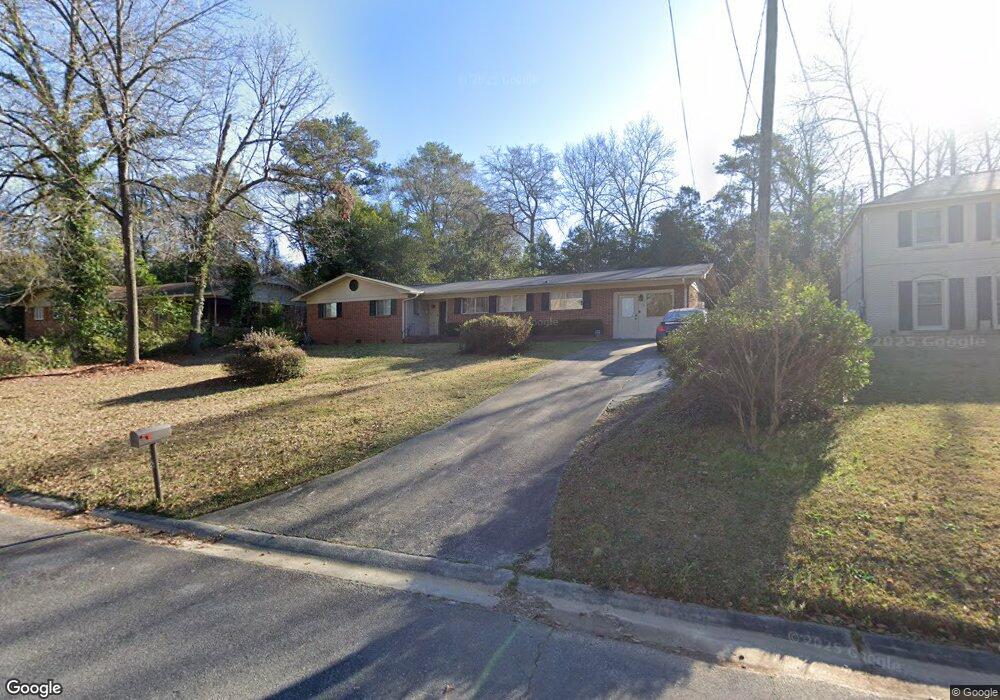
116 Kay Dr Warner Robins, GA 31088
Estimated Value: $179,000 - $214,000
4
Beds
2
Baths
2,006
Sq Ft
$99/Sq Ft
Est. Value
About This Home
This home is located at 116 Kay Dr, Warner Robins, GA 31088 and is currently estimated at $198,239, approximately $98 per square foot. 116 Kay Dr is a home located in Houston County with nearby schools including Miller Elementary School, Warner Robins Middle School, and Warner Robins High School.
Ownership History
Date
Name
Owned For
Owner Type
Purchase Details
Closed on
Feb 21, 2024
Sold by
Warnock Larry E
Bought by
Curry Kiana L and Curry Octavius D
Current Estimated Value
Home Financials for this Owner
Home Financials are based on the most recent Mortgage that was taken out on this home.
Original Mortgage
$6,475
Interest Rate
6.66%
Mortgage Type
New Conventional
Purchase Details
Closed on
Sep 12, 2023
Sold by
Dampier Marian G
Bought by
Warnock Larry E
Create a Home Valuation Report for This Property
The Home Valuation Report is an in-depth analysis detailing your home's value as well as a comparison with similar homes in the area
Home Values in the Area
Average Home Value in this Area
Purchase History
| Date | Buyer | Sale Price | Title Company |
|---|---|---|---|
| Curry Kiana L | $185,000 | None Listed On Document | |
| Warnock Larry E | $155,000 | None Listed On Document |
Source: Public Records
Mortgage History
| Date | Status | Borrower | Loan Amount |
|---|---|---|---|
| Closed | Curry Kiana L | $6,475 | |
| Open | Curry Kiana L | $181,649 |
Source: Public Records
Tax History
| Year | Tax Paid | Tax Assessment Tax Assessment Total Assessment is a certain percentage of the fair market value that is determined by local assessors to be the total taxable value of land and additions on the property. | Land | Improvement |
|---|---|---|---|---|
| 2025 | $2,097 | $72,000 | $6,000 | $66,000 |
| 2024 | $2,157 | $65,920 | $6,000 | $59,920 |
| 2023 | $1,420 | $43,080 | $4,840 | $38,240 |
| 2022 | $705 | $39,800 | $4,840 | $34,960 |
| 2021 | $608 | $35,440 | $4,840 | $30,600 |
| 2020 | $583 | $34,240 | $4,840 | $29,400 |
| 2019 | $583 | $34,240 | $4,840 | $29,400 |
| 2018 | $583 | $34,240 | $4,840 | $29,400 |
| 2017 | $584 | $34,240 | $4,840 | $29,400 |
| 2016 | $584 | $34,240 | $4,840 | $29,400 |
| 2015 | -- | $36,680 | $4,840 | $31,840 |
| 2014 | -- | $36,680 | $4,840 | $31,840 |
| 2013 | -- | $36,680 | $4,840 | $31,840 |
Source: Public Records
Map
Nearby Homes
- 216 Randall Dr
- 203 Springdale Dr
- 213 Briarcliff Rd
- 103 Spring St
- 1012 Briarcliff Rd
- 271 Lakeshore Dr
- 113 Sandra Ave
- 110 Hillridge Dr
- 210 Granada Terrace
- 101 Forest Hill Dr
- 515 Kimberly Rd
- 100 Brett Ave
- 112 Friar Tuck Ave
- 110 Friar Tuck Ave
- 306 Kingsbury Cir
- 105 Robinhood Dr
- 131 Cherokee Forest Trail
- 104 Oxford Ln
- 115 Trinity Dr
- 213 Stratford Dr
- 118 Kay Dr
- 114 Kay Dr
- 112 Kay Dr
- 120 Kay Dr
- 115 Kay Dr
- 517 N Briarcliff Rd
- 515 N Briarcliff Rd
- 110 Kay Dr
- 513 N Briarcliff Rd
- 113 Kay Dr
- 113 Kay Dr Unit 101 Woodland Ct
- 117 Kay Dr
- 102 Freeman Dr
- 519 N Briarcliff Rd
- 214 Randall Dr
- 108 Kay Dr
- 511 N Briarcliff Rd
- 431 Granada Terrace
- 429 Granada Terrace
- 521 N Briarcliff Rd
Your Personal Tour Guide
Ask me questions while you tour the home.