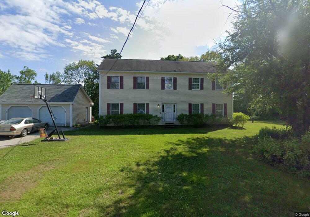
116 Manselville Rd Deering, NH 03244
Estimated Value: $451,000 - $529,000
4
Beds
3
Baths
3,010
Sq Ft
$163/Sq Ft
Est. Value
About This Home
This home is located at 116 Manselville Rd, Deering, NH 03244 and is currently estimated at $491,425, approximately $163 per square foot. 116 Manselville Rd is a home located in Hillsborough County with nearby schools including Hillsboro-Deering Elementary School and Hillsboro-Deering High School.
Ownership History
Date
Name
Owned For
Owner Type
Purchase Details
Closed on
Sep 14, 2007
Sold by
Bank Of New York T Co
Bought by
Laporte Jeffrey S and Laporte Danielle
Current Estimated Value
Home Financials for this Owner
Home Financials are based on the most recent Mortgage that was taken out on this home.
Original Mortgage
$210,000
Outstanding Balance
$133,841
Interest Rate
6.7%
Mortgage Type
Purchase Money Mortgage
Estimated Equity
$357,584
Purchase Details
Closed on
Apr 10, 2007
Sold by
Oleary Jennifer A
Bought by
2004-Bc4 Surf
Create a Home Valuation Report for This Property
The Home Valuation Report is an in-depth analysis detailing your home's value as well as a comparison with similar homes in the area
Home Values in the Area
Average Home Value in this Area
Purchase History
| Date | Buyer | Sale Price | Title Company |
|---|---|---|---|
| Laporte Jeffrey S | $200,000 | -- | |
| 2004-Bc4 Surf | $200,700 | -- |
Source: Public Records
Mortgage History
| Date | Status | Borrower | Loan Amount |
|---|---|---|---|
| Open | 2004-Bc4 Surf | $210,000 |
Source: Public Records
Tax History Compared to Growth
Tax History
| Year | Tax Paid | Tax Assessment Tax Assessment Total Assessment is a certain percentage of the fair market value that is determined by local assessors to be the total taxable value of land and additions on the property. | Land | Improvement |
|---|---|---|---|---|
| 2024 | $8,902 | $316,800 | $87,100 | $229,700 |
| 2023 | $8,230 | $316,800 | $87,100 | $229,700 |
| 2022 | $7,207 | $316,800 | $87,100 | $229,700 |
| 2021 | $7,147 | $316,800 | $87,100 | $229,700 |
| 2020 | $7,860 | $316,800 | $87,100 | $229,700 |
| 2019 | $7,367 | $240,600 | $63,900 | $176,700 |
| 2018 | $7,230 | $240,600 | $63,900 | $176,700 |
| 2017 | $7,211 | $240,600 | $63,900 | $176,700 |
| 2016 | $6,869 | $240,600 | $63,900 | $176,700 |
| 2015 | $7,115 | $240,600 | $63,900 | $176,700 |
| 2014 | $6,552 | $265,600 | $72,800 | $192,800 |
| 2013 | $6,892 | $265,600 | $72,800 | $192,800 |
Source: Public Records
Map
Nearby Homes
- 86 Manselville Rd
- 120 Deering Center Rd
- 10 Deering Center Rd
- 32 Union St
- 88 W Mill St
- 73 W Main St
- 20-22 Church St
- 1 W Main St
- 45 Keyes Farm Rd
- 9 Wyman Rd
- 5 Chamberlain Ct Unit 56
- 21 Wyman Rd
- 31 Woodlawn Ave
- 31 Central St Unit G
- 23 Pleasant St
- 00 Rochester Rd Unit 32
- 0 W Main St Unit 1
- 0 Route 202 Route Unit 4983445
- 28 Merrill Rd
- 126 Fisher Rd
- 86 Deering Center Rd
- 106 Manselville Rd
- 80 Deering Center Rd
- 94 Deering Center Rd
- 96 Deering Center Rd
- 93 Manselville Rd
- 100 Deering Center Rd
- 103 Deering Center Rd
- 61 Deering Center Rd
- 118 Deering Center Rd
- 118 Deering Ctr Rd
- 97 Deering Center Rd
- 7 Clement Hill Rd
- 70 Manselville Rd
- 40 Deering Center Rd
- 5 Merrill Way
- 37 Clement Hill Rd
- 61 Manselville Rd
- 6 Clement Hill Rd
- 13 Merrill Way