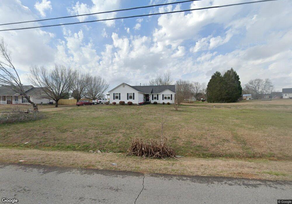
116 Michael Ln McDonough, GA 30252
Estimated Value: $285,496 - $310,000
3
Beds
2
Baths
2,144
Sq Ft
$139/Sq Ft
Est. Value
About This Home
This home is located at 116 Michael Ln, McDonough, GA 30252 and is currently estimated at $298,624, approximately $139 per square foot. 116 Michael Ln is a home located in Henry County with nearby schools including New Hope Elementary School, Locust Grove Middle School, and Locust Grove High School.
Ownership History
Date
Name
Owned For
Owner Type
Purchase Details
Closed on
Sep 30, 2002
Sold by
Whitten Mark L and Whitten Victoria M
Bought by
Borden Glenn and Borden Evelyn
Current Estimated Value
Home Financials for this Owner
Home Financials are based on the most recent Mortgage that was taken out on this home.
Original Mortgage
$126,004
Outstanding Balance
$52,406
Interest Rate
6.18%
Mortgage Type
FHA
Estimated Equity
$246,218
Purchase Details
Closed on
Jun 30, 1997
Sold by
Homebuilders Chamlee
Bought by
Whitten Mark and Whitten Victoria
Home Financials for this Owner
Home Financials are based on the most recent Mortgage that was taken out on this home.
Original Mortgage
$90,150
Interest Rate
7.7%
Mortgage Type
New Conventional
Create a Home Valuation Report for This Property
The Home Valuation Report is an in-depth analysis detailing your home's value as well as a comparison with similar homes in the area
Home Values in the Area
Average Home Value in this Area
Purchase History
| Date | Buyer | Sale Price | Title Company |
|---|---|---|---|
| Borden Glenn | $127,000 | -- | |
| Whitten Mark | $94,900 | -- |
Source: Public Records
Mortgage History
| Date | Status | Borrower | Loan Amount |
|---|---|---|---|
| Open | Borden Glenn | $126,004 | |
| Previous Owner | Whitten Mark | $90,150 |
Source: Public Records
Tax History
| Year | Tax Paid | Tax Assessment Tax Assessment Total Assessment is a certain percentage of the fair market value that is determined by local assessors to be the total taxable value of land and additions on the property. | Land | Improvement |
|---|---|---|---|---|
| 2025 | $3,052 | $112,440 | $14,000 | $98,440 |
| 2024 | $3,052 | $116,560 | $14,000 | $102,560 |
| 2023 | $2,868 | $113,440 | $14,000 | $99,440 |
| 2022 | $2,981 | $98,120 | $14,000 | $84,120 |
| 2021 | $2,354 | $73,600 | $14,000 | $59,600 |
| 2020 | $2,244 | $69,200 | $12,000 | $57,200 |
| 2019 | $2,142 | $65,200 | $12,000 | $53,200 |
| 2018 | $2,037 | $61,000 | $10,800 | $50,200 |
| 2016 | $1,779 | $52,400 | $10,000 | $42,400 |
| 2015 | $1,609 | $46,960 | $8,000 | $38,960 |
| 2014 | $1,594 | $46,200 | $10,000 | $36,200 |
Source: Public Records
Map
Nearby Homes
- 111 Michael Ln
- 125 Karen Dr
- 356 Cattlemans Cir
- 690 Laney Rd
- 173 Michael Ln
- 935 S Laney Rd
- 310 Cattlemans Cir
- 175 Laney Ct Unit 1
- 328 Cattlemans Cir
- 145 Ducati Dr
- 976 S Laney Rd
- 136 Ducati Dr
- 290 Laney Ct
- 290 New Hope Rd
- 732 New Hope Rd
- 995 Old Jackson Rd
- 845 Graeme Dr
- 812 Graeme Dr
- 145 Creekside Way
- 0 S Ola Rd Unit 10563258
- 120 Michael Ln
- 545 Plantation Rd
- 555 Plantation Rd
- 119 Michael Ln
- 115 Michael Ln
- 124 Michael Ln
- 575 Plantation Rd
- 535 Plantation Rd
- 505 Laney Rd Unit 805
- 505 Laney Rd
- 125 Michael Ln
- 525 Laney Rd
- 560 Plantation Rd
- 535 Laney Rd
- 525 Plantation Rd
- 594 Plantation Rd
- 475 Laney Rd
- 129 Michael Ln
- 130 Michaels Dr
- 130 Michael Ln
Your Personal Tour Guide
Ask me questions while you tour the home.