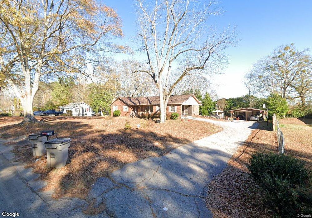
116 N Barnard Ave Lagrange, GA 30241
Estimated Value: $197,790 - $228,000
4
Beds
2
Baths
1,635
Sq Ft
$133/Sq Ft
Est. Value
About This Home
This home is located at 116 N Barnard Ave, Lagrange, GA 30241 and is currently estimated at $217,198, approximately $132 per square foot. 116 N Barnard Ave is a home located in Troup County with nearby schools including Callaway Elementary School, Hogansville Elementary School, and Callaway Middle School.
Ownership History
Date
Name
Owned For
Owner Type
Purchase Details
Closed on
Nov 24, 2003
Sold by
Mobley Hugh
Bought by
Barner Tommy
Current Estimated Value
Purchase Details
Closed on
Mar 9, 1985
Sold by
Landbank Equity Corp
Bought by
Mobley Hugh
Purchase Details
Closed on
Sep 4, 1984
Sold by
Ussery Cheryl and Ussery Gerald T
Bought by
Landbank Equity Corp
Purchase Details
Closed on
Jun 26, 1979
Sold by
Ussery Gerald T
Bought by
Ussery Cheryl and Ussery Gerald T
Purchase Details
Closed on
Jun 20, 1976
Sold by
Ussery Jason
Bought by
Ussery Gerald T
Purchase Details
Closed on
Feb 17, 1976
Sold by
Ussery Gerald T
Bought by
Ussery Jason
Create a Home Valuation Report for This Property
The Home Valuation Report is an in-depth analysis detailing your home's value as well as a comparison with similar homes in the area
Purchase History
| Date | Buyer | Sale Price | Title Company |
|---|---|---|---|
| Barner Tommy | $113,000 | -- | |
| Mobley Hugh | $52,000 | -- | |
| Landbank Equity Corp | $15,300 | -- | |
| Ussery Cheryl | -- | -- | |
| Ussery Gerald T | $4,000 | -- | |
| Ussery Jason | $4,500 | -- |
Source: Public Records
Tax History
| Year | Tax Paid | Tax Assessment Tax Assessment Total Assessment is a certain percentage of the fair market value that is determined by local assessors to be the total taxable value of land and additions on the property. | Land | Improvement |
|---|---|---|---|---|
| 2025 | $1,913 | $74,160 | $4,480 | $69,680 |
| 2024 | $1,811 | $68,400 | $4,480 | $63,920 |
| 2023 | $1,425 | $54,240 | $4,480 | $49,760 |
| 2022 | $1,351 | $50,400 | $4,480 | $45,920 |
| 2021 | $1,183 | $41,200 | $4,480 | $36,720 |
| 2020 | $1,183 | $41,200 | $4,480 | $36,720 |
| 2019 | $1,073 | $37,560 | $4,480 | $33,080 |
| 2018 | $1,096 | $36,348 | $4,428 | $31,920 |
| 2017 | $1,096 | $36,348 | $4,428 | $31,920 |
| 2016 | $1,066 | $35,349 | $4,428 | $30,921 |
| 2015 | $1,068 | $35,349 | $4,428 | $30,921 |
| 2014 | $1,020 | $33,722 | $4,428 | $29,294 |
| 2013 | -- | $35,348 | $4,428 | $30,920 |
Source: Public Records
Map
Nearby Homes
- 107 N Barnard Ave
- 0 N Barnard Ave
- 110 Lenox Cir
- 101 Sarah Ln
- 115 Clara Jean Ct
- 412 Sweetwood Ct Unit A36
- 109 Sarah Ln
- 304 Bridgette Blvd
- 212 Cleveland Dr
- 204 Cleveland Dr
- 210 Hearthstone Dr
- 509 Youngs Mill Rd
- 87 Youngs Mill Rd
- 5 Gulfstream Dr
- 224 Rutland Cir
- 3 Gulfstream Dr
- 793 Celebration Blvd
- 105 Ridgefield Dr
- 203 Bonaventure Dr
- 146 Shenandoah Ln
- 120 N Barnard Ave
- 113 N Barnard Ave
- 111 N Barnard Ave
- 115 N Barnard Ave
- 109 N Barnard Ave
- 213 N Barnard Ave
- 204 N Barnard Ave
- 110 Wood Ave
- 105 N Barnard Ave
- 90 N Barnard Ave
- N N Barnard Ave
- 103 N Barnard Ave
- 108 Wood Ave
- 210 N Barnard Ave
- 224 Lenox Cir
- 108 Peachtree Ct Unit B
- 108 Peachtree Ct Unit A
- 108 Peachtree Ct Unit A
- 108 Peachtree Ct Unit C
- 101 N Barnard Ave
Your Personal Tour Guide
Ask me questions while you tour the home.