B
Landlord's Agent in 2019
Bonnie Fraker
Bonnie Fraker Real Estate

Estimated Value: $247,000 - $275,000
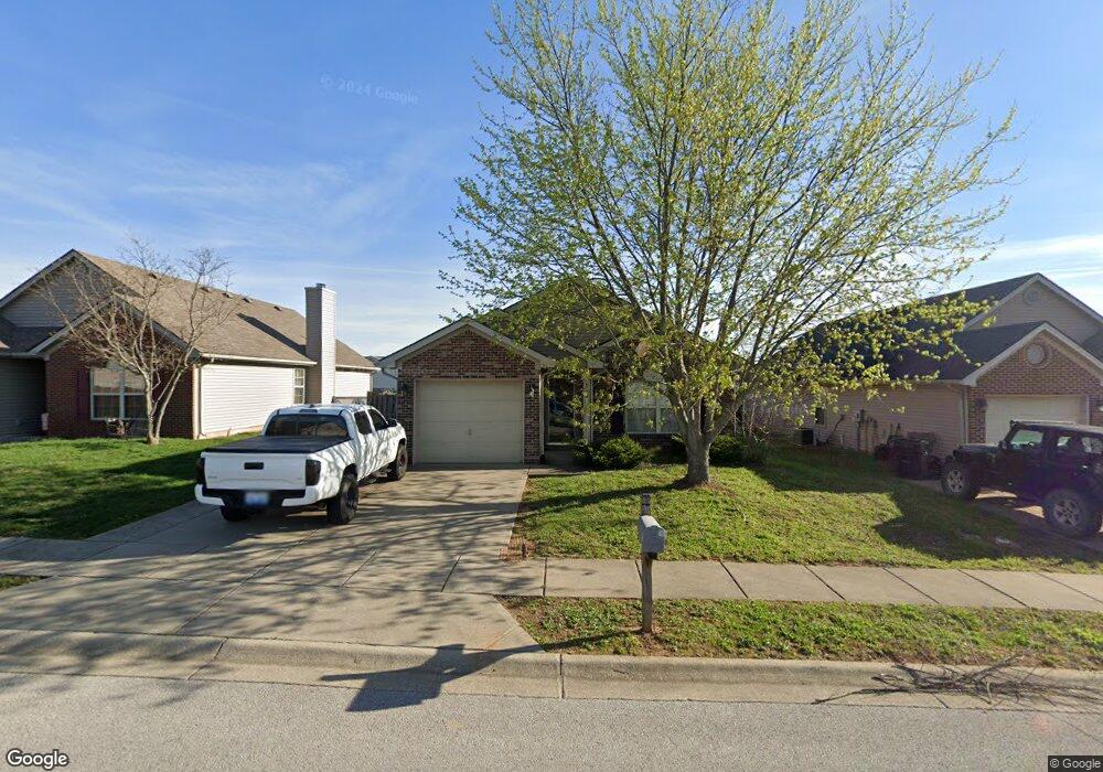
This home is located at 116 Ransom Trace, Georgetown, KY 40324 since 25 October 2019 and is currently priced at $258,300. This property was built in 2006. 116 Ransom Trace is a home located in Scott County with nearby schools including Southern Elementary School, Georgetown Middle School, and Scott County High School.
Last Agent to Rent the Property
Bonnie Fraker
Bonnie Fraker Real Estate License #197171 Listed on: 10/25/2019
Last Renter's Agent
Bonnie Fraker
Bonnie Fraker Real Estate License #197171 Listed on: 10/25/2019
| Date | Buyer | Sale Price | Title Company |
|---|---|---|---|
| Jenkins Wilbur M | $110,000 | None Available | |
| Smith John Paul | $125,000 | None Available | |
| Tuttle Karen L | $117,421 | First American Title Ins Co |
| Date | Status | Borrower | Loan Amount |
|---|---|---|---|
| Previous Owner | Smith John Paul | $123,000 | |
| Previous Owner | Tuttle Karen L | $92,360 |
| Date | Event | Price | List to Sale | Price per Sq Ft |
|---|---|---|---|---|
| 10/24/2019 10/24/19 | Rented | $1,000 | 0.0% | -- |
| 10/24/2019 10/24/19 | For Rent | $1,000 | -- | -- |
| Year | Tax Paid | Tax Assessment Tax Assessment Total Assessment is a certain percentage of the fair market value that is determined by local assessors to be the total taxable value of land and additions on the property. | Land | Improvement |
|---|---|---|---|---|
| 2025 | $1,725 | $193,700 | $0 | $0 |
| 2024 | $1,686 | $187,500 | $0 | $0 |
| 2023 | $1,609 | $177,500 | $35,000 | $142,500 |
| 2022 | $1,354 | $159,200 | $30,000 | $129,200 |
| 2021 | $1,397 | $148,300 | $30,000 | $118,300 |
| 2020 | $1,171 | $136,300 | $30,000 | $106,300 |
| 2019 | $1,142 | $130,800 | $0 | $0 |
| 2018 | $1,104 | $127,200 | $0 | $0 |
| 2017 | $1,083 | $124,180 | $0 | $0 |
| 2016 | $961 | $119,352 | $0 | $0 |
| 2015 | $901 | $112,600 | $0 | $0 |
| 2014 | $934 | $112,600 | $0 | $0 |
| 2011 | $78 | $125,000 | $0 | $0 |
B
Landlord's Agent in 2019
Bonnie Fraker
Bonnie Fraker Real Estate
Source: ImagineMLS (Bluegrass REALTORS®)
MLS Number: 1925006
APN: 141-20-200.000
Disclaimer: Certain information contained herein is derived from information provided by parties other than Homes.com. All information provided is deemed reliable, but is not guaranteed to be accurate and should be independently verified.
![]() The information is being provided by LBAR Multiple Listing Service. Information deemed reliable but not guaranteed. Information is provided for consumers' personal, non-commercial use, and may not be used for any purpose other than the identification of potential properties for purchase. Copyright 2026 LBAR Multiple Listing Service. All Rights Reserved.
The information is being provided by LBAR Multiple Listing Service. Information deemed reliable but not guaranteed. Information is provided for consumers' personal, non-commercial use, and may not be used for any purpose other than the identification of potential properties for purchase. Copyright 2026 LBAR Multiple Listing Service. All Rights Reserved.
Ask me questions while you tour the home.
