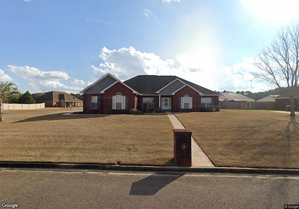
116 Red Dirt Rd Enterprise, AL 36330
Estimated Value: $371,093 - $395,000
4
Beds
4
Baths
2,631
Sq Ft
$143/Sq Ft
Est. Value
About This Home
This home is located at 116 Red Dirt Rd, Enterprise, AL 36330 and is currently estimated at $377,523, approximately $143 per square foot. 116 Red Dirt Rd is a home located in Coffee County with nearby schools including Pinedale Elementary School, Coppinville School, and Enterprise High School.
Ownership History
Date
Name
Owned For
Owner Type
Purchase Details
Closed on
Mar 15, 2022
Sold by
Howard Luzie M
Bought by
Howard Roger D
Current Estimated Value
Purchase Details
Closed on
Nov 10, 2008
Sold by
Teagle Douglas R and Teagle Cynthia S
Bought by
Howard Roger D and Howard Luzie M
Home Financials for this Owner
Home Financials are based on the most recent Mortgage that was taken out on this home.
Original Mortgage
$160,000
Interest Rate
5.89%
Purchase Details
Closed on
Dec 3, 2007
Sold by
Davison Tom and Davison Dorothy
Bought by
Teagle Douglas R and Teagle Cynthia S
Home Financials for this Owner
Home Financials are based on the most recent Mortgage that was taken out on this home.
Original Mortgage
$227,200
Interest Rate
6.22%
Create a Home Valuation Report for This Property
The Home Valuation Report is an in-depth analysis detailing your home's value as well as a comparison with similar homes in the area
Purchase History
| Date | Buyer | Sale Price | Title Company |
|---|---|---|---|
| Howard Roger D | $350,080 | -- | |
| Howard Roger D | -- | -- | |
| Teagle Douglas R | -- | -- |
Source: Public Records
Mortgage History
| Date | Status | Borrower | Loan Amount |
|---|---|---|---|
| Previous Owner | Howard Roger D | $160,000 | |
| Previous Owner | Teagle Douglas R | $227,200 |
Source: Public Records
Tax History
| Year | Tax Paid | Tax Assessment Tax Assessment Total Assessment is a certain percentage of the fair market value that is determined by local assessors to be the total taxable value of land and additions on the property. | Land | Improvement |
|---|---|---|---|---|
| 2024 | $1,542 | $35,840 | $4,301 | $31,539 |
| 2023 | $1,610 | $30,215 | $4,300 | $25,915 |
| 2022 | $1,286 | $29,960 | $0 | $0 |
| 2021 | $1,129 | $26,340 | $0 | $0 |
| 2020 | $1,138 | $26,560 | $0 | $0 |
| 2019 | $1,138 | $26,560 | $0 | $0 |
| 2018 | $1,149 | $26,800 | $0 | $0 |
| 2017 | $1,169 | $27,260 | $0 | $0 |
| 2016 | $1,169 | $27,260 | $0 | $0 |
| 2015 | $1,202 | $28,020 | $0 | $0 |
| 2014 | $1,202 | $28,020 | $0 | $0 |
| 2013 | $1,248 | $0 | $0 | $0 |
Source: Public Records
Map
Nearby Homes
- 430 County Road 711
- 406 County Road 711
- 0 County Road 708
- 100 Red Dirt Rd
- 100 Greyfox Trail
- 6022 Boll Weevil Cir
- 102 Brabham Dr
- 103 Jackson St
- 128 Brookestone Dr
- 101 Jackson St
- 200 Brabham Dr
- 201 Stonechase Dr
- 158 Boll Weevil Cir
- 206 Stonechase Dr
- 3710 County Road 708
- 4050 County Road 708
- 4120 County Road 708
- 4010 County Road 708
- 211 Brookstone Dr
- 213 Brookstone Dr
- LOT 8 Block E Brookwood
- 114 Red Dirt Rd
- 102 Brookwood Dr
- 26 Brookwood Dr
- 25 I Brookwood
- 4F Brookwood Dr
- LOT 31 BLOCK G Brookwood Dr
- 110 Brookwood Dr
- 112 Red Dirt Rd
- 117 Red Dirt Rd
- 113 Red Dirt Rd
- 200 Red Dirt Rd
- 21 Brookwood Dr
- 112 Brookwood Dr
- 201 Red Dirt Rd
- 115 Red Dirt Rd
- 110 Red Dirt Rd
- 105 Brookwood Dr
- 109 Red Dirt Rd
- 114 Brookwood Dr
Your Personal Tour Guide
Ask me questions while you tour the home.