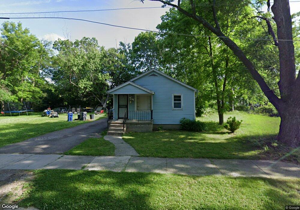
116 W Piper Ave Flint, MI 48505
MLK Circle NeighborhoodEstimated Value: $47,000 - $83,000
3
Beds
1
Bath
956
Sq Ft
$66/Sq Ft
Est. Value
About This Home
This home is located at 116 W Piper Ave, Flint, MI 48505 and is currently estimated at $62,960, approximately $65 per square foot. 116 W Piper Ave is a home located in Genesee County with nearby schools including Brownell STEM Academy, The New Standard Academy, and Eagle's Nest Academy.
Ownership History
Date
Name
Owned For
Owner Type
Purchase Details
Closed on
Jun 23, 2021
Sold by
Barbee Verice Layton
Bought by
Layton Latrell C
Current Estimated Value
Purchase Details
Closed on
Nov 19, 2015
Sold by
Genesee County Land Bank Authority
Bought by
Layton Barbee Verice
Purchase Details
Closed on
Jan 27, 2014
Sold by
The Genesee County Land Bank Authority
Bought by
Layton Barbee Verice
Purchase Details
Closed on
Dec 20, 2013
Sold by
Genesee County Treasurer
Bought by
Genesee County Land Bank
Purchase Details
Closed on
Jan 6, 2006
Sold by
Bethune Willie and Bethune Elizabeth A
Bought by
Layton Latrell
Purchase Details
Closed on
Feb 13, 1983
Sold by
Evans Bessie
Bought by
Bethune Willie and Bethune Elizabeth A
Create a Home Valuation Report for This Property
The Home Valuation Report is an in-depth analysis detailing your home's value as well as a comparison with similar homes in the area
Home Values in the Area
Average Home Value in this Area
Purchase History
| Date | Buyer | Sale Price | Title Company |
|---|---|---|---|
| Layton Latrell C | -- | None Listed On Document | |
| Layton Barbee Verice | $1,800 | None Available | |
| Layton Barbee Verice | $1,800 | None Available | |
| Genesee County Land Bank | -- | None Available | |
| Layton Latrell | $8,000 | First American Title Ins Co | |
| Bethune Willie | $1,000 | Lawyers Title Insurance Corp |
Source: Public Records
Mortgage History
| Date | Status | Borrower | Loan Amount |
|---|---|---|---|
| Closed | Layton Barbee Verice | $0 |
Source: Public Records
Tax History
| Year | Tax Paid | Tax Assessment Tax Assessment Total Assessment is a certain percentage of the fair market value that is determined by local assessors to be the total taxable value of land and additions on the property. | Land | Improvement |
|---|---|---|---|---|
| 2025 | $455 | $9,800 | $0 | $0 |
| 2024 | $430 | $7,900 | $0 | $0 |
| 2023 | $433 | $6,100 | $0 | $0 |
| 2022 | $0 | $4,700 | $0 | $0 |
| 2021 | $495 | $4,700 | $0 | $0 |
| 2020 | $470 | $4,400 | $0 | $0 |
| 2019 | $470 | $4,400 | $0 | $0 |
| 2018 | $428 | $3,600 | $0 | $0 |
| 2017 | $421 | $0 | $0 | $0 |
| 2016 | $435 | $0 | $0 | $0 |
| 2015 | -- | $0 | $0 | $0 |
| 2014 | -- | $0 | $0 | $0 |
| 2012 | -- | $4,300 | $0 | $0 |
Source: Public Records
Map
Nearby Homes
- 225 E Piper Ave
- 536 W Home Ave
- 518 W Ruth Ave
- 610 W Austin Ave
- 605 W Foss Ave
- 613 W Foss Ave
- 345 E Austin Ave
- 514 W Alma Ave
- 614 W Holbrook Ave
- 246 E York Ave
- 209 E York Ave
- 405 W Bundy Ave
- 5416 Dupont St
- 350 E Mott Ave
- 421 E Lorado Ave
- 425 E Lorado Ave
- 6609 Cranwood Dr
- 422 E Foss Ave
- 5610 Baldwin Blvd
- 6714 Cranwood Dr
- 6101 M l King Ave
- 128 W Piper Ave
- 113 W Russell Ave
- 205 W Russell Ave
- 109 W Russell Ave
- 202 W Piper Ave
- 119 W Piper Ave
- 105 W Russell Ave
- 123 W Piper Ave
- 127 W Piper Ave
- 201 W Piper Ave
- 209 W Russell Ave
- 101 E Piper Ave
- 205 W Piper Ave
- 116 W Home Ave
- 112 W Home Ave
- 120 W Home Ave
- 124 W Home Ave
- 217 W Russell Ave
- 105 E Piper Ave
Your Personal Tour Guide
Ask me questions while you tour the home.