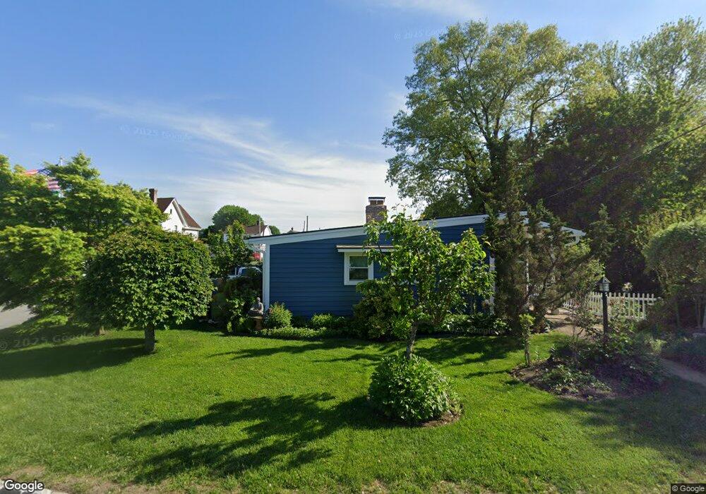
116 Wayland Ave Cranston, RI 02920
Meshanticut NeighborhoodEstimated Value: $332,000 - $413,000
2
Beds
1
Bath
888
Sq Ft
$405/Sq Ft
Est. Value
About This Home
This home is located at 116 Wayland Ave, Cranston, RI 02920 and is currently estimated at $359,529, approximately $404 per square foot. 116 Wayland Ave is a home located in Providence County with nearby schools including George J. Peters School, Western Hills Middle School, and Cranston High School West.
Ownership History
Date
Name
Owned For
Owner Type
Purchase Details
Closed on
Nov 22, 2000
Sold by
Forefront Llc
Bought by
Iannotta Franco
Current Estimated Value
Purchase Details
Closed on
Jul 19, 2000
Sold by
Fleet National Bank
Bought by
Forefront Llc
Purchase Details
Closed on
Dec 20, 1994
Sold by
Desaulniers Cherie L
Bought by
Collins John K
Create a Home Valuation Report for This Property
The Home Valuation Report is an in-depth analysis detailing your home's value as well as a comparison with similar homes in the area
Home Values in the Area
Average Home Value in this Area
Purchase History
| Date | Buyer | Sale Price | Title Company |
|---|---|---|---|
| Iannotta Franco | $105,000 | -- | |
| Forefront Llc | $60,000 | -- | |
| Collins John K | $90,000 | -- |
Source: Public Records
Mortgage History
| Date | Status | Borrower | Loan Amount |
|---|---|---|---|
| Open | Collins John K | $176,000 | |
| Closed | Collins John K | $10,000 | |
| Closed | Collins John K | $120,000 |
Source: Public Records
Tax History
| Year | Tax Paid | Tax Assessment Tax Assessment Total Assessment is a certain percentage of the fair market value that is determined by local assessors to be the total taxable value of land and additions on the property. | Land | Improvement |
|---|---|---|---|---|
| 2025 | $3,950 | $284,600 | $103,700 | $180,900 |
| 2024 | $3,873 | $284,600 | $103,700 | $180,900 |
| 2023 | $3,686 | $195,000 | $71,600 | $123,400 |
| 2022 | $3,609 | $195,000 | $71,600 | $123,400 |
| 2021 | $3,510 | $195,000 | $71,600 | $123,400 |
| 2020 | $3,392 | $163,300 | $68,000 | $95,300 |
| 2019 | $3,392 | $163,300 | $68,000 | $95,300 |
| 2018 | $3,313 | $163,300 | $68,000 | $95,300 |
| 2017 | $3,028 | $132,000 | $50,100 | $81,900 |
| 2016 | $2,963 | $132,000 | $50,100 | $81,900 |
| 2015 | $2,963 | $132,000 | $50,100 | $81,900 |
| 2014 | $3,045 | $133,300 | $50,100 | $83,200 |
Source: Public Records
Map
Nearby Homes
- 333 Phenix Ave
- 210 Hyde St
- 99 Salem Ave
- 00 Burton St
- 129 Vallette St
- 54 Randall St
- 80 W View Ave
- 47 Bretton Woods Dr
- 135 Meshanticut Valley Pkwy
- 19 Salem Ave
- 140 Lake View Rd
- 93 Elena St
- 321 Budlong Rd
- 214 Meshanticut Valley Pkwy
- 141 Glen Ridge Rd
- 178 Highland St
- 38 Baldino Dr
- 15 Vallone Rd
- 29 Valley St
- 9 Southern St
- 15 Norton Ave
- 100 Wayland Ave
- 130 Wayland Ave
- 130 Wayland Ave Unit 1
- 130 Wayland Ave Unit 2
- 111 Wayland Ave
- 67 Nichols St
- 67 Nichols St Unit First floor
- 125 Wayland Ave
- 21 Norton Ave
- 131 Wayland Ave
- 121 Wayland Ave
- 25 Norton Ave
- 59 Nichols St
- 145 Wayland Ave
- 92 Wayland Ave
- 103 Wayland Ave
- 105 Wayland Ave
- 148 Wayland Ave
- 29 Norton Ave
Your Personal Tour Guide
Ask me questions while you tour the home.