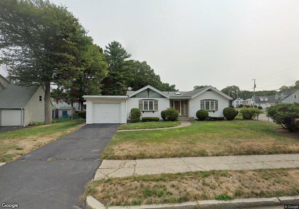
116 West St Brockton, MA 02301
Estimated Value: $526,170 - $570,000
3
Beds
2
Baths
1,560
Sq Ft
$351/Sq Ft
Est. Value
About This Home
This home is located at 116 West St, Brockton, MA 02301 and is currently estimated at $547,293, approximately $350 per square foot. 116 West St is a home located in Plymouth County with nearby schools including Manthala George Jr. School, Hancock Elementary School, and Louis F Angelo Elementary School.
Create a Home Valuation Report for This Property
The Home Valuation Report is an in-depth analysis detailing your home's value as well as a comparison with similar homes in the area
Tax History
| Year | Tax Paid | Tax Assessment Tax Assessment Total Assessment is a certain percentage of the fair market value that is determined by local assessors to be the total taxable value of land and additions on the property. | Land | Improvement |
|---|---|---|---|---|
| 2025 | $5,330 | $440,100 | $146,700 | $293,400 |
| 2024 | $5,217 | $434,000 | $146,700 | $287,300 |
| 2023 | $4,951 | $381,400 | $111,800 | $269,600 |
| 2022 | $4,755 | $340,400 | $101,700 | $238,700 |
| 2021 | $4,736 | $326,600 | $96,100 | $230,500 |
| 2020 | $4,774 | $315,100 | $92,000 | $223,100 |
| 2019 | $4,822 | $303,900 | $86,400 | $217,500 |
| 2018 | $4,426 | $275,600 | $86,400 | $189,200 |
| 2017 | $4,319 | $245,600 | $86,400 | $159,200 |
| 2016 | $4,111 | $236,800 | $82,400 | $154,400 |
| 2015 | $4,069 | $224,200 | $82,400 | $141,800 |
| 2014 | $3,936 | $217,100 | $82,400 | $134,700 |
Source: Public Records
Map
Nearby Homes
- 109 Lenox St
- 47 N Belcher Ave
- 131 Moraine St
- 69 W Elm Terrace Unit 1
- 29 Auna Dr Unit 3
- 11 Auna Dr Unit 6
- 433 W Elm St Unit 2
- 436 Pleasant St
- 425 W Elm St Unit 7
- 75 Colonel Bell Dr Unit 77-11
- 18 Belmont Place
- 81 Colonel Bell Dr Unit 9
- 77 Highland Terrace
- 193 Boylston St
- 97 Colonel Bell Dr Unit 8
- 130 Braemoor Rd
- 66 Cross Ave
- 65 Cross Ave
- 155 Rockland Dr
- 990 Pleasant St
Your Personal Tour Guide
Ask me questions while you tour the home.