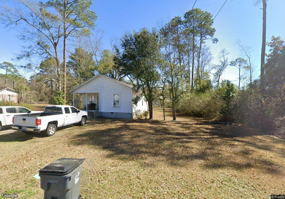
116 Wilder St SE Pelham, GA 31779
Estimated Value: $21,000 - $117,000
--
Bed
1
Bath
1,180
Sq Ft
$65/Sq Ft
Est. Value
About This Home
This home is located at 116 Wilder St SE, Pelham, GA 31779 and is currently estimated at $76,671, approximately $64 per square foot. 116 Wilder St SE is a home located in Mitchell County with nearby schools including Pelham Elementary School, Pelham City Middle School, and Pelham High School.
Ownership History
Date
Name
Owned For
Owner Type
Purchase Details
Closed on
Dec 16, 2024
Sold by
Gondor John E
Bought by
Kirkland Travis Lamar
Current Estimated Value
Home Financials for this Owner
Home Financials are based on the most recent Mortgage that was taken out on this home.
Original Mortgage
$24,805
Outstanding Balance
$24,315
Interest Rate
6.84%
Mortgage Type
New Conventional
Estimated Equity
$52,356
Create a Home Valuation Report for This Property
The Home Valuation Report is an in-depth analysis detailing your home's value as well as a comparison with similar homes in the area
Home Values in the Area
Average Home Value in this Area
Purchase History
| Date | Buyer | Sale Price | Title Company |
|---|---|---|---|
| Kirkland Travis Lamar | $22,000 | -- |
Source: Public Records
Mortgage History
| Date | Status | Borrower | Loan Amount |
|---|---|---|---|
| Open | Kirkland Travis Lamar | $24,805 |
Source: Public Records
Tax History Compared to Growth
Tax History
| Year | Tax Paid | Tax Assessment Tax Assessment Total Assessment is a certain percentage of the fair market value that is determined by local assessors to be the total taxable value of land and additions on the property. | Land | Improvement |
|---|---|---|---|---|
| 2024 | $580 | $16,920 | $1,920 | $15,000 |
| 2023 | $868 | $16,920 | $1,920 | $15,000 |
| 2022 | $587 | $13,240 | $1,920 | $11,320 |
| 2021 | $371 | $12,000 | $1,920 | $10,080 |
| 2020 | $346 | $12,000 | $1,920 | $10,080 |
| 2019 | $348 | $12,000 | $1,920 | $10,080 |
| 2018 | $543 | $12,000 | $1,920 | $10,080 |
| 2017 | $142 | $11,226 | $1,920 | $9,306 |
| 2016 | $229 | $11,226 | $1,920 | $9,306 |
| 2015 | $229 | $11,226 | $1,920 | $9,306 |
| 2014 | $229 | $11,226 | $1,920 | $9,306 |
| 2013 | $229 | $11,226 | $1,920 | $9,306 |
Source: Public Records
Map
Nearby Homes
- 375 Baggs Ave SE
- 438 Dogwood Dr NE
- 335 Curry St NE
- 323 Curry St NE
- 199 Carroll St NE
- 183 Baggs Ave SE
- 482 Curry St NE
- 547 Cotton Rd NE
- 135 Baggs Ave SE
- 3** Youngs Mill Rd
- 212 Hand Ave W
- 209 McDonald St SW
- 210 Castleberry St NW
- 233 Cannon St NW
- 354 Bennett St NW
- 00 Laverne Ln
- 277 Saunders St SW
- 389 Stewart St SW
- 410 Hollis St SW
- 443 Stewart St SW
- 104 Wilder St SE
- 348 Forrest St SE
- 311 Green St E
- 103 Wilder St NE
- 303 Green St E
- 110 Wilder St NE
- 117 Wilder St NE
- 122 Wilder St NE
- 322 Baggs Ave SE
- 283 Green St E
- 125 Wilder St NE
- 284 Green St E
- 334 Baggs Ave SE
- 373 Green St E
- 132 Wilder St NE
- 275 Green St E
- 380 Green St E
- 301 Fortson St NE
- 310 Baggs Ave SE
- 391 Green St E