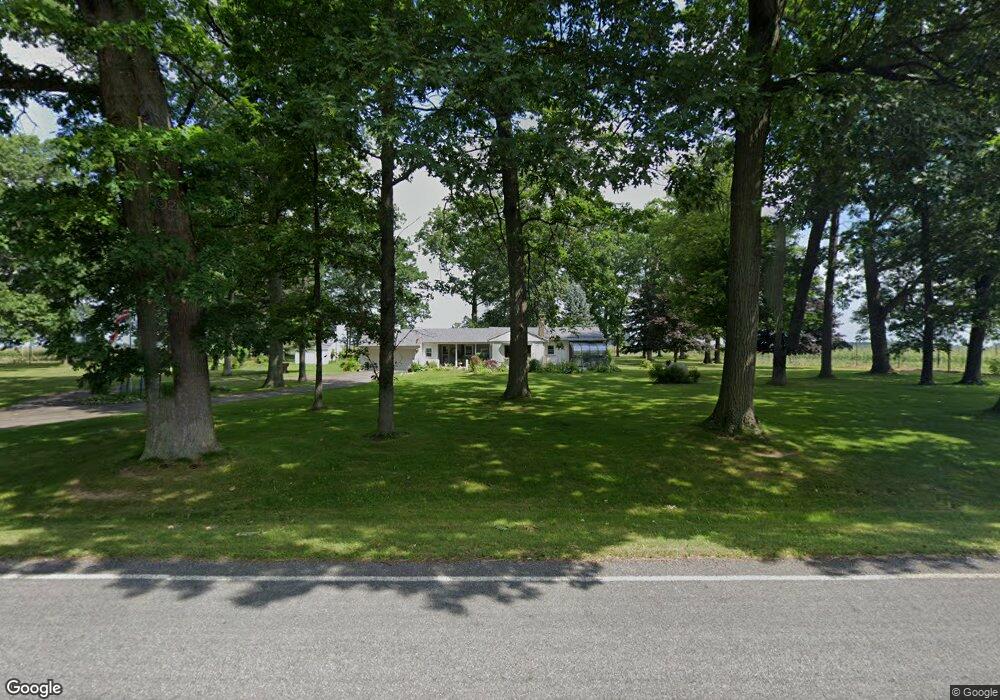
11600 Fisk Rd Belding, MI 48809
Estimated Value: $320,000 - $346,000
3
Beds
2
Baths
1,500
Sq Ft
$222/Sq Ft
Est. Value
About This Home
This home is located at 11600 Fisk Rd, Belding, MI 48809 and is currently estimated at $332,915, approximately $221 per square foot. 11600 Fisk Rd is a home located in Ionia County with nearby schools including Ellis Elementary School, Woodview Elementary School, and Belding Middle School.
Ownership History
Date
Name
Owned For
Owner Type
Purchase Details
Closed on
Mar 29, 2013
Sold by
Price Robert E
Bought by
Cameron Thomas W and Cameron Linda M
Current Estimated Value
Home Financials for this Owner
Home Financials are based on the most recent Mortgage that was taken out on this home.
Original Mortgage
$58,000
Outstanding Balance
$26,879
Interest Rate
3.52%
Mortgage Type
New Conventional
Estimated Equity
$306,036
Create a Home Valuation Report for This Property
The Home Valuation Report is an in-depth analysis detailing your home's value as well as a comparison with similar homes in the area
Home Values in the Area
Average Home Value in this Area
Purchase History
| Date | Buyer | Sale Price | Title Company |
|---|---|---|---|
| Cameron Thomas W | $110,000 | Cfc Title Services Inc |
Source: Public Records
Mortgage History
| Date | Status | Borrower | Loan Amount |
|---|---|---|---|
| Open | Cameron Thomas W | $58,000 |
Source: Public Records
Tax History Compared to Growth
Tax History
| Year | Tax Paid | Tax Assessment Tax Assessment Total Assessment is a certain percentage of the fair market value that is determined by local assessors to be the total taxable value of land and additions on the property. | Land | Improvement |
|---|---|---|---|---|
| 2025 | $2,794 | $133,800 | $36,400 | $97,400 |
| 2024 | $974 | $133,800 | $36,400 | $97,400 |
| 2023 | $929 | $107,000 | $28,100 | $78,900 |
| 2022 | $885 | $107,000 | $28,100 | $78,900 |
| 2021 | $2,470 | $101,700 | $28,100 | $73,600 |
| 2020 | $849 | $101,700 | $28,100 | $73,600 |
| 2019 | $791 | $93,100 | $22,500 | $70,600 |
| 2018 | $2,341 | $82,900 | $22,500 | $60,400 |
| 2017 | $798 | $82,900 | $22,500 | $60,400 |
| 2016 | $791 | $73,400 | $22,500 | $50,900 |
| 2015 | -- | $73,400 | $22,500 | $50,900 |
| 2014 | $798 | $74,800 | $28,100 | $46,700 |
Source: Public Records
Map
Nearby Homes
- 10950 W Bricker Rd
- 11701 Montcalm Ave NE
- 12831 Strotheide Rd NE
- 13697 Lower Bayside Dr
- 7718 Whites Bridge Rd
- 7999 Sierra Dr
- 7987 Sierra Dr
- 7897 Sierra Dr
- 7504 Lincoln Lake Rd NE
- 7762 Sierra Dr
- 2160 W Ellis Parcel 2
- 2160 W Ellis Parcel 3
- 2160 W Ellis Parcel 4
- 7858 Sierra Dr
- 7620 Storey Rd
- 2160 W Ellis Parcel 5
- 2160 W Ellis Parcel 6
- 9065 Lincoln Lake Rd NE
- 7229 Bordeau Dr NE
- 8377 Mcarthur Ave NE
- 11820 Fisk Rd
- 11939 Jenks Rd
- 12088 Jenks Rd
- 8723 Jenks Rd
- 14391 Heffron Rd NE
- 8300 Montcalm Ave
- 7929 Montcalm Ave NE
- 8179 Montcalm Ave NE
- 7855 Montcalm Ave NE
- 7811 Montcalm Ave NE
- 14340 Heffron Rd NE
- 11482 Ellis Rd
- 14301 Heffron Rd NE
- 11440 Ellis Rd
- 7771 Montcalm Ave NE
- 14299 Heffron Rd NE
- 11014 Ellis Rd
- 11531 Ellis Rd
- 8062 Montcalm Ave
- 7703 Montcalm Ave NE