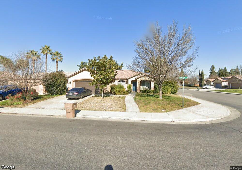
11602 Starlight Dr Bakersfield, CA 93312
Estimated Value: $390,000 - $416,000
3
Beds
2
Baths
1,566
Sq Ft
$257/Sq Ft
Est. Value
About This Home
This home is located at 11602 Starlight Dr, Bakersfield, CA 93312 and is currently estimated at $403,041, approximately $257 per square foot. 11602 Starlight Dr is a home located in Kern County with nearby schools including Rosedale-North Elementary School, Freedom Middle School, and Centennial High School.
Ownership History
Date
Name
Owned For
Owner Type
Purchase Details
Closed on
Sep 28, 2009
Sold by
Mcmillin Capella Llc
Bought by
Maduena Adrian
Current Estimated Value
Home Financials for this Owner
Home Financials are based on the most recent Mortgage that was taken out on this home.
Original Mortgage
$206,157
Outstanding Balance
$134,411
Interest Rate
5.05%
Mortgage Type
FHA
Estimated Equity
$268,630
Create a Home Valuation Report for This Property
The Home Valuation Report is an in-depth analysis detailing your home's value as well as a comparison with similar homes in the area
Home Values in the Area
Average Home Value in this Area
Purchase History
| Date | Buyer | Sale Price | Title Company |
|---|---|---|---|
| Maduena Adrian | $210,000 | First American Title Company |
Source: Public Records
Mortgage History
| Date | Status | Borrower | Loan Amount |
|---|---|---|---|
| Open | Maduena Adrian | $206,157 |
Source: Public Records
Tax History Compared to Growth
Tax History
| Year | Tax Paid | Tax Assessment Tax Assessment Total Assessment is a certain percentage of the fair market value that is determined by local assessors to be the total taxable value of land and additions on the property. | Land | Improvement |
|---|---|---|---|---|
| 2025 | $4,526 | $271,061 | $51,627 | $219,434 |
| 2024 | $4,438 | $265,747 | $50,615 | $215,132 |
| 2023 | $4,438 | $260,537 | $49,623 | $210,914 |
| 2022 | $4,355 | $255,429 | $48,650 | $206,779 |
| 2021 | $4,212 | $250,422 | $47,697 | $202,725 |
| 2020 | $4,141 | $247,855 | $47,208 | $200,647 |
| 2019 | $4,077 | $247,855 | $47,208 | $200,647 |
| 2018 | $3,973 | $238,232 | $45,376 | $192,856 |
| 2017 | $3,929 | $233,562 | $44,487 | $189,075 |
| 2016 | $3,665 | $226,000 | $57,000 | $169,000 |
| 2015 | $3,635 | $225,000 | $56,000 | $169,000 |
| 2014 | $3,443 | $210,000 | $53,000 | $157,000 |
Source: Public Records
Map
Nearby Homes
- 3122 Campfire Dr Unit 2
- 11705 Cactus Dr
- 11617 Cactus Dr
- 11908 Nebula Ct
- 11910 Compass Ave
- 3622 Azure Dr
- 11711 Stratosphere Ave
- 11201 Paddock Ave
- 3108 Holbrook St
- 3613 Aslin St
- 11265 Poulsen Way
- 3435 Moss St
- 10701 Meacham Rd
- 12421 Winn Ave
- 4136 Jewetta Ave
- 11805 Hannah Denise Ave
- 10601 Michele Ave
- 11126 New Forest Dr
- 2710 Maher Way
- 10600 Michele Ave
- 11606 Starlight Dr
- 11601 Sagebrush Ave
- 11605 Sagebrush Ave
- 11610 Starlight Dr Unit 2
- 3306 Campfire Dr
- 3209 Campfire Dr
- 3310 Campfire Dr
- 3302 Campfire Dr
- 11609 Sagebrush Ave
- 11614 Starlight Dr
- 3314 Campfire Dr
- 3212 Campfire Dr
- 3210 Aries Ct
- 3205 Campfire Dr Unit 2
- 11613 Sagebrush Ave
- 8636 Sagebrush Ave
- 8612 Sagebrush Ave
- 3221 Ranchgate Dr
- 3301 Ranchgate Dr
- 3208 Campfire Dr