Estimated Value: $324,000 - $345,000
3
Beds
2
Baths
1,908
Sq Ft
$174/Sq Ft
Est. Value
About This Home
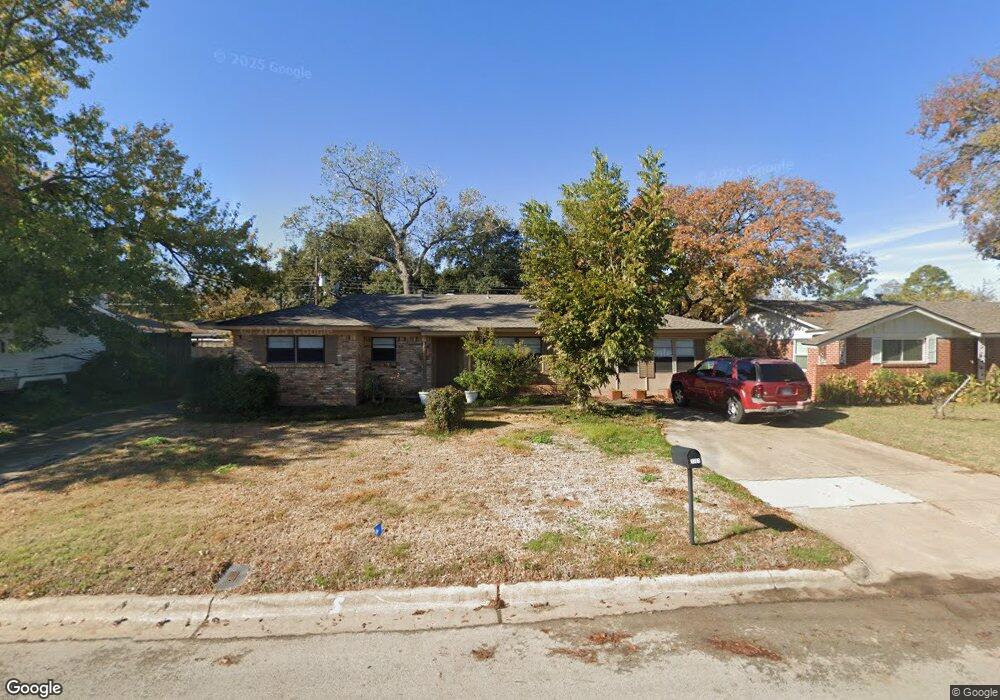
This home is located at 1161 Norwood Dr, Hurst, TX 76053 and is currently estimated at $331,742, approximately $173 per square foot. 1161 Norwood Dr is a home located in Tarrant County with nearby schools including Harrison Lane Elementary School, Hurst J High School, and L.D. Bell High School.
Ownership History
Date
Name
Owned For
Owner Type
Purchase Details
Closed on
Jul 7, 2005
Sold by
Whitfield John H
Bought by
Alba Armando
Current Estimated Value
Home Financials for this Owner
Home Financials are based on the most recent Mortgage that was taken out on this home.
Original Mortgage
$67,520
Outstanding Balance
$35,201
Interest Rate
5.64%
Mortgage Type
Fannie Mae Freddie Mac
Estimated Equity
$296,541
Create a Home Valuation Report for This Property
The Home Valuation Report is an in-depth analysis detailing your home's value as well as a comparison with similar homes in the area
Home Values in the Area
Average Home Value in this Area
Purchase History
| Date | Buyer | Sale Price | Title Company |
|---|---|---|---|
| Alba Armando | -- | Alamo Title Company |
Source: Public Records
Mortgage History
| Date | Status | Borrower | Loan Amount |
|---|---|---|---|
| Open | Alba Armando | $67,520 |
Source: Public Records
Tax History Compared to Growth
Tax History
| Year | Tax Paid | Tax Assessment Tax Assessment Total Assessment is a certain percentage of the fair market value that is determined by local assessors to be the total taxable value of land and additions on the property. | Land | Improvement |
|---|---|---|---|---|
| 2025 | $3,859 | $324,515 | $46,750 | $277,765 |
| 2024 | $3,859 | $324,515 | $46,750 | $277,765 |
| 2023 | $4,806 | $281,752 | $34,000 | $247,752 |
| 2022 | $5,021 | $274,990 | $34,000 | $240,990 |
| 2021 | $4,781 | $226,293 | $34,000 | $192,293 |
| 2020 | $4,336 | $205,094 | $34,000 | $171,094 |
| 2019 | $4,010 | $201,866 | $34,000 | $167,866 |
| 2018 | $3,091 | $148,939 | $16,150 | $132,789 |
| 2017 | $3,426 | $171,282 | $19,000 | $152,282 |
| 2016 | $3,115 | $171,309 | $19,000 | $152,309 |
| 2015 | $2,524 | $111,900 | $15,000 | $96,900 |
| 2014 | $2,524 | $111,900 | $15,000 | $96,900 |
Source: Public Records
Map
Nearby Homes
- 1220 Norwood Dr
- 1136 Simpson Dr
- 116 Oakhurst Dr
- 1337 Harrison Ln
- 905 Brown Trail
- 409 Vicki Place
- 1348 Norwood Dr
- 1352 Simpson Dr
- 420 Bedford Ct W
- 1016 Keith Dr
- 344 Bedford Ct E
- 341 Hurst Dr
- 113 Sunnyvale Terrace
- 1208 Karla Dr
- 802 Brown Trail
- 400 Joanna Dr
- 803 Glenda Dr
- 1008 Russell Ln
- 1236 King Dr
- 127 W Cedar St
- 1165 Norwood Dr
- 1157 Norwood Dr
- 1160 Simpson Dr
- 1164 Simpson Dr
- 1156 Simpson Dr
- 1169 Norwood Dr
- 1156 Norwood Dr
- 1160 Norwood Dr
- 1153 Norwood Dr
- 1168 Simpson Dr
- 1152 Norwood Dr
- 1164 Norwood Dr
- 1201 Norwood Dr
- 1152 Simpson Dr
- 1200 Simpson Dr
- 1148 Norwood Dr
- 1200 Norwood Dr
- 1165 Simpson Dr
- 1157 Valley View Dr
- 1161 Valley View Dr