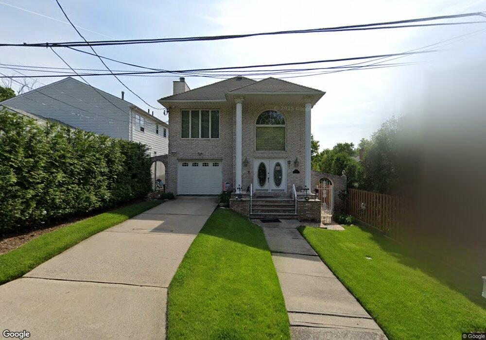
1161 Richmond Hill Rd Staten Island, NY 10306
Lighthouse Hill NeighborhoodEstimated Value: $977,920 - $1,521,000
3
Beds
4
Baths
2,800
Sq Ft
$480/Sq Ft
Est. Value
About This Home
This home is located at 1161 Richmond Hill Rd, Staten Island, NY 10306 and is currently estimated at $1,342,730, approximately $479 per square foot. 1161 Richmond Hill Rd is a home located in Richmond County with nearby schools including P.S. 23 Richmondtown, Myra S. Barnes Intermediate School 24, and Susan E Wagner High School.
Ownership History
Date
Name
Owned For
Owner Type
Purchase Details
Closed on
May 29, 2015
Sold by
Rocchio Patt and Rocchio Patricia
Bought by
Batone Demenick A
Current Estimated Value
Home Financials for this Owner
Home Financials are based on the most recent Mortgage that was taken out on this home.
Original Mortgage
$390,000
Outstanding Balance
$300,983
Interest Rate
3.65%
Mortgage Type
New Conventional
Estimated Equity
$1,041,747
Create a Home Valuation Report for This Property
The Home Valuation Report is an in-depth analysis detailing your home's value as well as a comparison with similar homes in the area
Home Values in the Area
Average Home Value in this Area
Purchase History
| Date | Buyer | Sale Price | Title Company |
|---|---|---|---|
| Batone Demenick A | $790,000 | None Available |
Source: Public Records
Mortgage History
| Date | Status | Borrower | Loan Amount |
|---|---|---|---|
| Open | Batone Demenick A | $390,000 |
Source: Public Records
Tax History Compared to Growth
Tax History
| Year | Tax Paid | Tax Assessment Tax Assessment Total Assessment is a certain percentage of the fair market value that is determined by local assessors to be the total taxable value of land and additions on the property. | Land | Improvement |
|---|---|---|---|---|
| 2025 | $9,093 | $55,740 | $9,402 | $46,338 |
| 2024 | $9,093 | $52,920 | $9,342 | $43,578 |
| 2023 | $9,195 | $45,274 | $7,992 | $37,282 |
| 2022 | $8,970 | $55,500 | $10,920 | $44,580 |
| 2021 | $8,921 | $58,500 | $10,920 | $47,580 |
| 2020 | $8,465 | $64,620 | $10,920 | $53,700 |
| 2019 | $7,892 | $56,160 | $10,920 | $45,240 |
| 2018 | $7,691 | $37,728 | $7,724 | $30,004 |
| 2017 | $7,633 | $37,444 | $7,631 | $29,813 |
| 2016 | $7,062 | $35,325 | $8,087 | $27,238 |
| 2015 | $5,729 | $33,326 | $8,053 | $25,273 |
| 2014 | $5,729 | $31,440 | $9,120 | $22,320 |
Source: Public Records
Map
Nearby Homes
- 203 Center St
- 443 Edinboro Rd
- 393 Saint Andrews Rd
- 265 Edinboro Rd
- 394 Clarke Ave
- 342 Edinboro Rd
- 219 Ardsley St
- 35 Kensico St
- 312 Barbara St
- 312 London Rd
- 197 Ardsley St
- 93 Aultman Ave
- 31 Franklin Ln Unit A
- 31 Franklin Ln Unit B
- 280 Edinboro Rd
- 265 Barbara St Unit 275
- 265 Lighthouse Ave
- 267 Edinboro Rd
- 256 Thomas St
- 61 Natick St
- 1161 Picadilly Place
- 500 Saint George Rd
- 492 Saint George Rd
- 475 Saint Andrews Rd
- 486 Saint George Rd
- 459 Saint Andrews Rd
- 476-482 Saint George Rd
- 453 Saint Andrews Rd
- 470 Saint George Rd
- 445 Saint Andrews Rd
- 466 Saint George Rd
- 439 Saint Andrews Rd
- 458 Saint George Rd
- 465 Saint George Rd
- 454 Saint George Rd
- 429 Saint Andrews Rd
- 21 Rigby Ave
- 455 Saint George Rd
- 450 Saint George Rd
- 3641 Richmond Rd