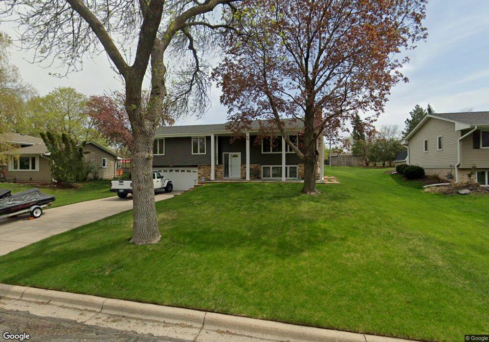
11613 Ravoux Ave Burnsville, MN 55337
Estimated Value: $374,752 - $427,000
4
Beds
2
Baths
1,348
Sq Ft
$296/Sq Ft
Est. Value
About This Home
This home is located at 11613 Ravoux Ave, Burnsville, MN 55337 and is currently estimated at $398,938, approximately $295 per square foot. 11613 Ravoux Ave is a home located in Dakota County with nearby schools including William Byrne Elementary School, Burnsville High School, and Gateway STEM Academy.
Ownership History
Date
Name
Owned For
Owner Type
Purchase Details
Closed on
Jul 10, 2019
Sold by
Peterson Brian E and Peterson Lisa M
Bought by
Peterson Brian E and Peeterson Lisa M
Current Estimated Value
Purchase Details
Closed on
Nov 27, 1996
Sold by
Arndt Allen L and Arndt Edith E
Bought by
Peterson Brian L and Mason Peterson Cheryl L
Create a Home Valuation Report for This Property
The Home Valuation Report is an in-depth analysis detailing your home's value as well as a comparison with similar homes in the area
Home Values in the Area
Average Home Value in this Area
Purchase History
| Date | Buyer | Sale Price | Title Company |
|---|---|---|---|
| Peterson Brian E | -- | None Available | |
| Peterson Brian L | $115,000 | -- |
Source: Public Records
Tax History Compared to Growth
Tax History
| Year | Tax Paid | Tax Assessment Tax Assessment Total Assessment is a certain percentage of the fair market value that is determined by local assessors to be the total taxable value of land and additions on the property. | Land | Improvement |
|---|---|---|---|---|
| 2024 | $3,494 | $333,600 | $83,900 | $249,700 |
| 2023 | $3,494 | $337,400 | $83,900 | $253,500 |
| 2022 | $2,926 | $330,400 | $83,700 | $246,700 |
| 2021 | $3,096 | $281,500 | $72,800 | $208,700 |
| 2020 | $3,054 | $282,000 | $69,300 | $212,700 |
| 2019 | $3,062 | $269,000 | $66,000 | $203,000 |
| 2018 | $3,015 | $250,300 | $62,900 | $187,400 |
| 2017 | $2,831 | $239,500 | $59,900 | $179,600 |
| 2016 | $2,881 | $222,200 | $57,100 | $165,100 |
| 2015 | $2,704 | $199,617 | $50,892 | $148,725 |
| 2014 | -- | $194,385 | $49,763 | $144,622 |
| 2013 | -- | $169,533 | $44,506 | $125,027 |
Source: Public Records
Map
Nearby Homes
- 3017 Mcleod St
- 11459 Galtier Dr
- 4427 Cinnamon Ridge Cir
- 4425 Cinnamon Ridge Cir
- 4463 Cinnamon Ridge Cir
- 4413 Slater Rd
- 11902 River Hills Cir
- 3309 Red Oak Cir N
- 4632 Westwood Ln
- 11921 Baypoint Dr
- 11900 Highland View Cir
- 11036 27th Ave S
- 4774 Slater Rd
- 10934 Southview Dr
- 2200 Horizon Rd
- 11017 27th Ave S
- 4370 Nicols Rd
- 319 River Woods Ln
- 2123 Cliffhill Ln
- 2115 Cliffview Dr
- 11617 Ravoux Ave
- 11609 Ravoux Ave
- 11624 Galtier Dr
- 11620 Galtier Dr
- 11700 Galtier Dr
- 11621 Ravoux Ave
- 11605 Ravoux Ave
- 11612 Ravoux Ave
- 11616 Galtier Dr
- 11704 Galtier Dr
- 11604 Ravoux Ave
- 11625 Ravoux Ave
- 11601 Ravoux Ave
- 11612 Galtier Dr
- 11712 Galtier Dr
- 3100 Mcleod St
- 11600 Ravoux Ave
- 11610 Ravoux Ct
- 11608 Galtier Dr
- 3018 Mcleod St