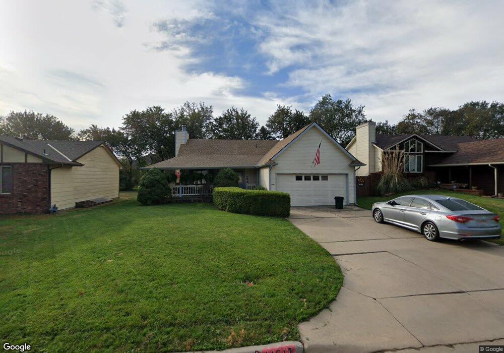
11617 W Rolling Hills Dr Wichita, KS 67212
Far West Wichita NeighborhoodEstimated Value: $225,453 - $242,000
2
Beds
2
Baths
1,016
Sq Ft
$230/Sq Ft
Est. Value
About This Home
This home is located at 11617 W Rolling Hills Dr, Wichita, KS 67212 and is currently estimated at $233,727, approximately $230 per square foot. 11617 W Rolling Hills Dr is a home located in Sedgwick County with nearby schools including Peterson Elementary School, Wilbur Middle School, and Wichita Northwest High School.
Ownership History
Date
Name
Owned For
Owner Type
Purchase Details
Closed on
Jul 28, 2025
Sold by
Tim Ewald Realty Co
Bought by
Ewald Timothy Joseph
Current Estimated Value
Purchase Details
Closed on
May 31, 2022
Sold by
Joseph Ewald Timothy
Bought by
Tim Ewald Realty Co
Home Financials for this Owner
Home Financials are based on the most recent Mortgage that was taken out on this home.
Original Mortgage
$155,000
Interest Rate
4.13%
Mortgage Type
New Conventional
Purchase Details
Closed on
Nov 9, 1998
Sold by
Schonlau Elizabeth A
Bought by
Schonlau Thomas and Schonlau Elizabeth A
Create a Home Valuation Report for This Property
The Home Valuation Report is an in-depth analysis detailing your home's value as well as a comparison with similar homes in the area
Home Values in the Area
Average Home Value in this Area
Purchase History
| Date | Buyer | Sale Price | Title Company |
|---|---|---|---|
| Ewald Timothy Joseph | -- | None Listed On Document | |
| Tim Ewald Realty Co | -- | Security 1St Title | |
| Ewald Timothy Joseph | -- | Security 1St Title | |
| Schonlau Thomas | -- | -- |
Source: Public Records
Mortgage History
| Date | Status | Borrower | Loan Amount |
|---|---|---|---|
| Previous Owner | Ewald Timothy Joseph | $155,000 |
Source: Public Records
Tax History Compared to Growth
Tax History
| Year | Tax Paid | Tax Assessment Tax Assessment Total Assessment is a certain percentage of the fair market value that is determined by local assessors to be the total taxable value of land and additions on the property. | Land | Improvement |
|---|---|---|---|---|
| 2025 | $2,137 | $21,758 | $5,497 | $16,261 |
| 2023 | $2,137 | $18,538 | $3,519 | $15,019 |
| 2022 | $1,902 | $17,251 | $3,324 | $13,927 |
| 2021 | $0 | $16,124 | $3,324 | $12,800 |
| 2020 | $1,787 | $15,652 | $3,324 | $12,328 |
| 2019 | $1,639 | $14,364 | $3,324 | $11,040 |
| 2018 | $1,579 | $13,812 | $3,243 | $10,569 |
| 2017 | $1,488 | $0 | $0 | $0 |
| 2016 | $1,486 | $0 | $0 | $0 |
| 2015 | -- | $0 | $0 | $0 |
| 2014 | -- | $0 | $0 | $0 |
Source: Public Records
Map
Nearby Homes
- 209 N Milstead St
- 410 N David St
- 11508 W Douglas Ave
- 12018 Meribeau Ct
- 11112 W Rolling Hills Dr
- 236 S Parkridge St
- 110 N Prescott St
- 11218 W Taylor St
- 126 S Coach House Rd
- 12400 W Jayson Ln
- 12521 W Hardtner Ct
- 522 N Bay Country St
- 11005 W Taylor Cir
- 12514 W Hardtner St
- 313 N Jaax St
- 12505 W Binter St
- 810 N Parkridge St
- 11110 W Central Ave
- 373 S Covington St
- 238 N Mesa St
- 11621 W Rolling Hills Dr
- 11605 W Rolling Hills Dr
- 11627 W Rolling Hills Dr
- 11614 W Oneil St
- 304 N Mark Allen St
- 11705 W Rolling Hills Dr
- 11624 W Oneil St
- 11527 W Rolling Hills Cir
- 11711 W Rolling Hills Dr
- 310 N Mark Allen St
- 311 N Parkridge St
- 11632 W Oneil St
- 222 N Parkridge St
- 11528 W Rolling Hills Cir
- 305 N Mark Allen St
- 11603 W Oneil St
- 11715 W Rolling Hills Dr
- 11715 W Rolling Hills St
- 316 N Mark Allen St
- 11702 W Oneil St